
Toronto is going to be hit with bitter cold and some snow ahead of a ‘blast of cold arctic air’ this weekend. Bill Coulter has your seven-day forecast
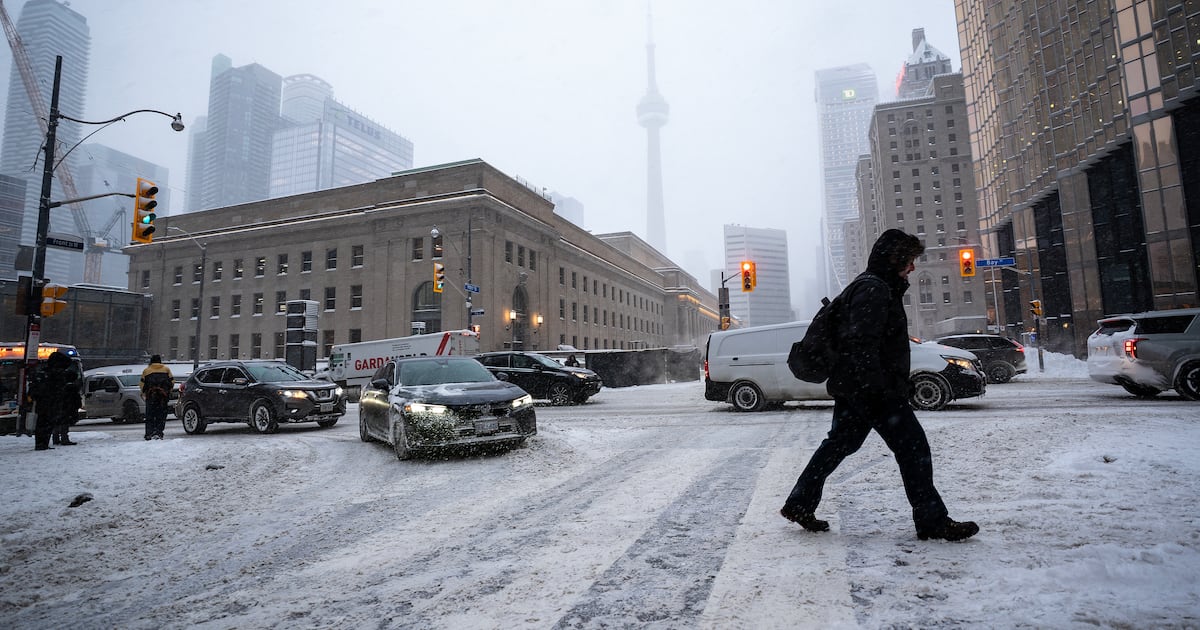
Another winter storm is expected to hit Toronto on Wednesday and could lead to a tricky commute to work, with the heaviest snowfall arriving during the morning rush hour.
Environment Canada has issued a yellow snowfall warning for the city, which could see up to 10 centimetres of snow on Wednesday.
“An Alberta clipper will push into the region with snow beginning Wednesday morning impacting the morning commute,” Environment Canada said in its advisory.
The federal agency added that snow will ease through the afternoon or early evening, which could impact the commute home as well.
Parts of York Region and Durham Region are also under a snowfall warning.
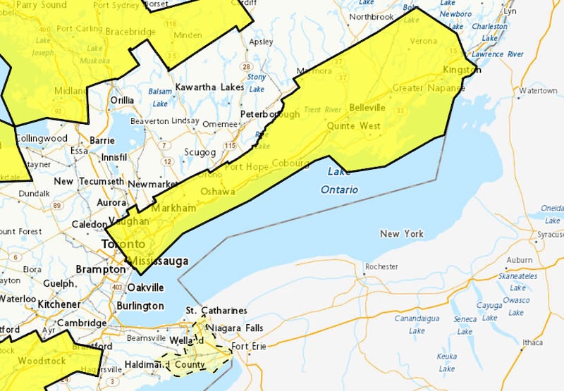 Environment Canada Toronto and other parts of the GTA are under a yellow snowfall warning. (Environment Canada)
“Travel will likely be challenging. Roads and walkways will likely be difficult to navigate due to accumulating snow. There may be a significant impact on rush hour traffic,” Environment Canada said.
When factoring last week’s major winter storm, Wednesday’s system will likely bring the total snowfall accumulation this winter to about 100 cm, David Phillips, a retired climatologist for Environment Canada, told CP24 on Tuesday.
Cold snap continues
The inclement weather comes as the city continues to grapple with an extended cold snap.
Environment Canada is calling for a high of -9 C on Tuesday, but it will feel closer to -18 this afternoon when factoring in the wind chill.
“At its warmest today, the wind chill will top out in the high minus teens under a mix of sun and clouds. We may also see the tail end of lake effect snow bands off Lake Huron and Georgian Bay dip into the city with isolated flurries,” CP24 Meteorologist Bill Coulter said Tuesday.
“The temperatures will moderate as (Wednesday’s) system arrives, but they’ll drop again in the wake of the system. It’ll get close to the freezing mark for a high tomorrow.”
The national weather agency said Toronto will feel like -17 in the morning and -8 in the afternoon on Wednesday.
Temperatures will continue to dip for the remainder of the week, with daytime highs of -5 C on Thursday, -9 C on Friday, -12 C on Saturday, and -10 C on Sunday.
“Overnight Friday and Saturday may have wind chills dipping into the -30s at Pearson,” Coulter added.
“Prepare your outer wardrobe accordingly to stay safe. Those cold winds will also keep the lake effect snow machine going in some of the traditional snow belts.”
‘This is about as cold as it gets in Toronto’
Phillips said Toronto is dealing with temperatures that are about 10 degrees colder than normal for this time of year.
“It is the nighttime temperatures. We are going to see temperatures of -20 C, -21 C. If we get to that temperature, that is going to be the coldest in three years,” he said.
The duration of the cold snap is also concerning, he said.
“So far, we’ve had bouts of maybe six days of temperatures below freezing… this one is as far as I can see, 18 days where we won’t see a thawing temperature,” Phillips noted.
“Even next week where it tries to warm up, then there is an arctic resupply of cold air to kind of freshen it up.”
Additional Warming Centres will open at 5 p.m. due to extreme cold temperatures:
📍 Cecil Community Centre, 58 Cecil St.
📍 Jimmie Simpson Recreation Centre, 870 Queen St. E.
The previously opened Warming Centres remain open. Find locations: https://t.co/tRpue1Palo. pic.twitter.com/hQ9lDmMxnk
— City of Toronto 🇨🇦 (@cityoftoronto) January 19, 2026
He said Toronto likely won’t see a warmup until the first full week of February.
“It is the intensity of it but it also the duration of it that actually wears you down,” Phillips said.
“This is about as cold as it gets in Toronto.”