
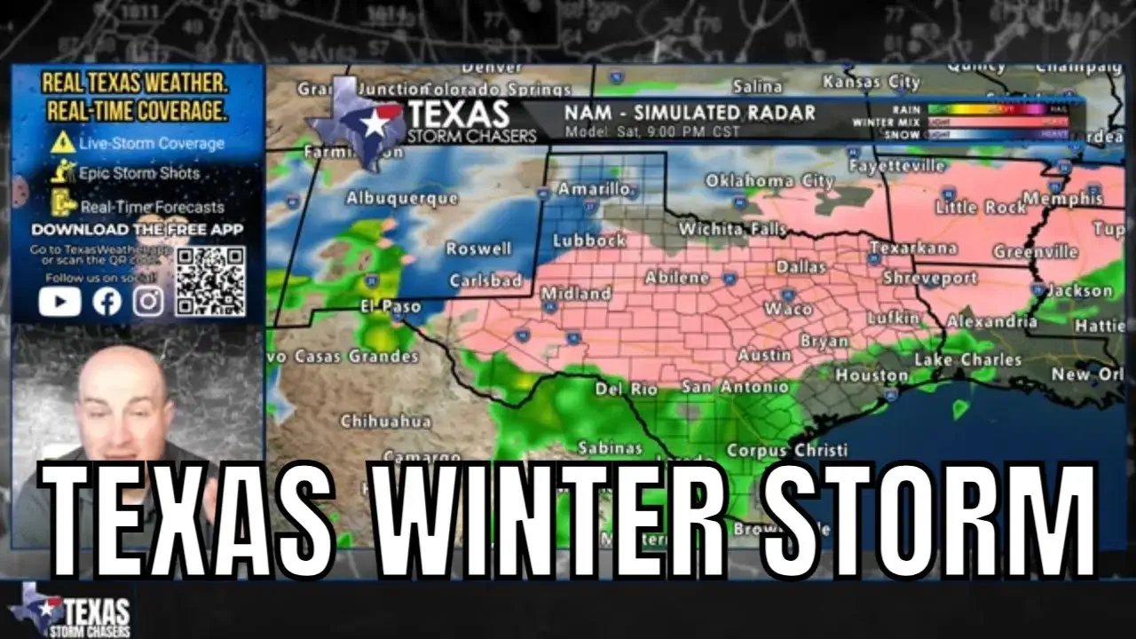
Texas is heading toward its most significant cold snap of the winter so far, and confidence is growing that parts of the state will also deal with a high-impact winter storm late Friday through Sunday.
This is not about hype, viral snow maps, or worst-case fantasies. This is about impacts, timing, and what Texans should realistically expect as a large Arctic air mass and an active storm system begin to interact over the region.
First, the Big Picture: This Is Primarily a Cold Event
It’s easy to get fixated on snow and ice, but the cold itself is the bigger story.
Beginning late Friday and lasting into early next week, much of Texas will experience well-below-average temperatures, with many locations dropping below freezing for multiple days. Some areas, especially across the Panhandle, West Texas, North Texas, and parts of Central Texas, may struggle to get above freezing again until Monday or Tuesday.
Morning low temperatures will be harsh:
Single digits and teens across the Panhandle and West Texas
Teens and low 20s across North Texas, the Big Country, and parts of the Hill Country
20s and low 30s extending unusually far south, possibly reaching the upper Texas coast
Wind chills will make it feel even colder, particularly Friday night through Sunday morning, when gusty north winds accompany the coldest air.
Even in places that avoid snow or ice, the cold alone will be impactful.
Why This Setup Is Concerning
The concern increases because this Arctic air is arriving at the same time a storm system moves in from the southwest.
In Texas winter weather events, that combination matters.
Cold air near the surface in Texas is typically shallow, while warmer air often remains a few thousand feet above the ground. When precipitation falls through that warm layer and then re-enters sub-freezing air near the surface, we end up with sleet or freezing rain, not just snow.
That is why this event has the potential to become messy and disruptive, even if snow totals outside the Panhandle are modest.
Snow, Sleet, and Freezing Rain: What We Know So Far
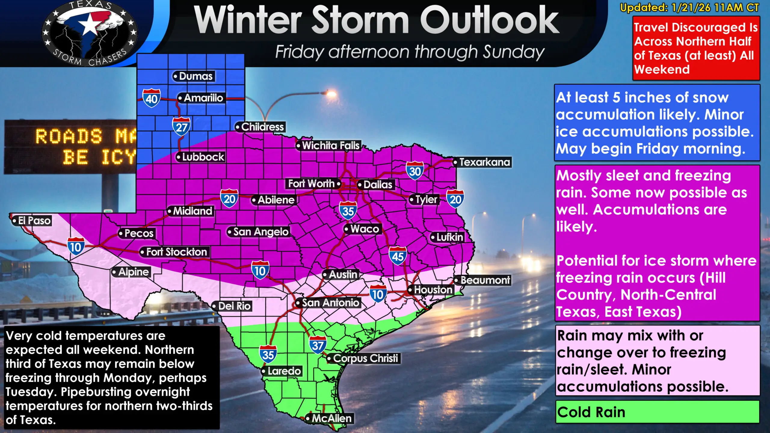
A high-impact winter storm is expected late this week, with dangerous travel conditions likely across much of North Texas through the weekend.
It is still too early to lock down exact precipitation types for specific neighborhoods, but confidence is increasing in a general pattern.
Panhandle and Far Northwest Texas
This region has the highest confidence for mostly snow, with accumulating snowfall likely. Current data supports a high probability of at least several inches, with some locations potentially exceeding half a foot if trends hold.
Travel in the Panhandle late Friday through Sunday is expected to be very difficult or impossible at times.
West Texas, North Texas, Big Country, Texoma, and Northeast Texas
These areas are most likely to experience a wintry mix, including sleet and freezing rain. Snow may mix in at times, but ice is the bigger concern.
Sleet can make roads dangerously slick. Freezing rain is more problematic, as it can coat power lines and trees, increasing the risk of outages and damage.
Central Texas, Hill Country, Brazos Valley, and East Texas
This region sits near the critical freezing line, which will determine whether impacts are minor or severe.
If surface temperatures fall below about 30 degrees while precipitation is ongoing, ice will accumulate efficiently. That scenario could lead to significant travel disruptions and localized power issues, especially in the Hill Country and parts of Central Texas.
South Texas and the Rio Grande Valley
These areas are expected to remain mostly rain-only during the event, but will still experience unusually cold temperatures. Even here, overnight freezes are possible early next week.
Timing: When Conditions Go Downhill
Friday morning: Cold air begins pushing into the Panhandle and West Texas
Friday afternoon: Freezing line advances south; temperatures fall rapidly behind the front
Friday night into Saturday: Highest risk for winter precipitation and travel impacts
Saturday into early Sunday: Prolonged cold, lingering winter weather, and dangerous road conditions
Sunday afternoon: Precipitation gradually exits, but cold remains
Sunday night through Tuesday: Repeated hard freezes, refreezing of melted ice, and slow recovery
Even if roads improve briefly during daylight hours, refreezing each night will remain a major issue.
Travel Impacts Are Likely
For much of North and Central Texas, travel late Friday through Sunday is not recommended.
This is not a short, overnight event. The combination of ice, snow, and sustained cold means roads may remain unsafe for multiple days, especially north of Interstate 10.
If you have flexibility in weekend plans, now is the time to build contingencies.
How This Compares to 2021
Many Texans understandably think back to February 2021. While this event will not be a carbon copy, there are similarities worth noting.
This does not appear to be a week-long deep freeze statewide, and temperatures will not be as extreme in South Texas. However, the duration of freezing temperatures, combined with ice potential, means impacts could still be significant for parts of the state.
This is a serious winter weather event, even if it doesn’t check every 2021 box.
What You Should Be Doing Now
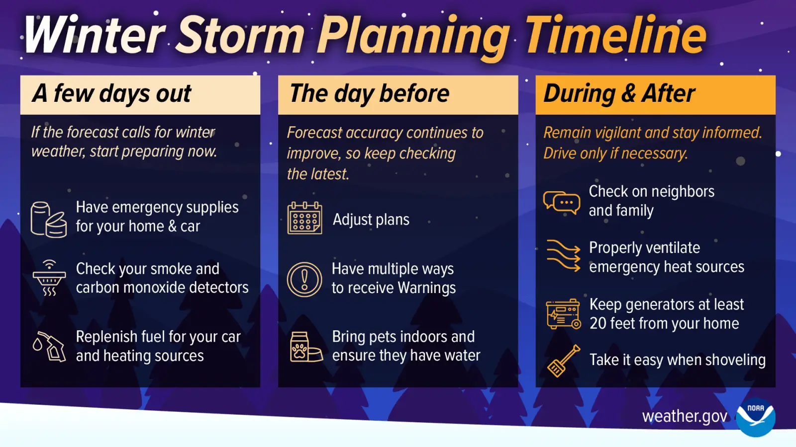
A simple timeline showing how to prepare for winter weather before it arrives, as colder conditions become more likely across Texas.
Preparation does not mean panic.
It means:
Planning to limit travel this weekend
Protecting pipes and outdoor plumbing
Making sure pets have warmth and shelter
Ensuring you have blankets, warm clothing, and essentials
Charging devices and having backup power plans if you’re in an ice-prone area
The goal is to be ready, not scared.
The Bottom Line
Confidence is increasing that Texas will face a dangerous stretch of Arctic cold, with a high-impact winter storm affecting at least the northern half of the state late Friday through Sunday.
Details will continue to evolve, especially regarding where the freezing line sets up, but the overall message is clear:
This weekend will not be business as usual across Texas.
We will continue refining the forecast and updating you as confidence increases.
For ongoing updates, local forecasts, and alerts, use the free Texas Storm Chasers mobile app and check back here frequently as this event unfolds.
Stay informed. Stay prepared. And we’ll get through it together.