

RELATED: The Great Lakes’ winter superpower is fading, polar vortex punches through
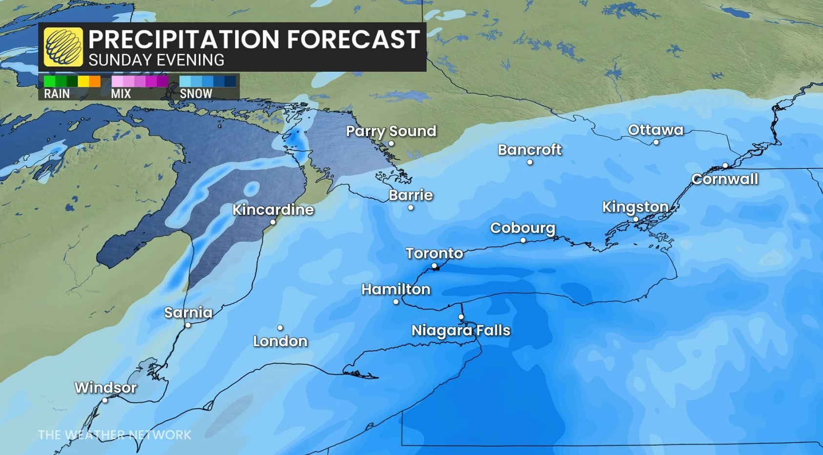
Ontario stays on the cold, northern side of the storm, so all precipitation will remain as snow.
Temperatures in the -10s to -20s mean fluffy, fast-accumulating snow that snowplows struggle with.
The GTA and Golden Horseshoe can expect to see a widespread 20–30+ cm, impacting the QEW, 401, 404, 407 corridors.
Snow begins Sunday morning and will peak in the afternoon and evening, then continuing into Monday morning.
 WATCH: Tracking a major winter storm heading to Canada’s East
Wind gusts are forecast to be close to 60 km/h through Sunday evening, creating widespread blowing snow, especially in open areas and near Lake Ontario.
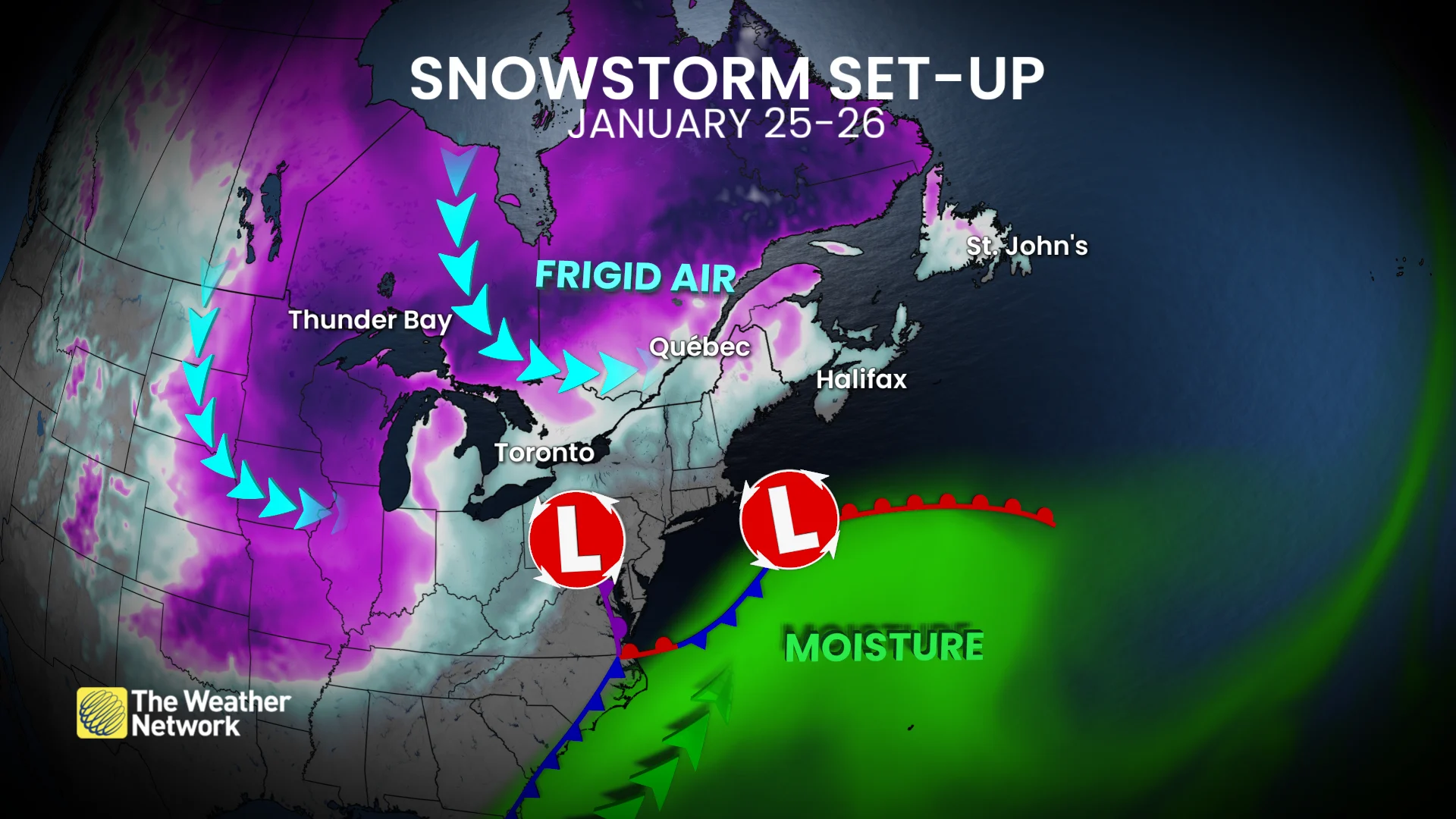
With the low tracking south and Arctic air locked in, easterly winds off Lake Ontario may boost snowfall. Band placement is uncertain and depends on precise wind direction.