

Impacts will begin in Nova Scotia, Prince Edward Island, and New Brunswick late in the afternoon or evening hours on Sunday.
RELATED: What turns a snowstorm into a raging blizzard?
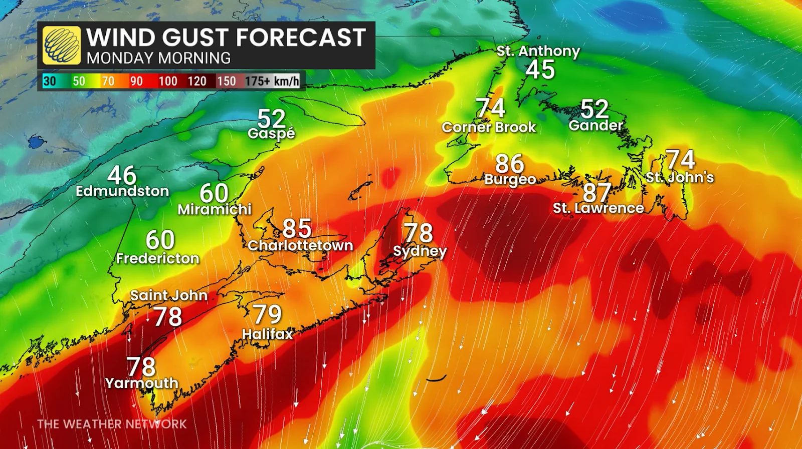
Snowfall rates and wind gusts will both intensify as the storm approaches the coast overnight.
Rates of 2-3 cm per hour, combined with 60-90 km/h wind gusts, will likely create whiteout and blizzard-like conditions.
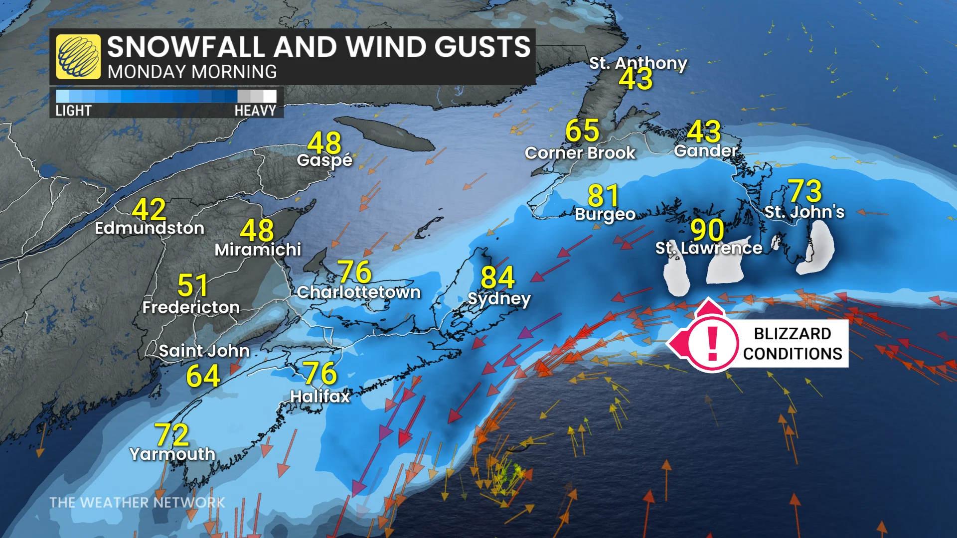
Expect the storm’s disruptions to continue into Monday as the snow and wind move into Newfoundland.
Dangerous winter travel is expected with whiteouts and rapidly accumulating snow. School closures are likely.
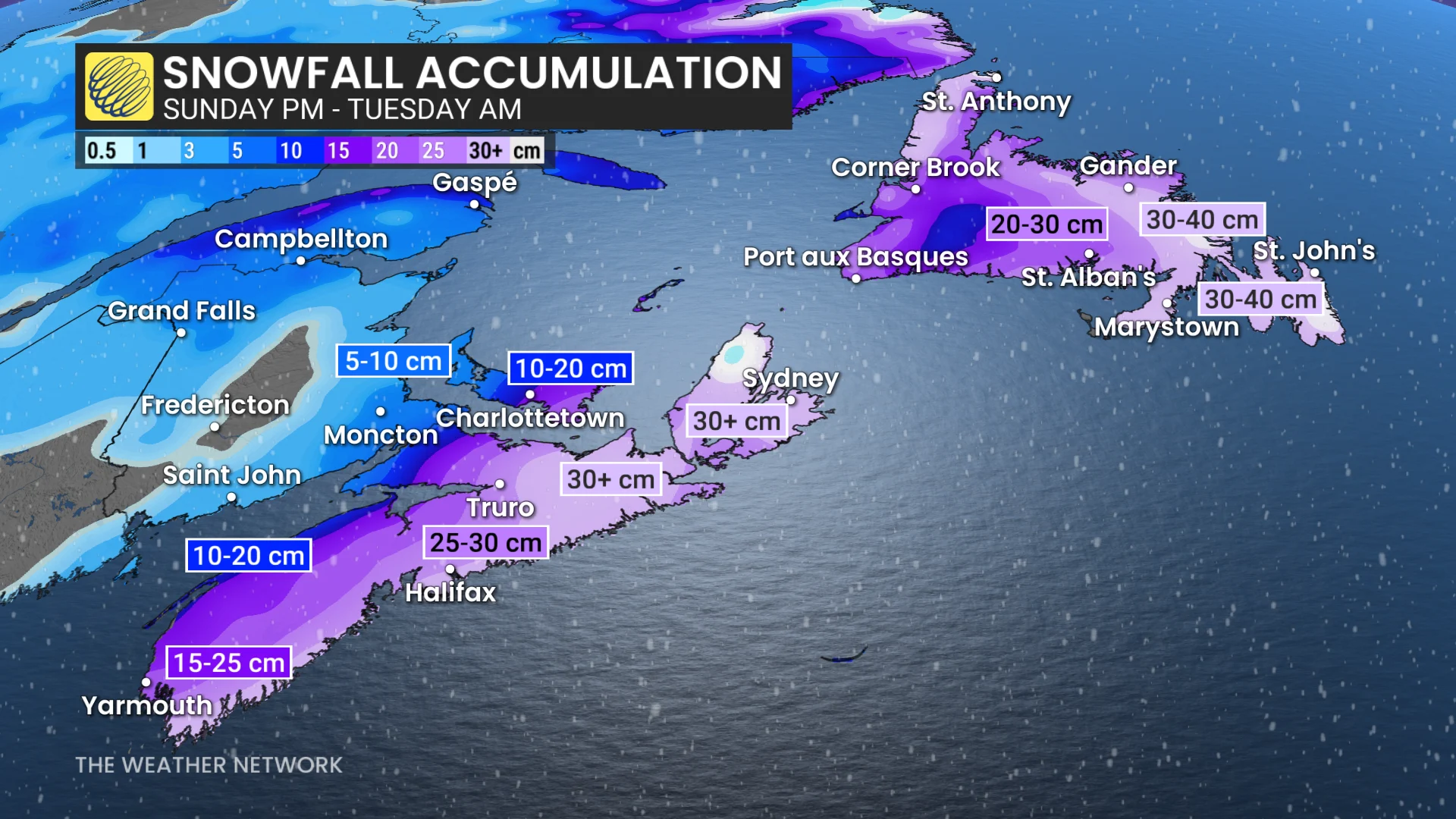
Snowfall totals may range from 20 to more than 30 cm in the hardest-hit regions, which appear to include Nova Scotia and Newfoundland at this time. The precise track of this storm will affect where the heaviest snowfall totals occur.
WATCH: Another Monday snowstorm? Nova Scotia’s storm streak continues