
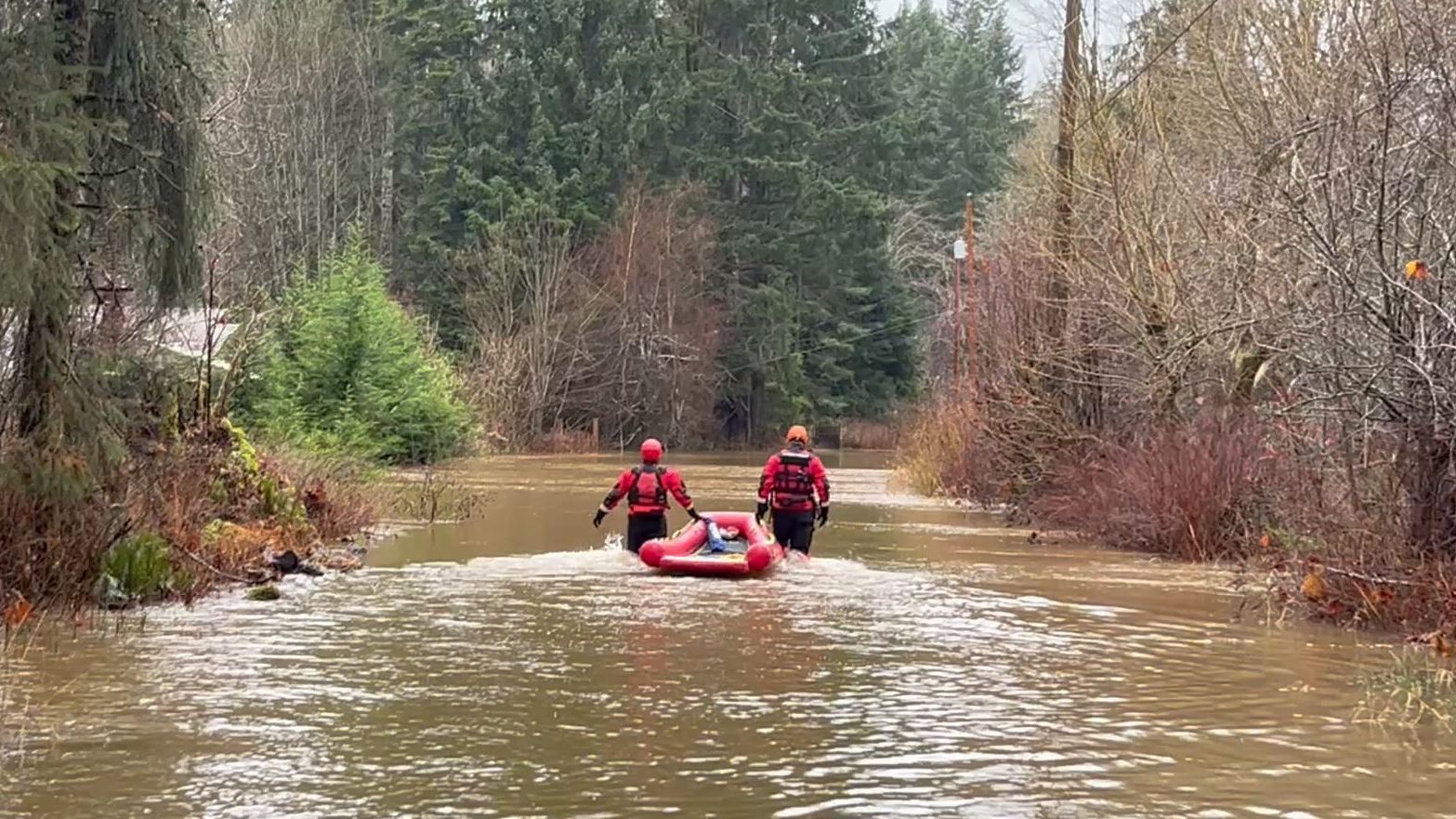
A state of local emergency has been activated and Comox Valley Search and Rescue is launching boats and two Sea-doos in an effort to reach people, dogs and sheep that are trapped amid a flood warning for Dove Creek near Courtenay.
The search and rescue teams are working to pick up seniors along Headquarters Road as chest-deep floodwater continues to rise Friday.
The rescue efforts come after EmergencyInfoBC issued flood warnings, watches and advisories across Vancouver Island, including a flood warning for Dove Creek. Around 1:30 p.m., the Comox Valley Regional District (CVRD) also issued a state of local emergency.
The CVRD says it has opened emergency operations centre (EOC) in response to the flood.
“Residents are encouraged to follow directions of emergency service personnel and obey all road and trail closures,” said the CVRD, adding people should stay away from waterways and low-lying areas.
“If you are in immediate danger, call 911.”
The regional district says an update is expected Friday afternoon.
Flood warning and watches
On Friday afternoon, the BC River Forecast Centre upgraded several weather alerts on Vancouver Island to flood warnings.
Just before 1:30 p.m., flood warnings were issued for Courtenay River and Tsolum River, in addition to Dove Creek.
A flood warning is issued when river levels have exceeded their banks, or will imminently exceed their banks, resulting in flooding of adjacent areas.
Meanwhile, flood watches were issued for Somass River in Port Alberni, and Englishman River.
Flood watches are less severe than flood warnings and are issued when “river levels are rising and will approach or may exceed bankfull,” according to the BC River Forecast Centre.
“Flooding of areas adjacent to affected rivers may occur.”
The remainder of Vancouver Island is under a high streamflow advisory, meaning “river levels are rising or expected to rise rapidly, but that no major flooding is expected.”
During a high streamflow advisory, people should also watch for minor flooding in low-lying areas, and be aware of increased risk to safety in fast-flowing bodies of water.
“Based on the current hydrological modeling, streamflows in the above regions are expected to rise significantly today into tomorrow,” said the forecast centre on Friday afternoon.
“Very localized heavy rainfall has caused the river level in the Dove Creek to rise significantly overnight and the Water Survey of Canada hydrometric station DOVE CREEK NEAR THE MOUTH (08HB075) has recorded a flow of 161 m3/s, which is a flow greater than the 100-year return period,” it said.
It added that flows in Dove Creek are receding as of 1:30 p.m., but they are still considered “very high.”
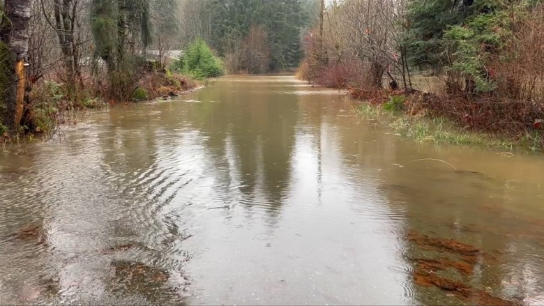 Flood waters are shown along Headquarters Road on Jan. 30, 2026. (CHEK News)
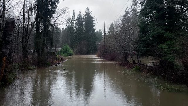 Flood waters are shown along Headquarters Road on Jan. 30, 2026. (CHEK News)
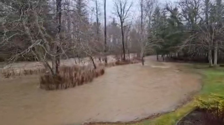 Dove Creek is pictured just south of Dove Creek Bridge on Jan. 30, 2026. (Brennan Day)
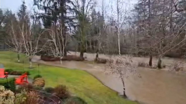 Dove Creek is pictured just south of Dove Creek Bridge on Jan. 30, 2026. (Brennan Day)
EmergencyInfoBC urges people to “stay safe in and around rivers through the region” and to be prepared for difficult driving conditions and potential road washouts.
“Never drive through flood waters or across road washouts,” said the organization.
The latest updates on river conditions can be found on the BC River Forecast Centre website.
The City of Courtenay also closed several recreation spaces due to flooding.
Rain warnings and washouts
Meanwhile, on Friday morning DriveBC said Highway 28, which connects Campbell River to Gold River, was closed due to a washout.
The closure was announced just after 7:30 a.m., with DriveBC saying that no detours were in place.
A rainfall warning is also in effect for large swaths of Vancouver Island, including East Vancouver Island and West Vancouver Island.
On East Vancouver Island, 50 to 70 millimetres of rain is expected to fall over communities from Nanoose Bay to Campbell River, according to Environment Canada.
Meanwhile, over West Vancouver Island, Environment Canada is forecasting 100 to 140 millimetres of rain on Friday for coastal communities including Tofino, Ucluelet, Bamfield, Zeballos and Tahsis – as well as Highway 4.
With files from CHEK’s Skye Ryan
RELATED: Video shows washout that closed Highway 28 near Campbell River