
A ‘Beast from the East’ storm could soon bring snow to several cities across the UK including London, Birmingham, Manchester and Edinburgh, weather forecasting maps suggest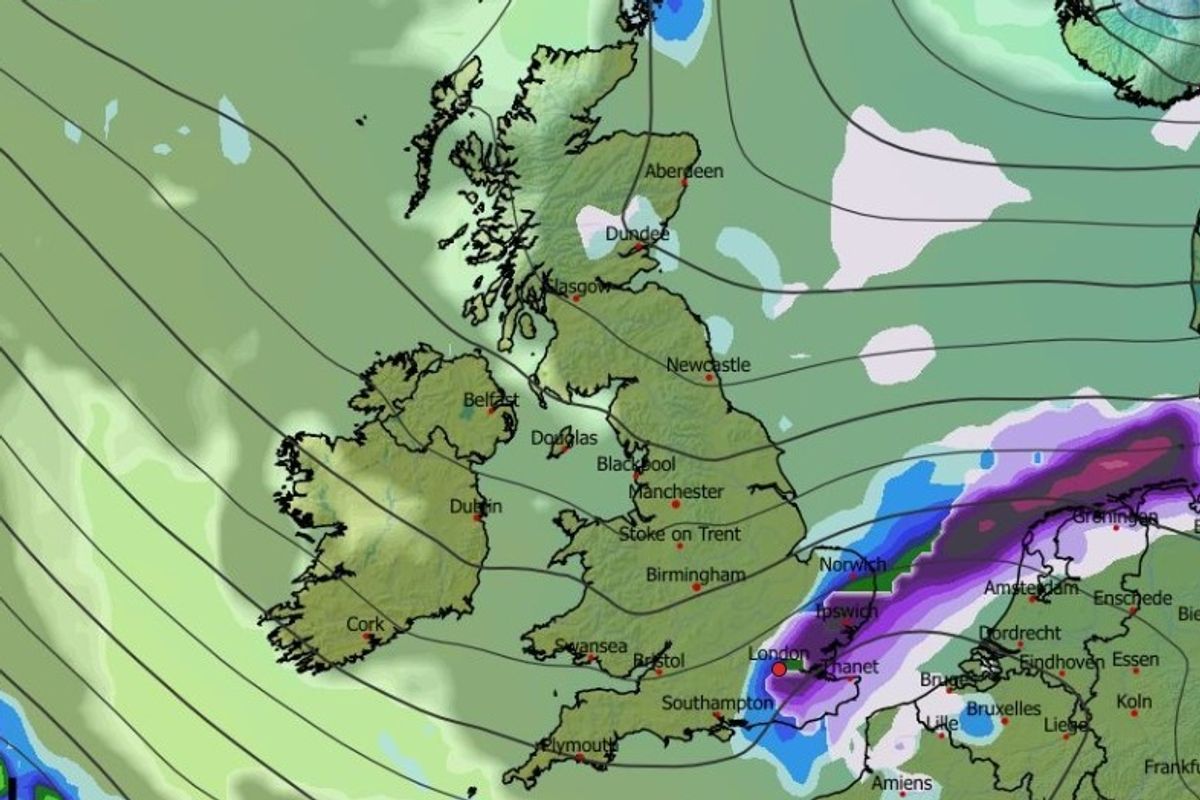
A major snowstorm could soon move in from the east(Image: WX CHARTS)
Advanced weather modelling maps suggest a ‘Beast from the East’ snowstorm could be just days away from bringing the white stuff to major cities across the UK.
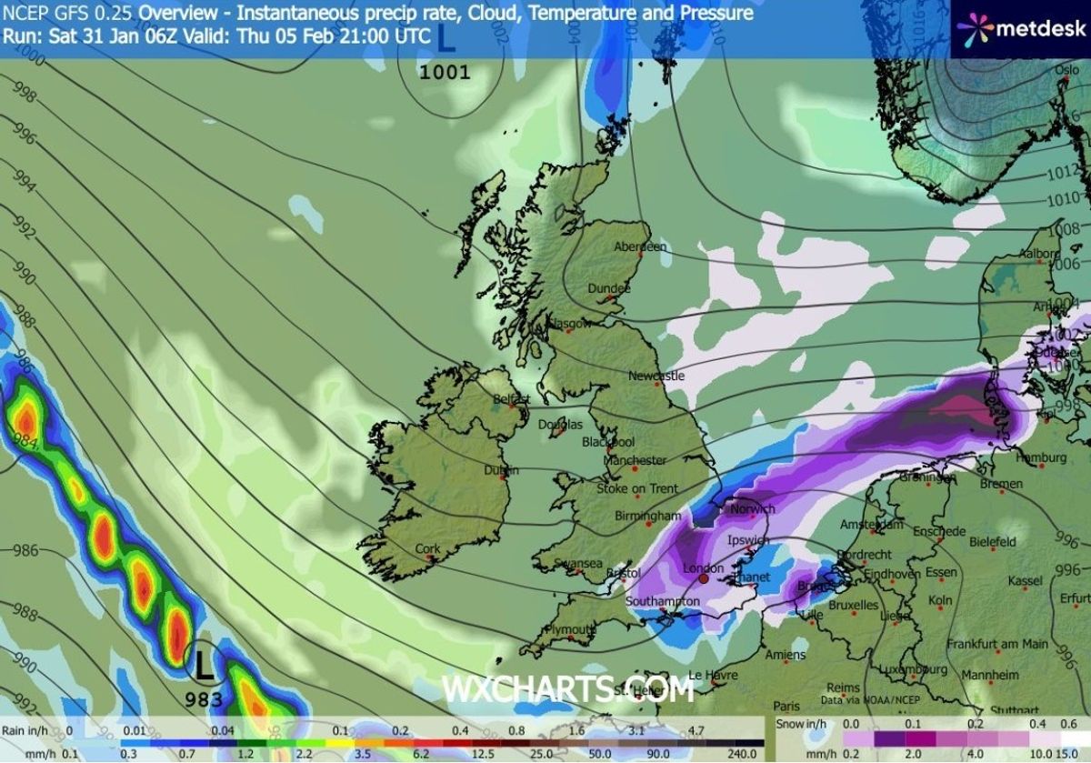
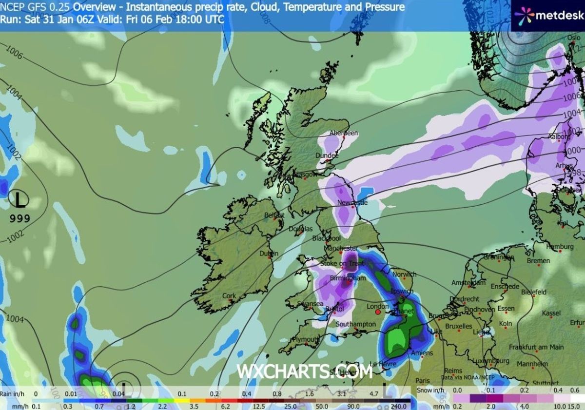
The GFS weather model shows snow moving across the UK from the east on February 5, with flurries initially hitting the south-east and East Anglia. London looks set to see snow at around 6pm, the maps suggest.
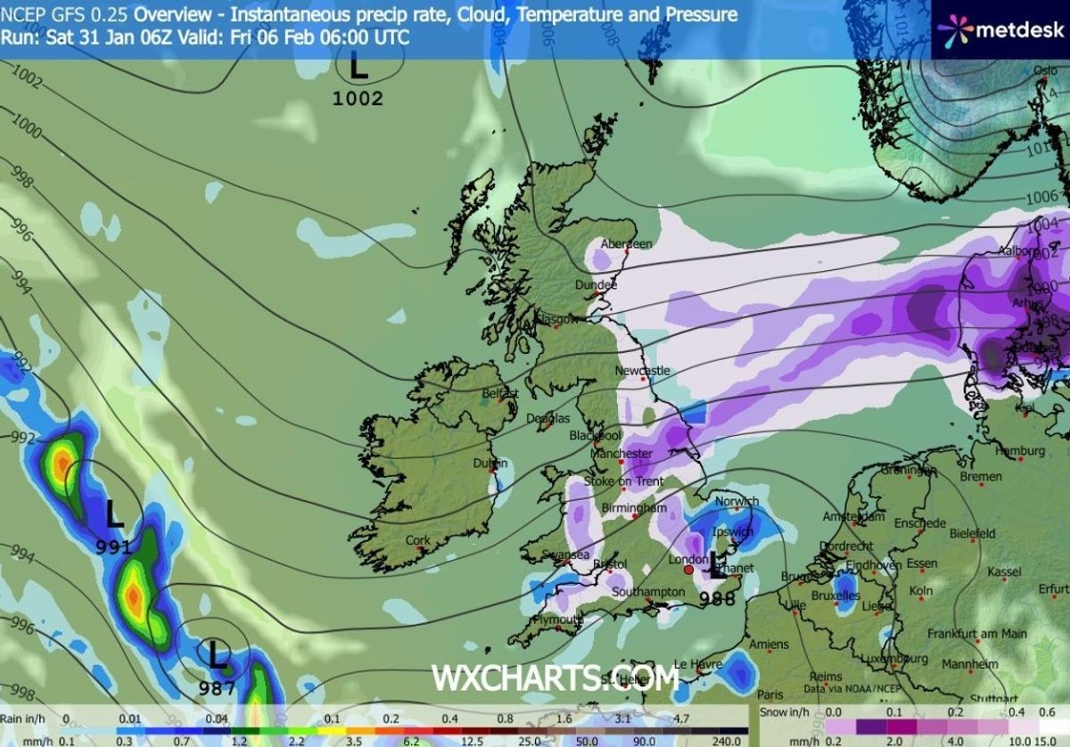
By 9pm, maps show snow falling over a massive swathe of eastern, central and southern England as the storm makes its way across the country. Flurries will have reached northern Scotland and Wales by 6am on February 6.
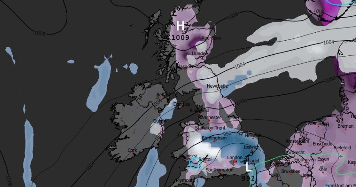
London is among the cities facing snow(Image: WX CHARTS)
READ MORE: Met Office urges Brits in 7 areas to make ’emergency’ kit with 3 essential itemsREAD MORE: Snow maps reveal twin blizzards to bury most of Britain in 48 hour weather blast
Several major cities look set to see snow during this blizzard. As well as London, the maps suggest Birmingham, Cardiff, Manchester, Newcastle and Edinburgh could all see snow.
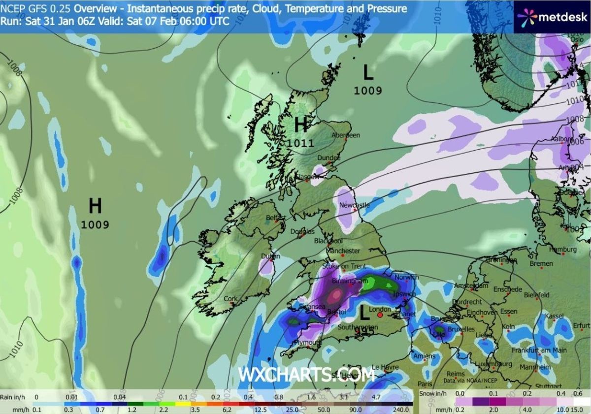
At 6pm on February 6, maps show heavy flurries falling over Birmingham and the Peak District. Intense snow is expected on the England-Wales border on February 7.
Snow could also hit Wales and Scotland(Image: WX CHARTS)
READ MORE: Snow maps reveal exact date ‘Beast from the East’ storm will bury 90% of UK
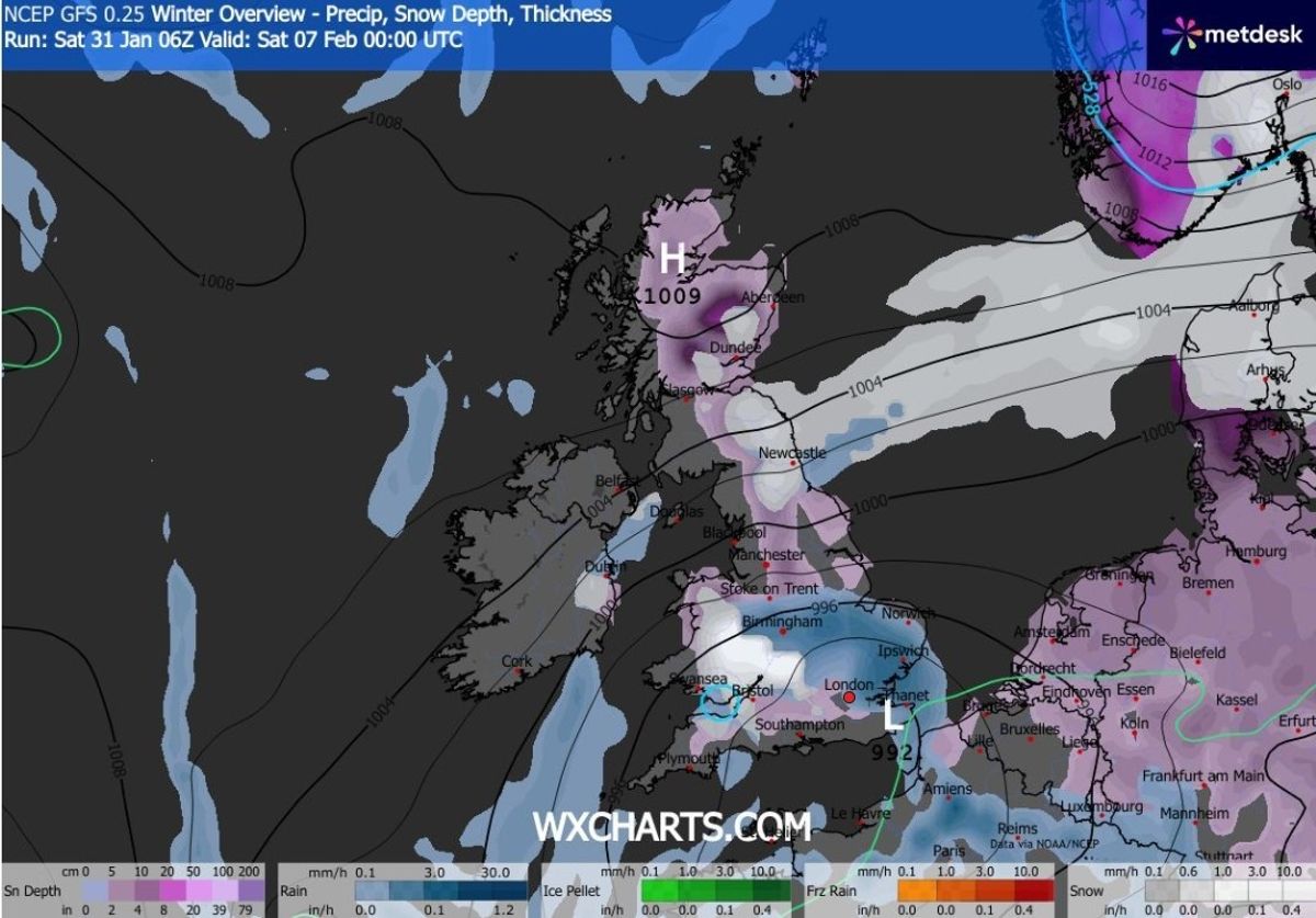
Snow coverage maps reveal the full extent of this wintry weather blast, with snow settling on the ground across southern England, the Midlands, Wales, northern England and most of Scotland.
The data suggests as much as 20cm could settle in the Scottish Highlands. Thankfully, accumulations elsewhere won’t be as great. Northern England and Wales can expect up to 5cm, according to the maps.
The blizzard is expected to last for several hours(Image: WX CHARTS)
READ MORE: UK snow forecast as ‘Beast from the East’ to bring 26 inches and bury cities
The Met Office says there is a risk of “wintry hazards” as we move into February. Its forecast for February 4 to 13 states: “Frontal systems over the North Atlantic, steered by a south-shifted jet stream, are likely to approach the UK at times, but tending to stall as they encounter a blocking area of high pressure to the north and northeast.
“This will result in further spells of rain at times, falling in areas already sensitive to flooding. As these bands of rain spread northwards, some snow will be possible on high ground in northern England and Scotland as they encounter colder air.
Heavy flurries are on the cards across the England-Wales border(Image: WX CHARTS)
READ MORE: Snow forecast maps reveal ‘devastating’ weather phenomenon to hit Brits in days
“A subtle shift southwards of these areas of low pressure is anticipated during the second week of February, which may allow a greater chance of colder air to spread across northern UK at least, bringing an increased risk of wintry hazards for a time.”
There is also the possibility of more snow to come later in the month, the Met Office says. Its forecast for February 14 to 28 adds: “Whilst confidence is lower through this period, a south-shifted jet stream is likely to persist much of the time, steering areas of low pressure towards and south of the UK.
Snow coverage (in purple) on February 7(Image: WX CHARTS)
READ MORE: Snow forecast as six-day blizzard bringing 100cm to bury 600-mile stretch of UK
“This is likely to bring further spells of wet and windy weather, rain most frequent in the south and west, and perhaps also eastern Scotland, with the driest conditions, relative to normal, in northwest Scotland.
“Some hill snow will be possible at times as the wet weather encounters colder air across northern parts of the UK. Temperatures for the period as a whole will likely be close to average in the southwest, but a little below in the northeast.”