
The Met Office expects this week’s rain to ‘turn wintry later in the week as colder air moves in from the north’
16:00, 09 Feb 2026Updated 16:12, 09 Feb 2026
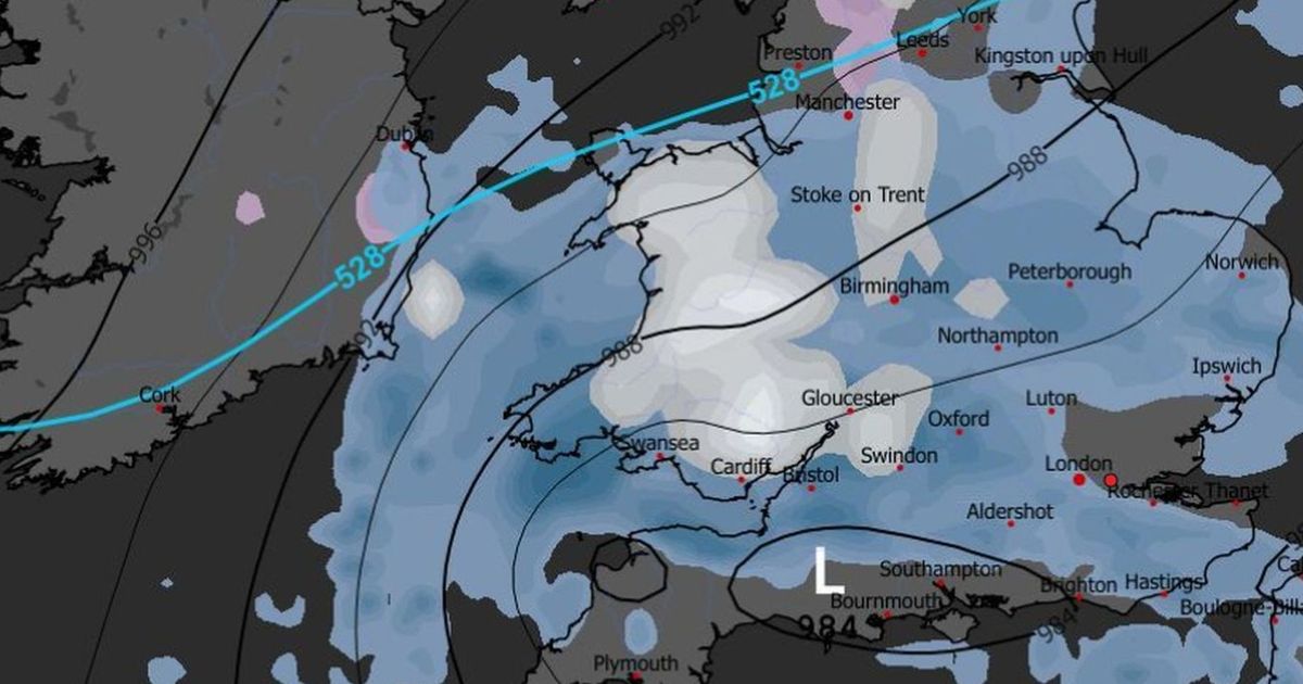
ECM forecasted snow on Friday, February 13. The Met Office expects any snow to arrive later in the day(Image: WXCharts)
Weather models are aligning for a switch to colder conditions later this week. This introduces the potential for snow, with falls currently signalled for two days in North Wales.
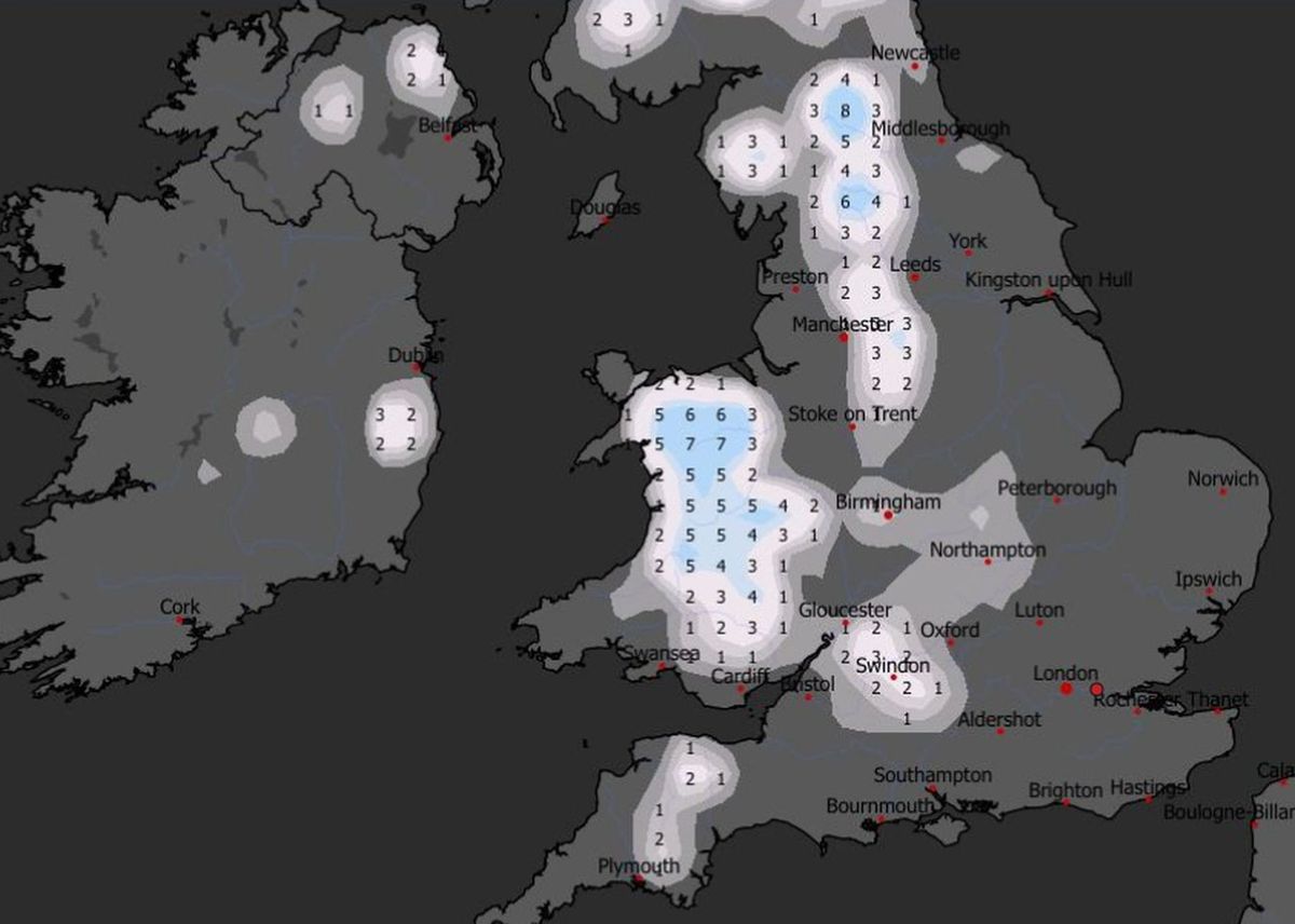
Accumulations of up to 7cm are forecast on Friday, February 13, and potentially again on Sunday, February 15. Any snow is likely to be mainly on the hills – but with minimum temperatures set to dip below zero, falls could also be seen on lower ground away from the coast.
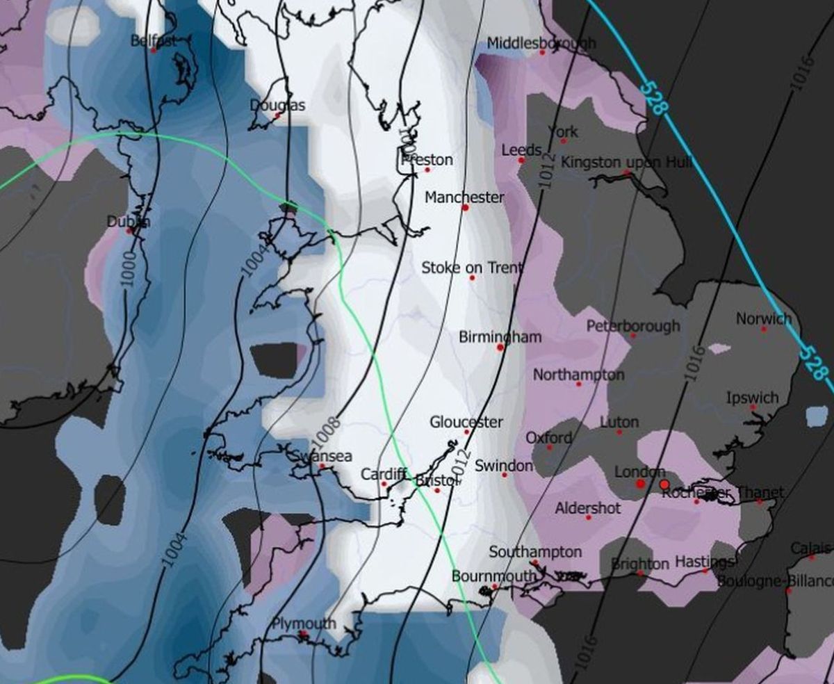
At present, model runs suggest a switch to northerly air flow, introducing colder conditions. As low pressure systems move in from the Atlantic, rain could turn to snow as they meet the cold air mass.
In its forecast for Wales, the Met Office said much of the week is set to be dominated by rain, some of it heavy and prolonged. But the forecaster confirmed: “Rain and showers turning wintry later in the week as colder air moves in from the north.”
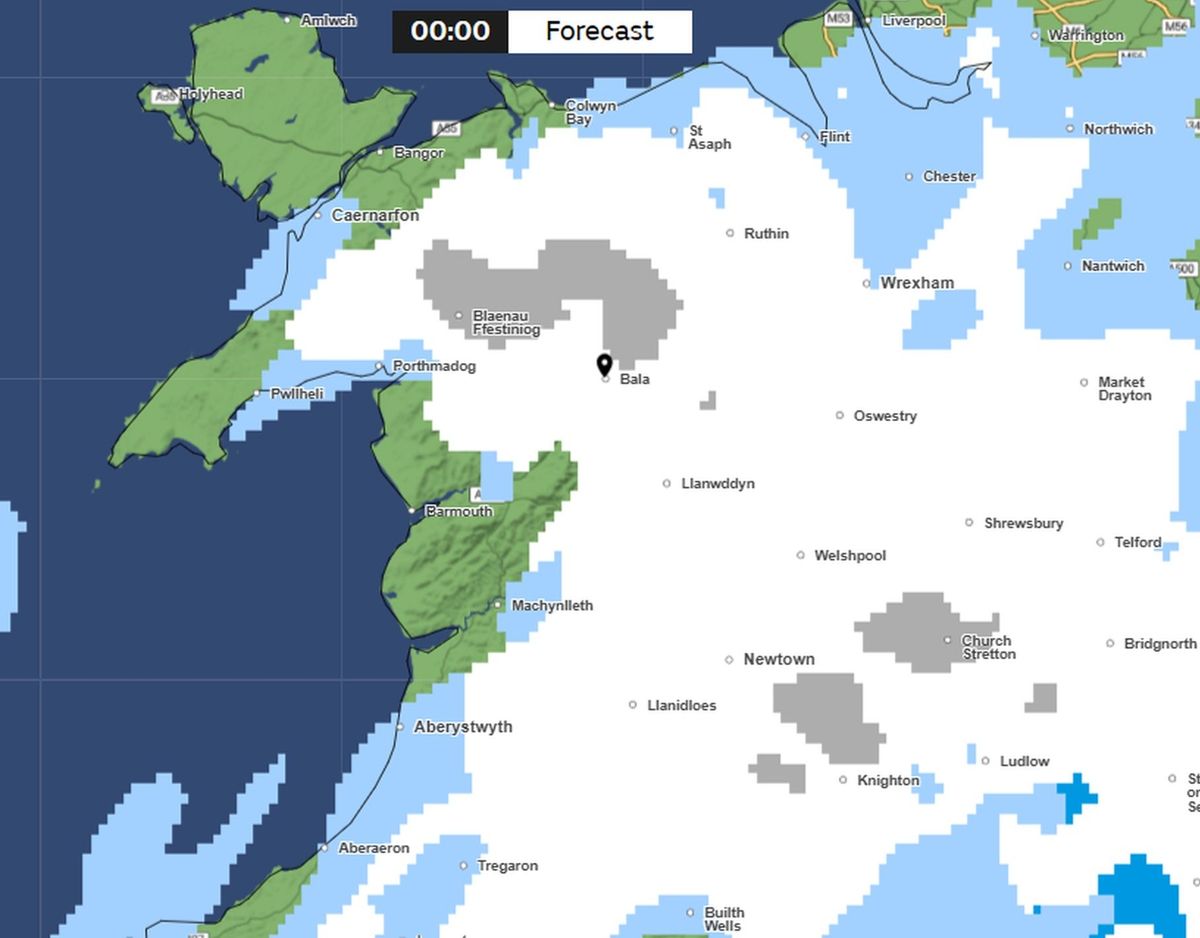
The Met Office expects falls from late Friday afternoon into Saturday. These will be mainly in Gwynedd, Conwy and Denbighshire, with shorter spells in Flintshire and Wrexham. On most model runs, Anglesey is expected to remain snow-free.
These will be mainly in Gwynedd, Conwy and Denbighshire, with shorter spells in Flintshire and Wrexham. On most model runs, Anglesey is expected to remain snow-free.
With rain fronts moving south east, spells of snow are also forecast for Mid Wales and southeast Wales. The North Wales Live Whatsapp community for top stories and breaking news is live now – here’s how to sign up
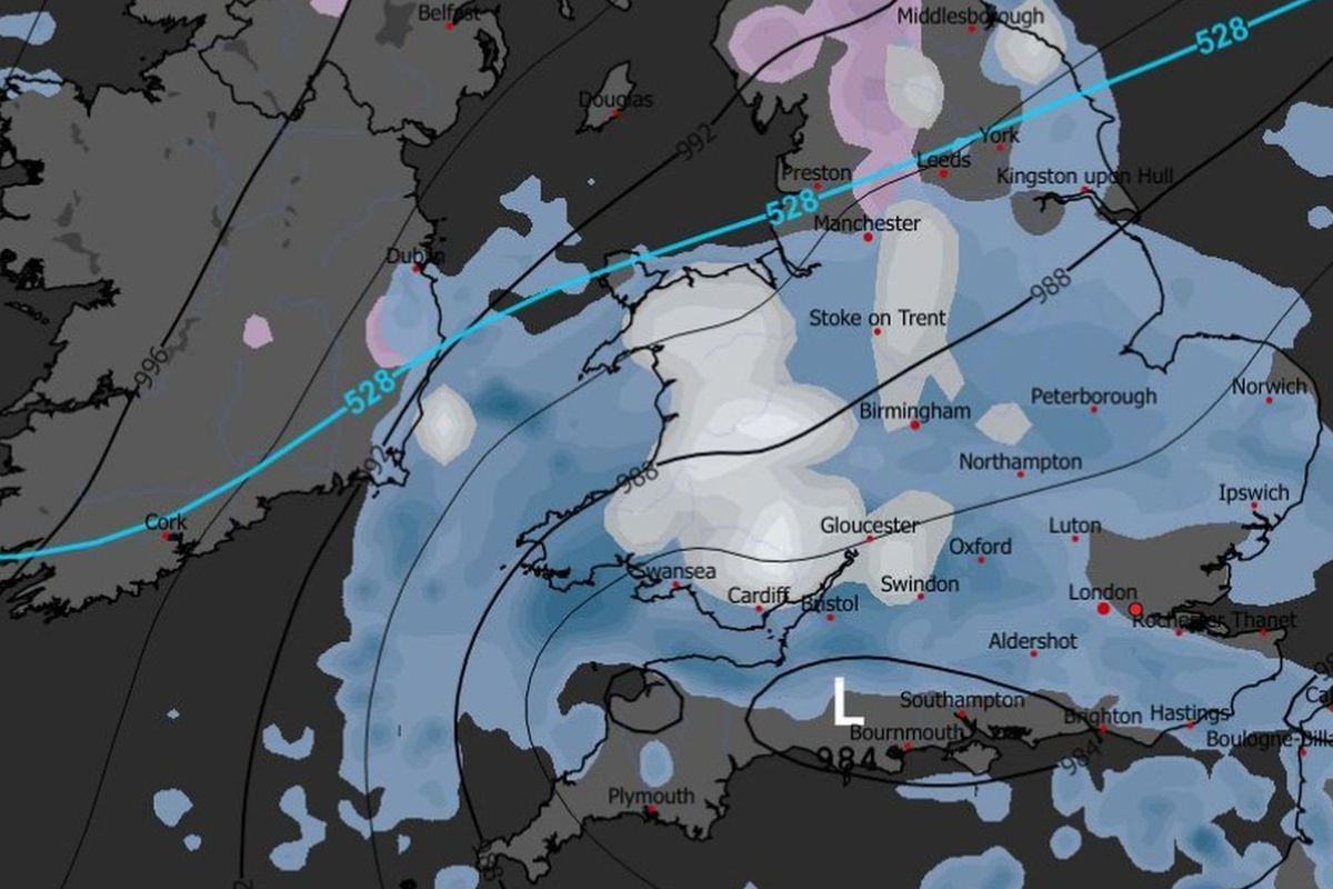
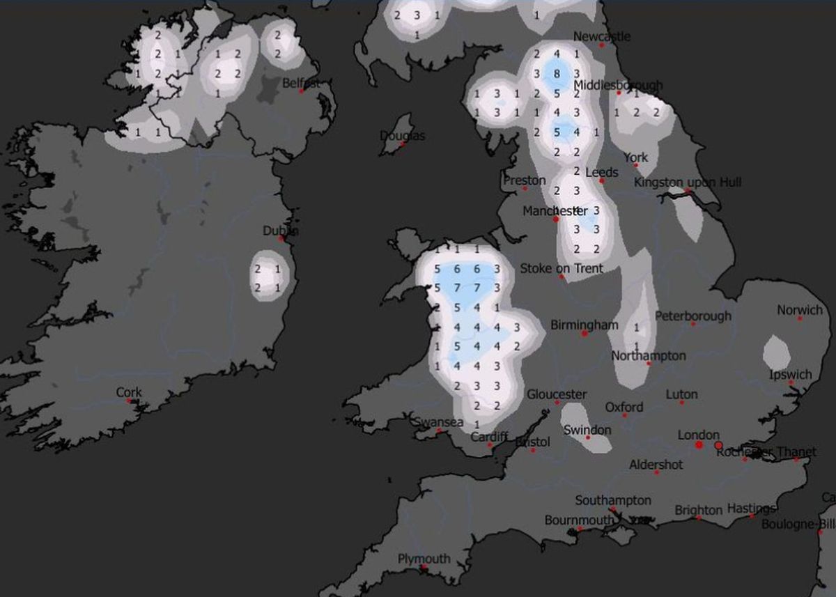
Forecasted snowfall distribution at midnight on Friday, February 13(Image: Met Office)
More snow is possible on Sunday, though confidence is lower. Approaching rain is forecast, with US model runs suggesting snowfall right across Wales.
However the European model indicates the cold spell will be short-lived and any snow in Wales will be focused further north.
Potential snow depths on Friday, February 13, according to ECM modelling(Image: WXCharts)
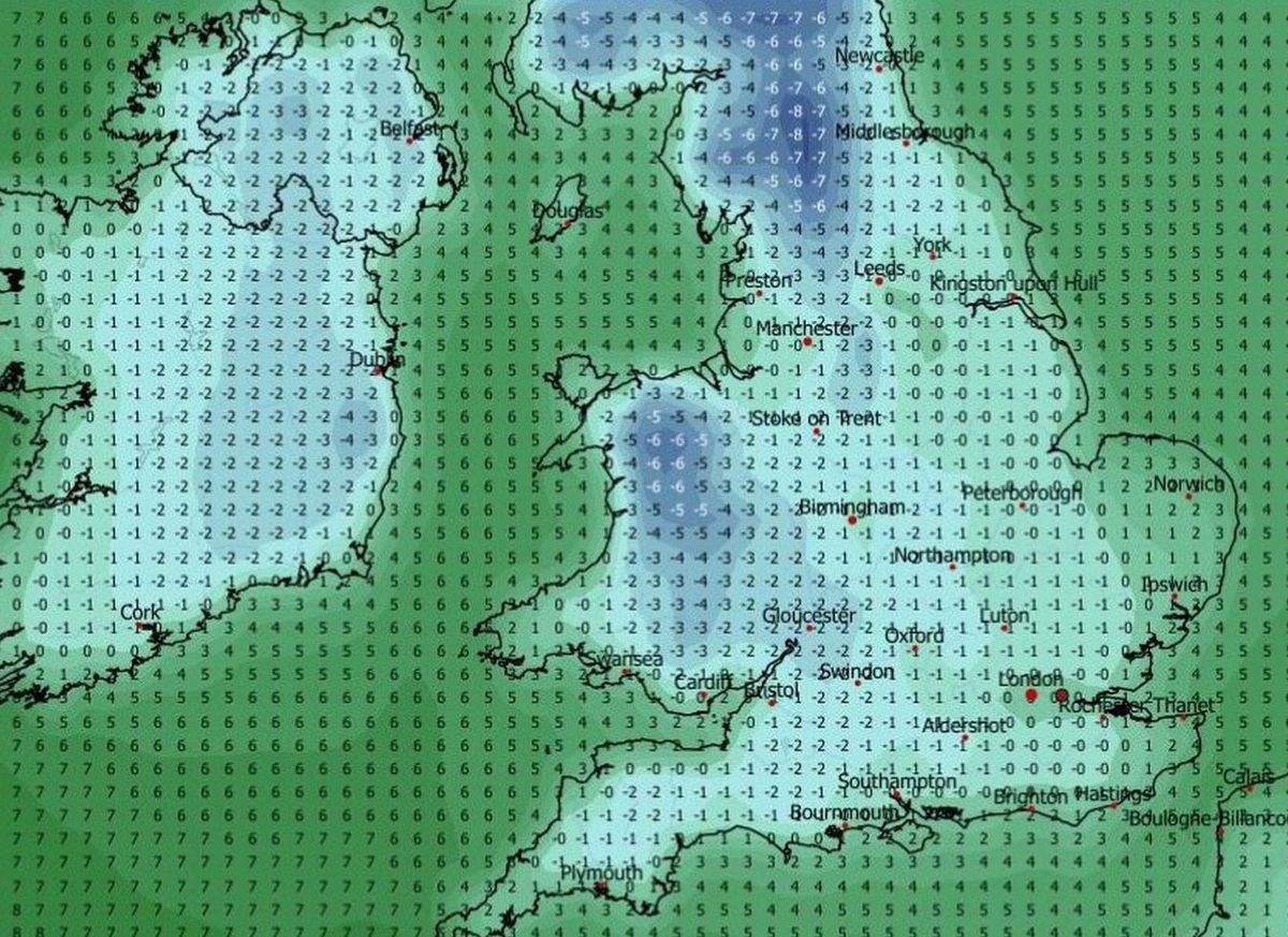
The Met Office expects temperatures to tumble on Friday night, encouraging any rain to turn to snow. Temperature minimums of -6C are possible in places.
Saturday night is set to be cold again before temperatures start easing back up, at least for a while.
Later in the month, incursions of high pressure are possible, at times giving relief from this winter’s incessant rain. Another cold spell is currently for later the following week (February 20-21) – but at this range, confidence is low.
GFS forecasted temperature minimums in the early hours of Saturday, February 14(Image: WXCharts)
In its medium-range UK outlook, for Friday to Sunday, February 13-22, the Met Office, said a return to wetter conditions is likely after the cold snap.
The forecaster said: “The early part of this period could see colder conditions becoming established more widely for a time, bringing with it the likelihood of some snow, primarily to the north and northeast.
“By the end of this period, the track of Atlantic depressions may shift a little further north than during the last few weeks. This will maintain broadly unsettled weather, with further spells of rain and perhaps strong winds at times.
“Many parts may become somewhat milder, given more of a westerly influence, though there remains the chance that colder conditions could linger towards the northeast.”
GFS forecasted snow on Sunday, February 15. Confidence in this model run is lower, with any snow more likely to be confined to North Wales(Image: WXCharts)
If this week’s set-up materialises, it will mark a change in modelled outcomes that, since mid-January 2026, have been signalling potential snowy spells.
A Scandinavian blocking high was expected to pull easterly winds across Britain, pushing temperatures down and ushering in widespread snow.
However this hasn’t happened as cold air over North America has super-changed the jet stream, pushing it south.
With North America set to warm this week, weakening the jet stream, colder air may finally make an entrance, albeit from the north.
ECM forecasted snow depths on Sunday, February 15(Image: WXCharts)
Later in February into March, the Met Office expects more wet weather, some with potential to cause flooding given the sodden ground. Sign up for the North Wales Live newsletter sent twice daily to your inbox
For this period, the national forecaster added: “Temperatures probably close to or a little above average overall, with a reduced chance – compared to earlier thinking – of a late-season prolonged cold spell.”
Find the weather forecast where you live