
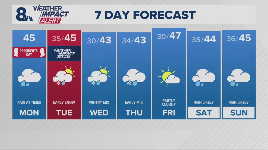
Snow is going to roll through the Cascades this week, and Portland could even get dusted overnight.
PORTLAND, Ore. — A Winter Weather Advisory is in place with snow levels expected to drop low enough to give the Valley — and even Portland — a dusting of snow overnight Monday.
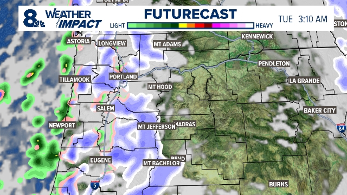
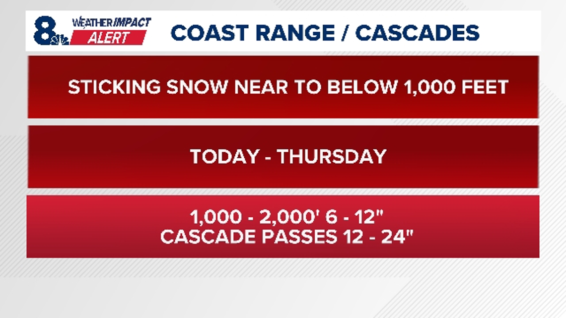
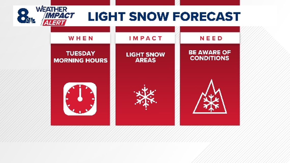
The lowest elevations are expected to start getting snow around 3:10 a.m. on Tuesday. The Cascades are likely to get snow throughout the rest of the week. Snow will stick around near to below 1,000 feet of elevation.
Forecast models predicted 6 to 12 inches of snow above 1,000 feet. The Cascade Passes could get 12 to 24 inches.
KGW Meteorologist Rod Hill said that the snow threat will continue at times into Thursday morning, especially overnight.
KGW issued a KGW Weather Impact Alert for the Portland metro area on Tuesday. There is already a Weather Impact Alert in place for the Coast Range and the Cascades.
RELATED: Weather Impact Alert issued for Coast Range and Cascades

When
Snow and colder temperatures are expected in the Coast Range and Cascades from Monday through Thursday, and Portland could get a dusting of snow overnight starting around 3 a.m. on Tuesday.

Impact
Light snow totals in Portland could affect driving conditions. Drive slowly, and be careful on sidewalks.
The incoming cold air and low snow levels are expected to bring snow accumulation to the Coast Range and Cascades, creating slick roads and challenging travel conditions in higher elevations.

Need
Residents are urged to monitor forecasts, use traction tires if driving, carry an emergency bag, and avoid unnecessary travel in affected areas.
What are Weather Impact Alert days?
It’s our goal to make sure you have the most accurate and up-to-date information about the weather and its impact on you. The new KGW Weather Impact Alerts will be just that, alerts as far in advance as possible, so that you can be armed with accurate information to keep yourself and your family safe.