
Environment Canada has issued a winter storm warning for Toronto and the GTHA, with snow, freezing rain, and ice pellets in the forecast for Wednesday.
A winter storm yellow warning is now in effect for Toronto ahead of the arrival of a system that will bring snow, freezing rain and ice pellets and could cause treacherous conditions on roadways on Wednesday.
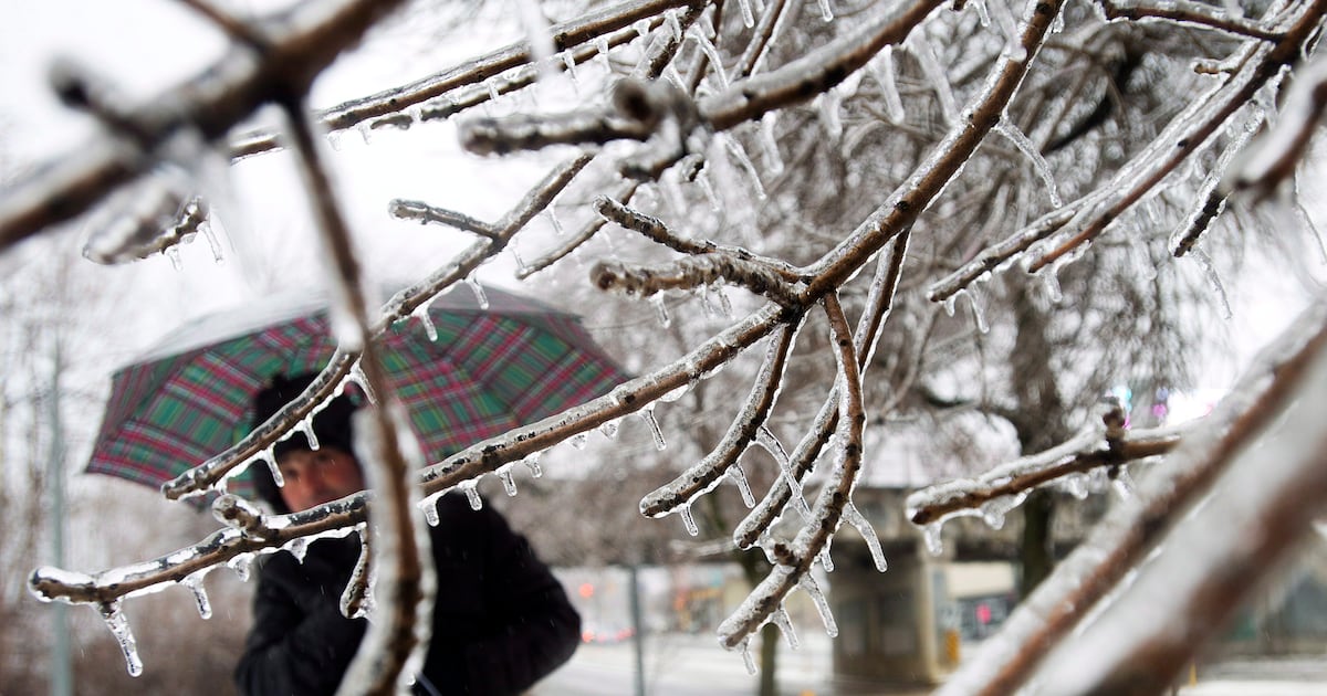
Environment Canada says the city and the rest of the Greater Toronto Area could see snow and ice pellet amounts of up to five centimetres and “multiple hours of freezing,” which could result in an ice buildup of a few millimetres.
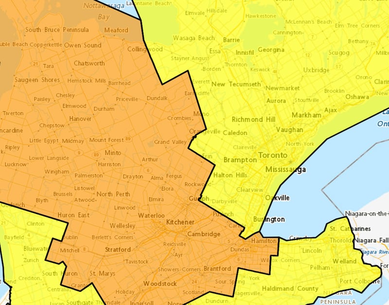 Weather warnings Most of southern Ontario is under a weather advisory ahead of the arrival of a winter storm.
“Roads and walkways will likely be difficult to navigate. There may be a significant impact on rush hour traffic. Prepare for quickly changing and deteriorating travel conditions. Allow extra time for travel,” Environment Canada said in its advisory.
The national weather agency notes that areas west of Toronto will predominantly see freezing rain.
“We are on the approach to a major storm system that is going to arrive tomorrow morning at around 3 a.m. and last until just after the dinner hour,” CP24 Meteorologist Bill Coulter said Tuesday.
“(It will be) high impact with snow and freezing rain and plenty of it coming in overnight tonight.”
Coulter added five millimetres of ice accretion is also expected.
“It doesn’t sound like a lot but it is and that ice accretion is especially dangerous on untreated secondary roads and can weigh heavy of tree limbs and tree branches and cause some power outages as well,” he said.
Other parts of southern Ontario, including the City of Hamilton, are under an orange freezing rain warning.
Those areas could see ice accretion of five to 10 millimetres.
“The most hazardous conditions are expected over areas of higher elevation. Areas closer to Lake Huron may be less affected with temperatures likely rising above the freezing mark,” Environment Canada said.
The GTA is also currently under a yellow advisory for fog.
“Near-zero visibility in fog continues over some areas,” Environment Canada said. “Visibility will likely be suddenly reduced at times.”
Metrolinx warns of delays on GO, UP Express
Coulter noted that anyone with travel plans on Wednesday should “pay attention and adjust accordingly.”
“Maybe take advantage of today’s relative calm and mild conditions,” he added.
In response to the upcoming system, Metrolinx sent out a statement on Tuesday, warning commuters to anticipate delays on GO Transit and UP Express when the inclement weather hits.
“A significant winter storm is expected to reach the Greater Toronto Area early Wednesday, and customers travelling on GO Transit and UP Express may experience delays. We’re encouraging everyone to plan ahead, allow extra time, and travel with caution,” the statement read.
“We will monitor the conditions and update customers when new information is available. Please use caution at stations and on platforms and try to use shelters to shield yourself.”
‘A buffet of weather types’
Retired Environment Canada climatologist David Phillips said while Toronto got to a balmy high of 6 C on Tuesday, the warmest temperature the city has seen in 40 days, winter will be in full gear come Wednesday.
“We have an enormous storm out (in) Western Canada. They say it is a Montana Clipper… It is packed with lots of moisture from the Pacific and Arctic air from the north and it is creating havoc across the Prairies as we speak,” he said.
He said that system will make its way to Ontario early Wednesday morning.
“It is really tricky. … Some areas of Ontario are going to see just rain, and that is going to maybe cause some flooding issues. We are going to see some areas, like… Newmarket, Richmond Hill might see 15 cm of snow. And up in Barrie, may be even more snow,” he said.
“Then there is that tricky area where you are near that freezing mark. Lots of action happens weather-wise… when you get near that freezing mark. It could be rain, snow, or it could be that congealed mixture of the freezing rain or ice pellets.”
He said Toronto could see a “buffet of weather types.”
“In the Toronto area, we could see the rain, and we could see mixed with freezing rain, beginning about 4 a.m. and then snow after that,” Phillips said.
“We just have to kind of wait until the storm arrives to be able to see well how many hours of freezing rain (we’ll get).”
With files from CTV News Toronto’s Alex Arsenych