
The Met Office has issued a warning for snow which came into force at 4pm on Wednesday, but we could see some snowfall before then
17:03, 17 Feb 2026Updated 17:17, 17 Feb 2026

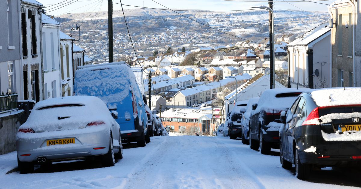
Snow in Merthyr Tydfil in January. There could be more on the way according to the Met Office(Image: WalesOnline/Rob Browne)
Snow and ice is expected to cause disruption in parts of Wales on Wednesday with a Met Office warning in place across most of the country. The yellow warning for snow comes into force at 4pm on Wednesday and will remain in place until 6am on Thursday.
It will cover Blaenau Gwent, Bridgend, Caerphilly, Carmarthenshire, Ceredigion, Conwy, Denbighshire, Gwynedd, Merthyr Tydfil, Monmouthshire, Neath Port Talbot, Newport, Pembrokeshire, Powys, Rhondda Cynon Taf, Swansea, Torfaen and Wrexham. Read the biggest stories in Wales first by signing up to our daily newsletter here.
According to the Met Office: “A period of snow could bring some disruption to parts of Wales and central England later Wednesday and overnight into Thursday.
“2-5 cm of snow could accumulate quite widely above 150-200 metres, with perhaps as much as 10-15 cm above 250-300 metres in mid and southeast Wales.
“Snowy, wintry weather can cause delays and make driving conditions dangerous so, to keep yourself and others safe, plan your route, checking for delays and road closures, amending your travel plans if necessary.”
Ensure our latest news and sport headlines always appear at the top of your Google Search by making us a Preferred Source. Click here to activate or add us as Preferred Source in your Google search settings.
Wednesday morning
Looking at the Met Office weather maps, snow could start to fall in south Wales shortly after midnight on Wednesday in areas around Maesteg, Pontypridd, Llandeilo, and parts of Pembrokeshire.
By 2am this could be much more widespread, affecting larger parts of Pembrokeshire and further afield in mid and east Wales.
By 6am snow is expected to fall in Merthyr Tydfil, Brecon, Abergavenny, and further north to Builth Wells
By 9am snow will be seen in large parts of mid Wales and stretching into north Wales, according to Met Office maps.
Wednesday afternoon
As we get to 1pm on Wednesday large parts of mid and north Wales will have snow, as well as Merthyr Tydfil.
By the time the 4pm yellow warning comes into force, snow will mainly affect eastern parts of south Wales, as well as most of mid and north Wales.
The picture looks largely the same at 7pm on Wednesday, with areas north of Swansea and around Carmarthen expected to see some snowfall too.
By 10pm pockets of snow will fall in south Wales, with much more hitting parts of mid and north Wales.
Thursday morning
By 1am on Thursday most of the snow will have stopped, with bits still likely to fall in isolated areas.
By 4am on Thursday, the snow looks likely to have stopped across the country.
How much of it sticks will depend on how much rainfall we have.
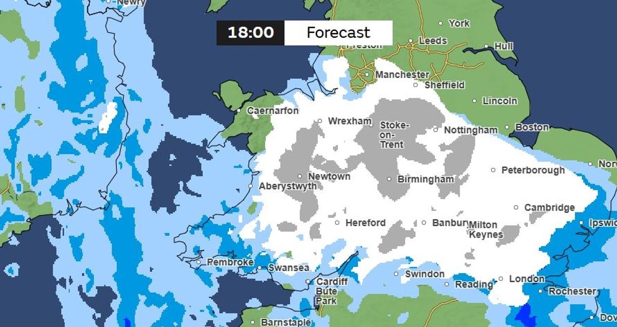
A Met Office weather map for 6pm on Wednesday (Image: Met Office)
Met Office Deputy Chief Forecaster Steven Keates explained the outlook: “On Wednesday, weather fronts are expected to move in from the Atlantic into some western, southern and central areas of the UK.
“As they bump into the cold air already in place, we are likely to see some snow developing, although there is still some uncertainty around the details.
“Initially, we may see some snow over the highest parts of southern England, such as Dartmoor, but the main chance of snow will be across higher parts of the Midlands and mid and southeast Wales.
“Above 150 to 200 metres, 2–5 cm of snow may accumulate, with a few places -most likely above 300 metres -possibly seeing 10 cm or more. Temperatures will be around 3 to 5 °C for much of the UK on Wednesday.”
Get daily breaking news updates on your phone by joining our WhatsApp community here. We occasionally treat members to special offers, promotions and ads from us and our partners. See our Privacy Notice.