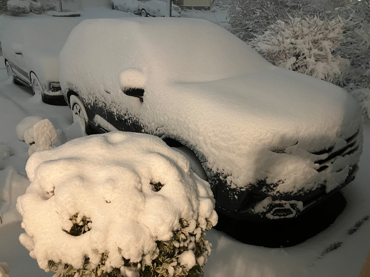
The monster snowstorm that has been pelting New Jersey on Sunday hasn’t even ramped up into a full-blown blizzard yet, but it already has dropped more than a half-foot of snow in at least nine counties.
Preliminary snowfall reports from the National Weather Service showed 9.4 inches of snow on the ground in Howell in Monmouth County, 8 inches in Blackwood in Camden County, and 8 inches in Lakewood in Ocean County as of 9:45 p.m.
Snow accumulations of 6.5 inches were reported in South River in Middlesex County, with 6 inches in several other towns — Edison and East Brunswick in Middlesex County, Freehold and Freehold Township in Monmouth County, and Jackson in Ocean County.
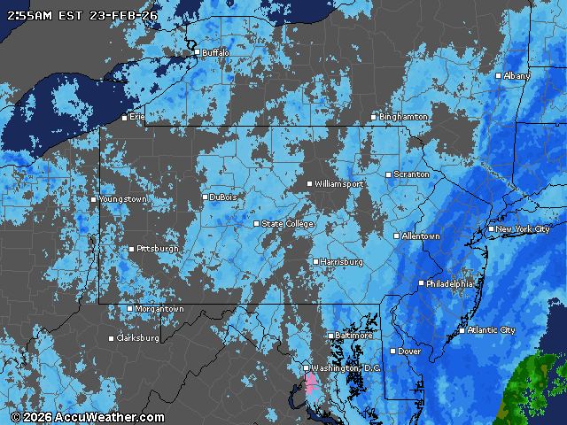
The weather service says the storm is far from over. Forecasters noted snow will be falling at its heaviest rate overnight Sunday into Monday morning, and winds will also be ramping up, posing a risk of downed trees and power outages.
Here’s a look at early snowfall totals across New Jersey as of late Sunday night:
Atlantic CountyVentnor City – 7.6 inchesBrigantine – 7.5 inchesAtlantic City – 7.3 inchesSomers Point – 4.0 inchesHammonton – 3.8 inchesBuena Vista Township – 3 inchesAtlantic City International Airport – 2.6 inchesBergen CountyLeonia – 7.7 inchesRidgefield – 6.8 inchesFranklin Lakes – 7.0 inchesCarlstadt – 6.3 inchesRiver Edge – 5.7 inchesFair Lawn – 5.5 inchesWallington – 4.6 inchesNew Milford – 4.0 inchesNorthvale – 2.6 inchesBurlington CountyLumberton – 7.5 inchesChesterfield – 7.4 inchesMount Laurel – 7.0 inchesBrowns Mills – 6.8 inchesLake Pine – 6.5 inchesTabernacle – 5.3 inchesSouth Jersey Regional Airport – 5.2 inchesMarlton – 5.0 inchesHainesport – 4.8 inchesRancocas – 4.7 inchesLeisuretowne – 3.5 inchesMount Holly WFO – 2.8 inchesColumbus – 1 inchCamden CountyBlackwood – 8.0 inchesCollingswood – 7.0 inchesAshland – 5.0 inchesMt. Ephraim – 3.5 inchesCherry Hill – 3.5 inchesCamden – 2.8 inchesLindenwold – 2.0 inchesCape May CountyCumberland CountyEssex CountyNorth Caldwell – 6.1 inchesNutley – 4.5 inchesGlen Ridge – 4.0 inchesBloomfield – 3.0 inchesNewark Airport – 4.0 inches (Essex & Union)Gloucester CountyWilliamstown – 3.5 inchesWashington Township – 2.1 inchesMickleton – 2.0 inchesHudson CountyHoboken – 5.3 inchesHarrison – 5.0 inchesBayonne – 4.5 inchesKearny – 3.7 inchesHunterdon CountyReadington Township – 3.5 inchesStanton – 3.5 inchesRingoes – 3.0 inchesMercer CountyWest Windsor Township – 5.8 inchesWoodsville – 4.5 inchesHamilton Square – 4.3 inchesEwing – 4.0 inchesTrenton Mercer Airport – 2.8 inchesWashington Crossing – 2.0 inchesPennington – 1.5 inchesMiddlesex CountyPerth Amboy – 7.0 inchesSouth River – 6.5 inchesEdison – 6.1 inchesEast Brunswick – 6.0 inchesNorth Brunswick – 5.6 inchesMetuchen – 5.3 inchesConcordia – 3.5 inchesJamesburg – 3.0 inchesMonmouth CountyHowell – 9.4 inchesColts Neck – 7.8 inchesCenterville – 6.5 inchesFreehold Township – 6.1 inchesFreehold – 6.0 inchesClarksburg – 6.0 inchesWest Long Branch – 4.5 inchesKeyport – 4.2 inchesTinton Falls – 1.9 inchesOakhurst – 1.0 inchMorris CountyMillington – 2.7 inchesJefferson Township – 2.0 inchesOcean CountyLakewood – 8.0 inchesJackson – 6.0 inchesBrick – 5.8 inchesNew Egypt – 5.0 inchesLakewood Township – 5.0 inchesOcean Gate – 4.7 inchesManahawkin – 4.0 inchesBarnegat Township – 3.3 inchesToms River – 3.0 inchesPoint Pleasant Beach – 3.0 inchesTuckerton – 3.0 inchesPassaic CountyClifton – 3.9 inchesWayne – 3.5 inchesSalem CountySomerset CountyWarren – 5.1 inchesHillsborough Township – 1.0 inchSussex CountyAndover-Aeroflex Airport – 2.0 inchesWantage Township – 1.5 inchesUnion CountyWestfield – 6.0 inchesCranford – 6.0 inchesNewark Airport – 4.0 inches (Essex & Union)Warren CountyStewartsville – 3.2 inchesBlairstown – 2.2 inches Current weather radar