
Winter is still holding a firm grip over the city as Environment Canada issued another special weather statement Tuesday for much of the Greater Toronto Area and beyond.
5 to 10 cm of snow expected in GTA Tuesday night, special weather statement says
CBC News · Posted: Feb 24, 2026 3:15 PM EST | Last Updated: February 25
![]()
Listen to this article
Estimated 1 minute
The audio version of this article is generated by AI-based technology. Mispronunciations can occur. We are working with our partners to continually review and improve the results.
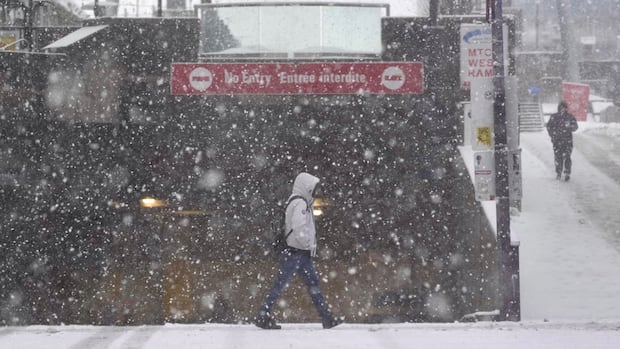
 Environment Canada has issued another special weather statement for much of the Greater Toronto Area and beyond, with up to 10 cm of snow expected to fall Tuesday night. (Evan Mitsui/CBC)
Winter is still holding a firm grip over the city as Environment Canada issued another special weather statement Tuesday for much of the Greater Toronto Area (GTA) and beyond.
The weather agency says five to 10 centimetres of snow is expected Tuesday night, ending overnight. Reduced visibility is expected, with roads and walkways likely difficult to navigate with the accumulating snow.
A large swath of southern Ontario falls under the special weather statement, which spans the GTA and goes as far southwest as London and as far north as the Muskoka area.
The highest snowfall amounts are expected to be along the Oak Ridges Moraine, Environment Canada said.
The snowfall is associated with an Alberta Clipper making its way across the province, according to the weather agency.
That weather system has already shut down major stretches of northern roads near Thunder Bay, and prompted Environment Canada to issue two yellow weather alerts for blowing snow and snow squalls in regions around Georgian Bay and Lake Huron.
Corrections and clarifications·Submit a news tip·Report error