
Published on Mar. 14, 2026, 1:53 PM
Fans of snow and warmth will both have a place to be pleased in Ontario for the coming days, with temperatures nearing 20°C and 40-50+ cm of snow–all in the same province.
A significant winter storm will strengthen and track toward Ontario on Sunday, delivering a mix of snow, ice, rain, and strong winds into early next week.
The major system will bring heavy snow to northern parts of the province and a chance of blizzard conditions for areas along the Trans-Canada Highway in northeastern Ontario.
DON’T MISS: A potentially strong El Niño will develop by this summer
Blowing and drifting snow, coupled with gusts between 50–90+ km/h, will likely make travel impossible through Monday. Road closures are likely. In fact, most of Ontario can expect a threat of strong-to-potentially damaging winds as a result.
Be sure to check back for the latest forecast updates as this system develops, and keep an eye on the road conditions before heading out.
Sunday: Major winter storm develops, with blustery winds, snow and ice
A deep Arctic air supply across the eastern Prairies, paired with exceptionally mild air across the southern U.S., will provide the perfect environment to rapidly develop a low-pressure system throughout Sunday.
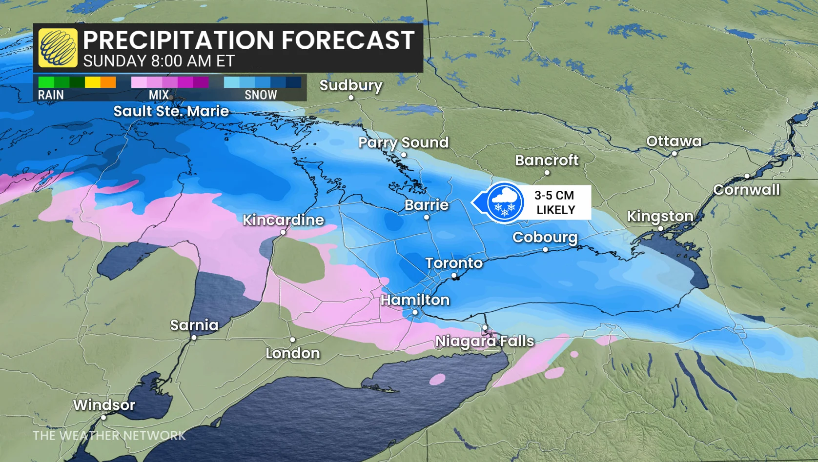
The Colorado low will have a noteworthy low-pressure, likely near 980 hPa by Monday. That means most of Ontario can expect a threat of strong-to-potentially damaging winds.