
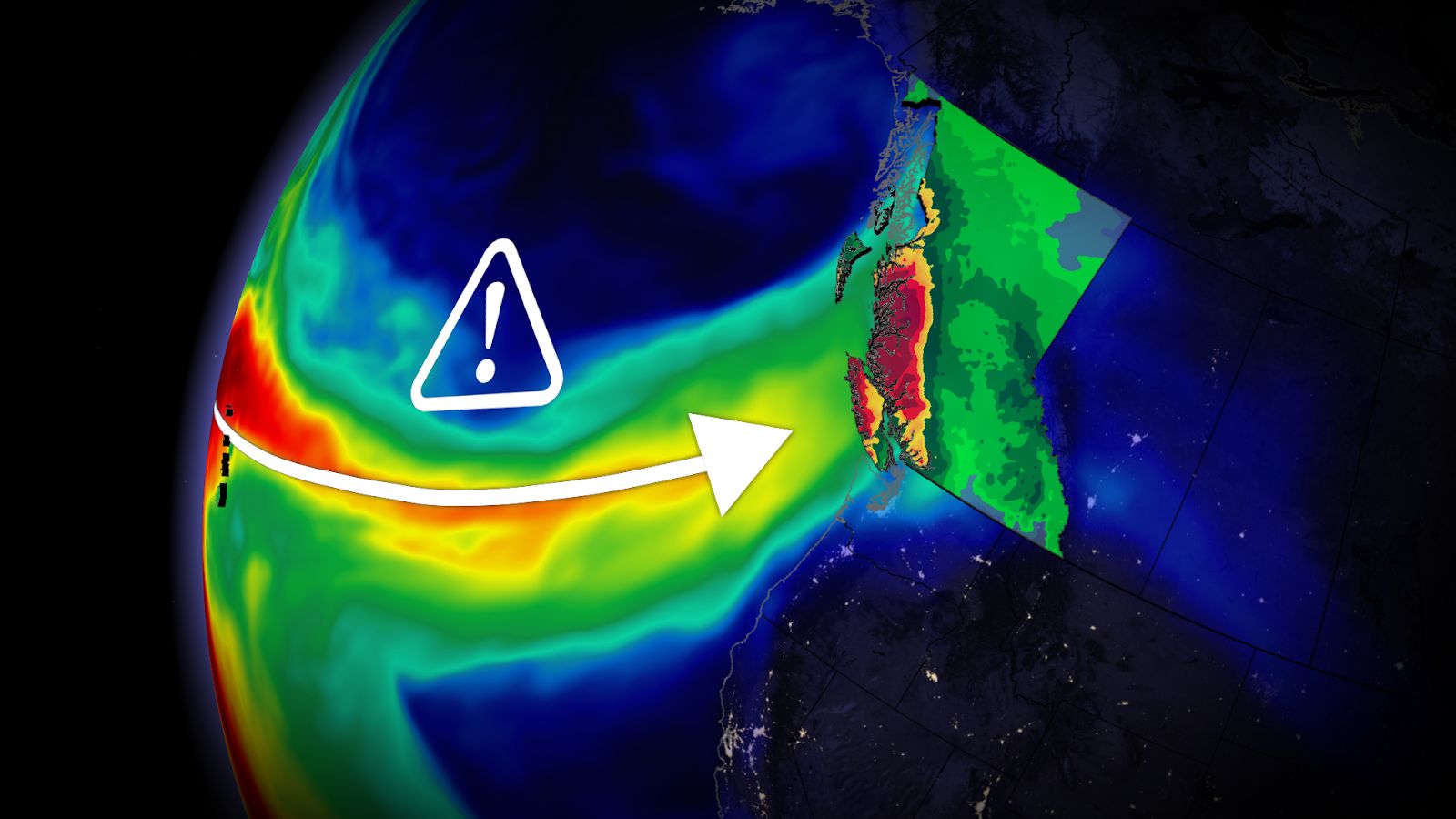
Given its strength and predicted longevity, forecasters anticipate this upcoming pineapple express event to rank an AR3 or AR4 along the immediate coastline, which means this type of event is often hazardous with river flooding impacts possible. Some areas could see the atmospheric river endure in two waves and persist for more than 72 hours.
Some remote locations on western Vancouver Island and the North Shore Mountains will be subjected to up to 100 straight hours of rainfall this week.
That’s more than four days of consecutive rainfall, highlighting the risk of flooding and rapid snowmelt.
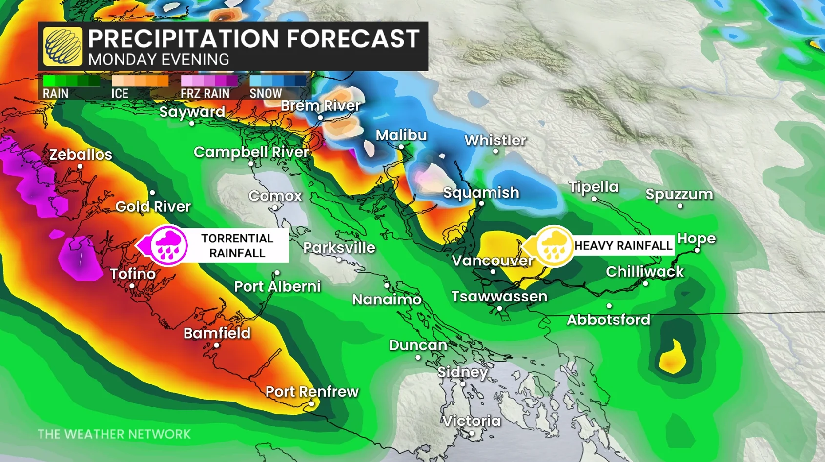
Sunday afternoon initially features low snow levels on Vancouver Island and the Lower Mainland, with wet snow above 300 metres in elevation.
This surge of moisture tracking northeast directly from Hawaii will fuel heavy rainfall beginning late Sunday and continuing into next work week.
DON’T MISS: A potentially strong El Niño will develop by this summer
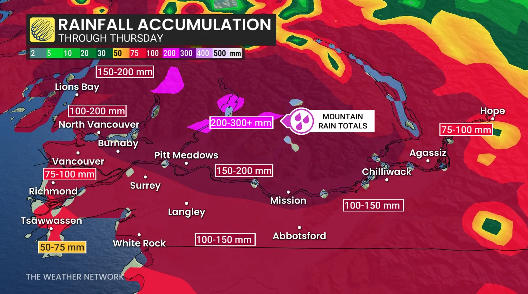
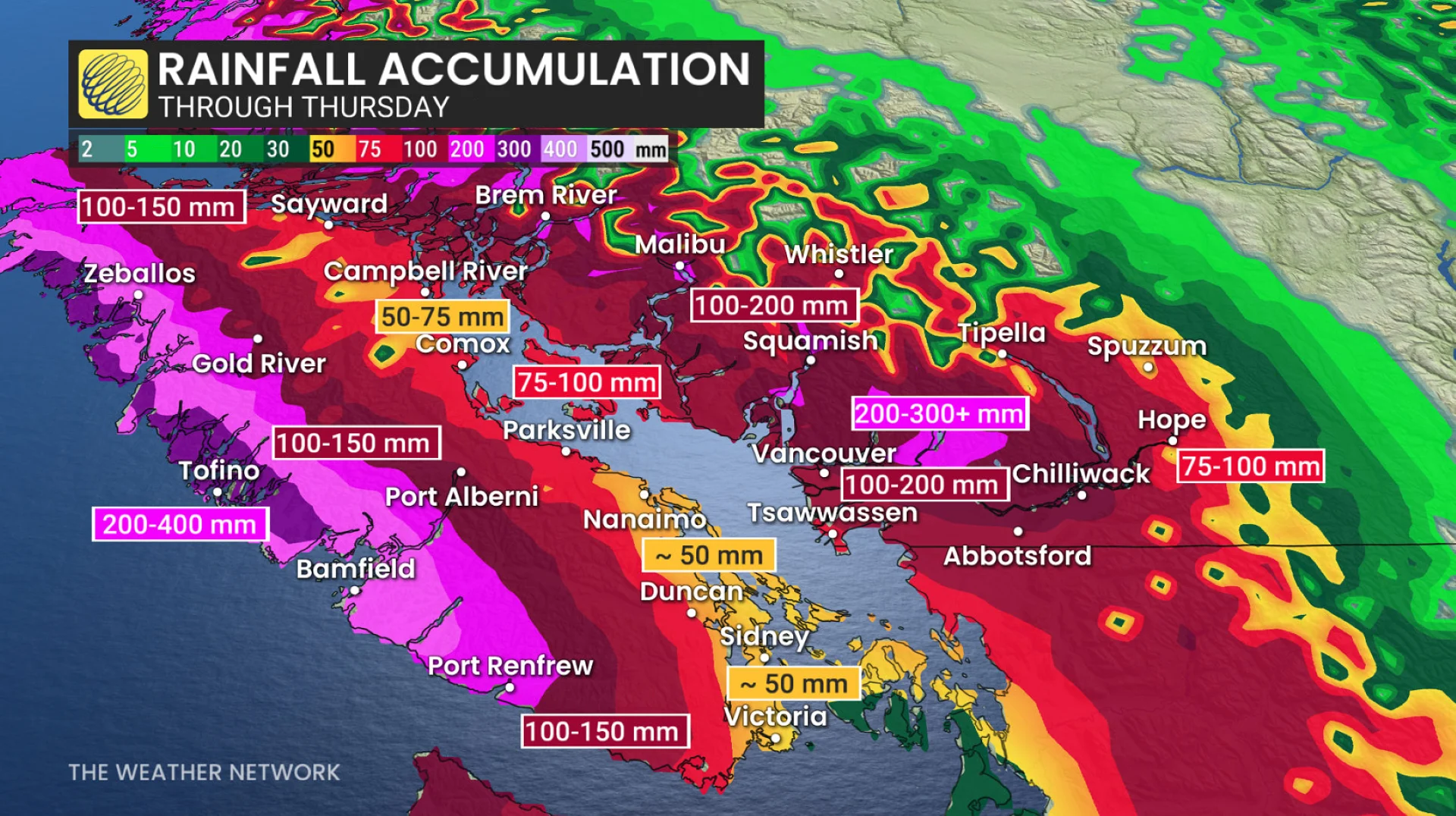
Rainfall forecast
Tofino: 200-400 mm
North Shore Mountains: 150 mm-200+ mm
Squamish: 150 mm-200 mm
Campbell River/Comox Valley: 75 mm
Nanaimo: 50-75 mm
Victoria: Approximately 50 mm
Lower Mainland (south of Fraser River: 75 mm-100 mm)
North of Fraser: 100-200 mm
In addition to the heavy rainfall, we’ll also see freezing levels spike to more than 2000 metres on Monday, a rise that will last through the week before falling on Friday.
As a result, alpine rain is expected over the course of the week, leading to the elevated avalanche danger .