
By Sunday night, snowfall becomes steady across the South Shore of Nova Scotia.
Winds along the coast pick up to 30-60 km/h, increasing the risk for reduced visibility and local, blowing snow conditions.
Monday and Tuesday: More disruptions likely as snow pushes east
On Monday, snow has the potential to mix with ice pellets along the southern tip of Nova Scotia. However, locales inland will remain as all snowfall.
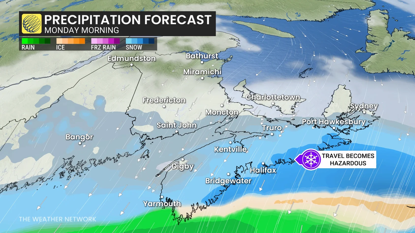
Heaviest snowfall rates develop along the entire coast of Nova Scotia, from Yarmouth to Sydney (1-3 cm an hour).
Snowfall lightens across the Halifax area, but remains locally heavy across southeastern Nova Scotia, including southern Cape Breton, where more bursts of heavy snow are forecast through Monday evening.
Very little snowfall accumulation is expected for New Brunswick and P.E.I. As much as 5-8 cm is possible for southwestern New Brunswick and 5 cm for P.E.I.
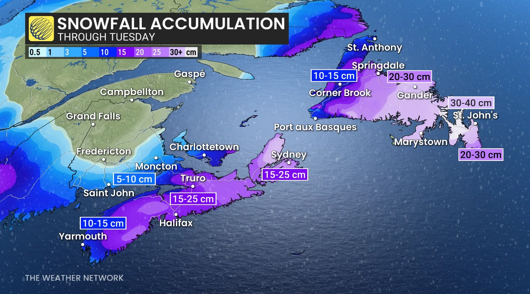
Heavier, widespread totals of 10-20 cm are forecast for most of Nova Scotia from Sunday afternoon to Monday afternoon, but up to 25 cm is possible locally in some areas that see lingering snowfall late Monday.