

Wintry showers are forecast across the UK this week
Wintry weather is set to make a return this week(Image: Sean Hansford | Manchester Evening News)
Just one week after the UK recorded its warmest day of the year so far, widespread snow showers are forecast across the country.
Temperatures soared to 20.9C in Wales on Wednesday (March 18), but forecasters warn wintry weather is set to make a brief return, with snow, frost and ice on the cards for some.
Snow is forecast across Scotland, Wales, Northern Ireland and parts of northern England on Wednesday morning (March 25), including in parts of Greater Manchester.
Get MEN Premium now for just £1 HERE – or get involved in our WhatsApp group by clicking HERE. And don’t miss out on our brilliant selection of newsletters HERE.
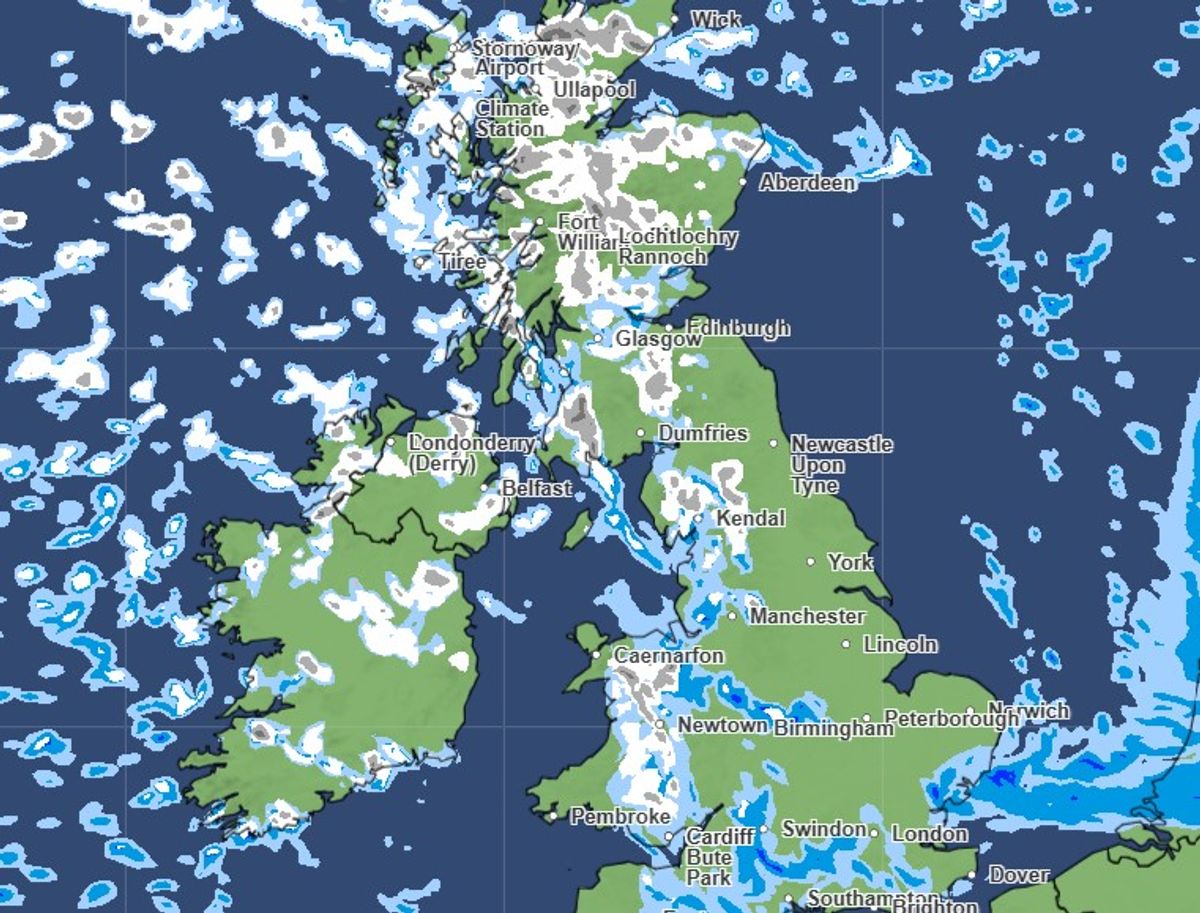
Snow forecast across the UK on Wednesday morning (March 25)(Image: Met Office)
Met Office Deputy Chief Forecaster Steven Keates said: “After a spell of mild and brighter weather, the UK will turn increasingly unsettled in the coming days. A series of weather fronts will bring periods of rain, strong winds and much colder air by midweek. Wednesday could be quite a shock to the system.
“Temperatures will range from 6C to 10C, but it will feel closer to low single figures for many areas in the wind. Wintry showers are likely, especially over higher ground in the north, and a widespread frost – with icy patches for some – is possible on Wednesday night. It should be a little milder again by the end of the week, with many areas seeing another spell of rain on Friday.”
The Met Office warns temperatures could drop to -5C in rural Scotland overnight on Wednesday, with a widespread frost overnight and ice in the north on Thursday morning (March 26).
Met Office maps show patches of rain across the UK turning into snow overnight, with the first flurries hitting Greater Manchester from around 6am on Wednesday. By 7am, the region is expected to be covered by both rain and snow, with the heaviest wintry showers over Oldham and Tameside.
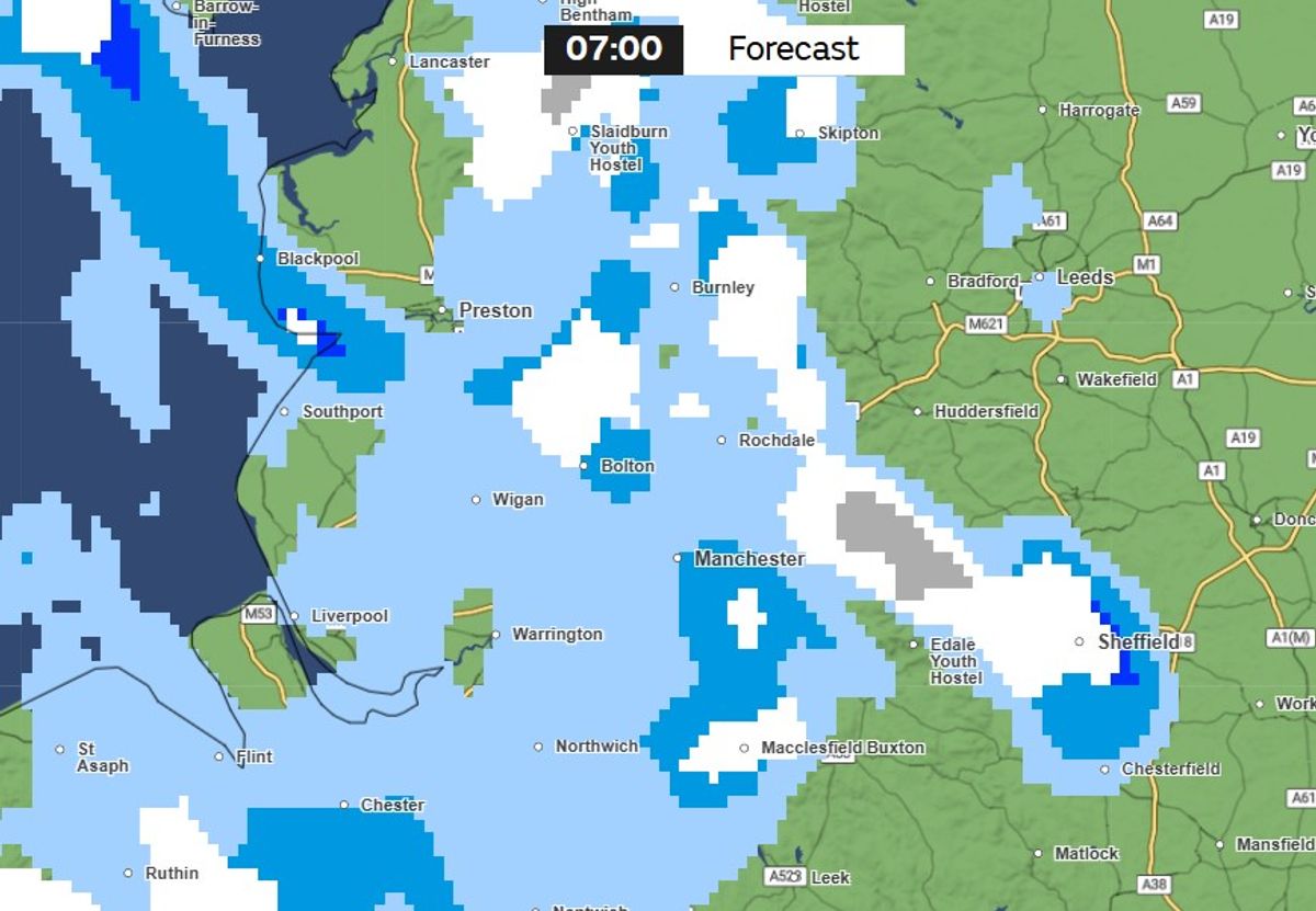
Snow is forecast in parts of Greater Manchester from 7am on Wednesday(Image: Met Office)
By 8.30am, weather maps show dark grey patches showing heavy snow over Rochdale, with lighter snow forecast in parts of Manchester, Oldham, Tameside and Stockport. Elsewhere, rain or patches of light snow is forecast.
Flurries of snow in Greater Manchester are expected to continue throughout the morning, with the heaviest snowfall in Rochdale and Oldham. Met Office maps show the last snowfall is forecast in the area at around 4pm, with snow showers continuing mainly in parts of Wales and Scotland.
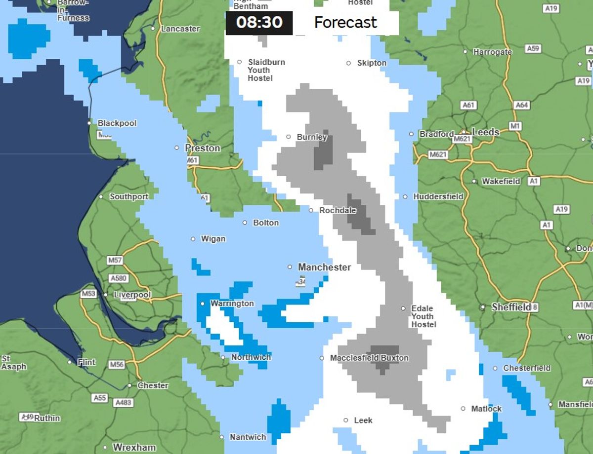
Snow forecast in Greater Manchester on Wednesday (March 25)(Image: Met Office)
The Met Office says rain showers are likely to be heaviest in the north and west, with hail and isolated thunder expected at times.
It said sleet or snow is expected over higher ground, particularly across Scotland, but also over hills in northern England, Wales and Northern Ireland, adding that settling snow is expected to be confined mainly to high ground.
The Met Office forecast for tonight and into Wednesday states: “The band of rain continuing to move southeastwards, clearing East Anglia during the early hours. Scattered blustery showers following, with these turning wintry in the north.
“Sunny spells and blustery wintry showers. The showers most frequent across the north and northwest where they will be heavy with hail and thunder. Feeling cold with brisk winds.”
Forecasters say temperatures are expected to ‘slowly recover’ from Thursday and into the weekend. The forecast states: “Briefly drier for most on Thursday, before another spell of rain moves southeastwards later and into Friday. Scattered showers following into Saturday, most frequent in the north.”