

Windsor could be the only location in the province to reach 20°C on Thursday afternoon.
A cold front linked to the clipper system will sweep across southern Ontario from Thursday evening into the overnight hours.
SEE ALSO: Storm cleanup: Some Sudbury school bus routes finally rolling again
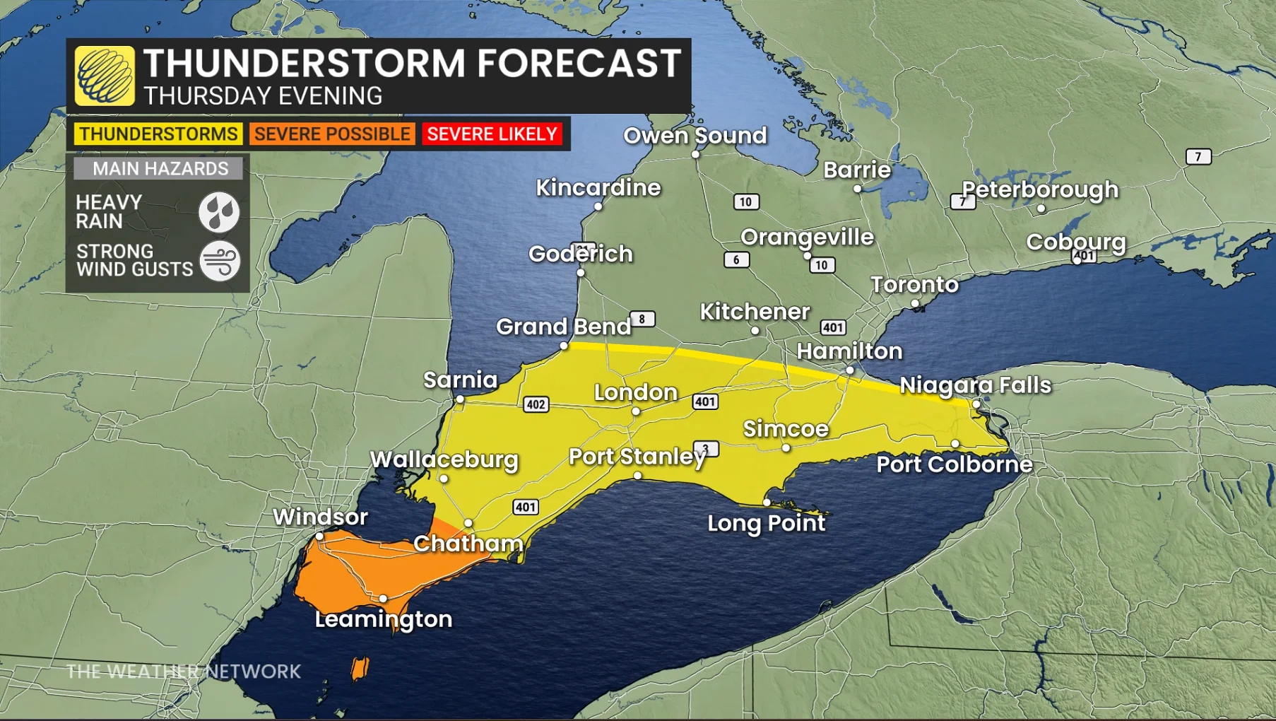
The greatest confidence for severe thunderstorms is Essex County with the risk of lightning, heavy rainfall, and a possible, isolated risk of small hail.
The evening cold front will try to develop a line of storms for Kitchener to Windsor before the front crosses Lake Erie.
Regardless of the strength of the storms, the cold front will be efficient, dropping temps by 15° to 20° by Friday morning.
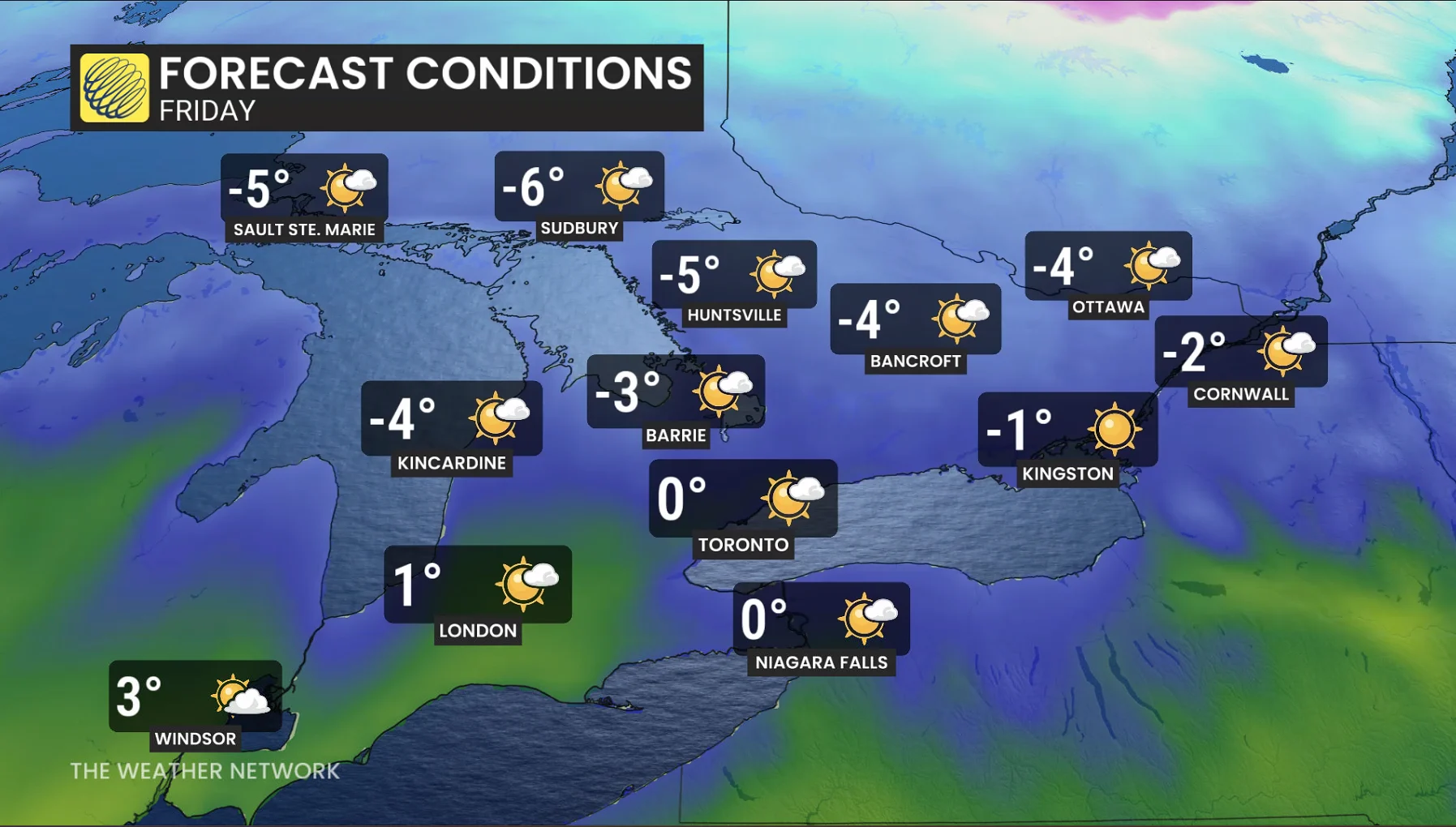
Temperatures will drop significantly behind the cold front, falling 15°C to 20°C by Friday morning.