
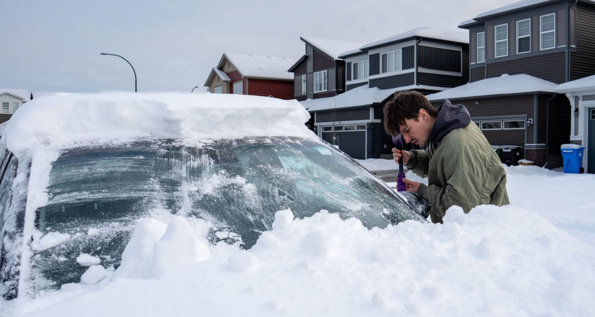
April may be just mere days away, but the snow is not giving up in Alberta, with more fresh powder in the forecast for parts of the province.
A snowfall warning is currently in effect for a portion of northwestern Alberta and some of the Rockies, with Environment and Climate Change Canada (ECCC) saying heavy snow is expected late tonight and Sunday, with total amounts of 15 to 25 cm. Snow will taper off by Monday morning.
“Visibility will likely be reduced at times. Prepare for quickly changing and deteriorating travel conditions. Allow extra time for travel,” the warning added.
A special weather statement was also issued Saturday afternoon for areas such as Calgary, Banff National Park, Diamond Valley, Okotoks, Kananaskis Village, Airdrie, Chestermere, and Cochrane.
Poor travel conditions are expected tonight through Monday morning, and bands of heavy snow are expected to develop starting late tonight and continuing through Sunday. Locations impacted will likely include the Highway 1 and Highway 2 corridors near Calgary and areas to the west.
Looking at the ECCC Significant Weather Outlook, other portions of Alberta are at risk of seeing some more snow starting on Sunday, March 29.
Calgary is under the gun of seeing five to 15 centimetres of snow, while the Jasper National Park region could see 10 to 20 centimetres. The Icefields Parkway, Foothills, and Red Deer could receive five to 10 centimetres.
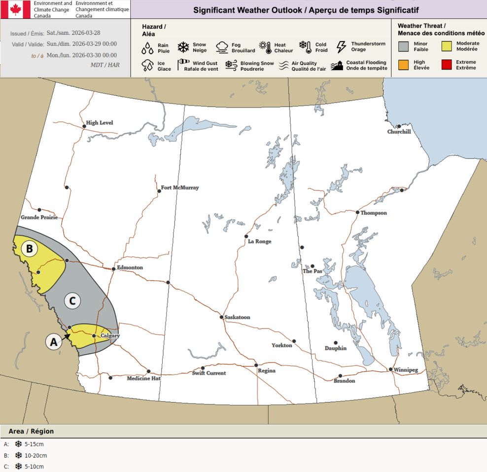
ECCC Significant Weather Outlook
Turning to the outlook for Monday, March 30, more snow is on the way for much of the Alberta Rockies, the Foothills, and portions of central and southern Alberta.
Banff National Park north along some of the Icefields Parkway and Calgary could see five to 10 centimetres, while the southern Rockies, including Waterton Lakes National Park, could see 10 to 20 centimetres of snow.
A section of the Alberta Foothills could also see 10 centimetres of snow, along with the chance of thunder snow.
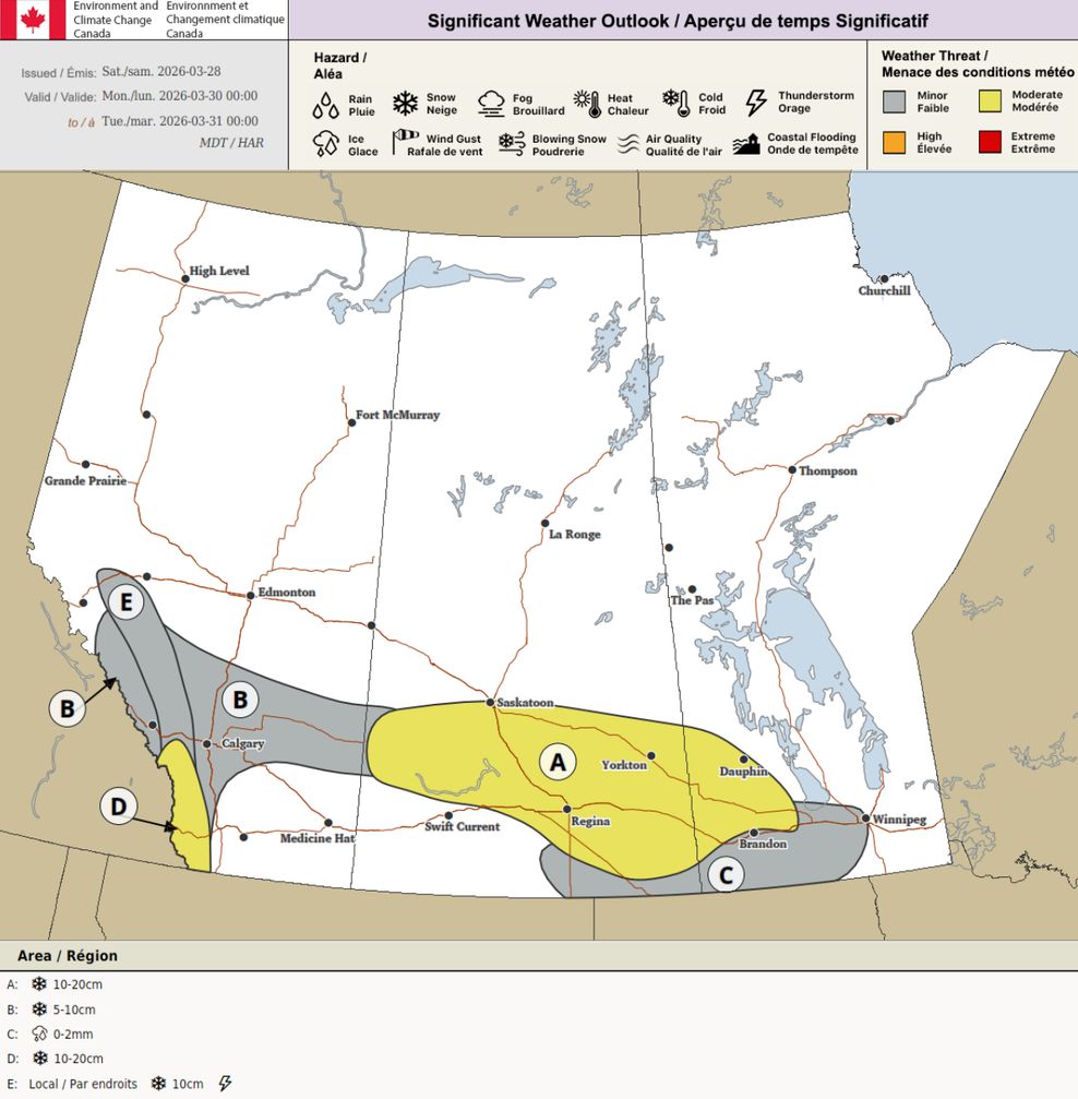
ECCC Significant Weather Outlook
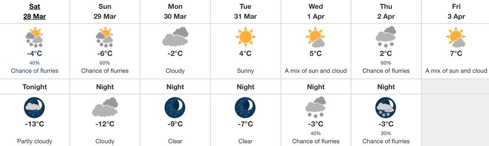
Sneaking a look at the major city centres in Alberta, the risk of snow over the next seven days is apparent for Edmonton, with a chance of flurries today and tomorrow, and a chance of flurries on the evening of Wednesday, April 1, into Thursday, April 2.
The seven-day forecast for Calgary is even snowier than for Edmonton, with a chance of flurries on tap for today and tomorrow, before transitioning to snow tomorrow night into periods of snow for Monday, March 30.
The chance of flurries comes back into the picture for YYC on the evening of Wednesday, April 1, and the chance of flurries or rain showers sticks around for Thursday, April 2, and Friday, April 3.
Edmonton forecast
Environment and Climate Change Canada
According to ECCC, the average high for Edmonton around this time of year is 7°C, while the average low is -4°C.
Calgary forecast
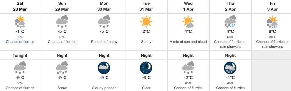
Environment and Climate Change Canada
According to ECCC, the average high for Calgary around this time of year is 8°C, while the average low is -5°C.
Are you over seeing snow in the forecast for Alberta as we creep towards April? Let us know in the comments.