
![]()
Listen to this article
Estimated 3 minutes
The audio version of this article is generated by AI-based technology. Mispronunciations can occur. We are working with our partners to continually review and improve the results.
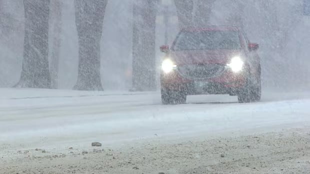
Another late season winter storm is bearing down on Manitoba as some communities in the Interlake region area already bracing for spring flooding.
Most of southern Manitoba, except for the southeast, is under a special weather statement from Environment Canada, which says a storm is poised to hit overnight Wednesday and through Thursday.
“Although Wednesday during the day will see many locations through southern Manitoba experiencing pleasant spring weather with highs in the mid- to upper-teens … the weather will see a stark shift,” the weather agency says.
The highest concern with this system is freezing rain risk along the Trans-Canada Highway corridor and just south of it, as well as through the Red River Valley.
The southern part of the Interlake is also included, where places like Peguis First Nation and Arborg are already concerned about rising water.
Last week, an Alberta Clipper brought heavy snow to central and southern areas of the province, and across the Red River Valley.
The hardest-hit areas were the Parkland region in the west and parts of the Interlake.
Manitoba Infrastructure Minister Lisa Naylor said Tuesday that it’s an “all-hands-on-deck situation” in Peguis.
As of Monday, nearly 110,000 filled sandbags had been delivered to the community, 145 kilometres north of Winnipeg. Even so, Naylor said people will “very likely” have to leave if flooding cuts off roads.
“There’s not medical care access [so] support can’t get in and out,” she said. “All of this preparation doesn’t guarantee no evacuations. But what it means is that if you do have to evacuate, when you go home, your home will be protected.”
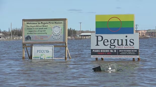 Flooding is seen in Peguis First Nation in 2022. (CBC)
There is still some uncertainty as to whether the freezing rain in the latest system will be patchy in nature or a more general area, the special weather statement says.
The western part of the province is likely to primarily get snow, with accumulations of four to eight centimetres.
As the system progresses, the weather statement may be upgraded to warnings, Environment Canada says.
Meanwhile, central and parts of northern Manitoba are under a snowfall warning.
A low-pressure system could bring snowfall amounts of 10-20 centimetres, while there will also be a risk of freezing rain for some communities.
The affected region is a band from The Pas and Flin Flon east to the Ontario border. That system is expected to occur through Wednesday before ending later that same night.