
![]()
Listen to this article
Estimated 4 minutes
The audio version of this article is generated by AI-based technology. Mispronunciations can occur. We are working with our partners to continually review and improve the results.
Another spring day, another snow storm.
Some parts of the province are already seeing precipitation while weather warnings are in place for much of Saskatchewan.
“Yesterday we had mainly showers in the south, even some thunderstorms,” said Danielle Desjardins, a warning preparedness meteorologist with Environment and Climate Change Canada.
“That system is currently producing snow over north-central Saskatchewan, and there’s also a band of rain that has changed over to snow in the south … that round of snow is going to slowly progress to the east.”
Snowfall warnings stretch all the way east to west in the southern half of the province, following a wide swath along the Trans-Canada corridor. Areas in central Saskatchewan and most of the north will likely be hit with heavy precipitation.
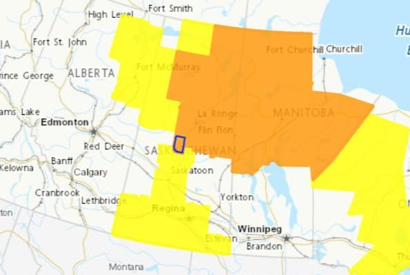 A map showing the weather warnings for the province as of 9:45 a.m. CST on Thursday. (Environment Canada and Climate Change)Up to 50 centimetres expected in north
Snowfall totals in the south are expected to be between five and 15 centimetres. That is expected to taper off into the evening.
Further north, areas will likely experience two or more days of snow. Communities like Pelican Narrows are expected to get the most, up to 50 cm.
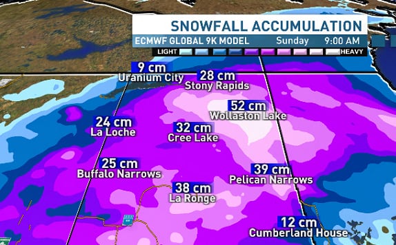 The predicted snowfall accumulation numbers for northern Sask. communities as of Thursday morning. (ECMWF GLOBAL 9K forecasting model)
“They’ve been hit quite a number of times, so the risk there would be flooding,” Desjardins said. “It’s falling snow right now, but as we head into spring, there’s going to be a potential for a high runoff.”
Total snow amounts of 30 to 50 cm are expected by the end of the day Friday, with the heaviest snow expected to fall today, according to Environment and Climate Change Canada.
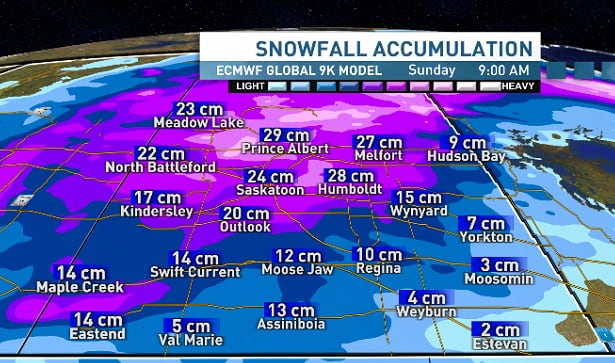 The predicted snowfall accumulation numbers for southern Sask. communities as of Thursday morning. (ECMWF GLOBAL 9K forecasting model)
Freezing rain or ice pellets may also cause slippery conditions in some areas, including Cumberland House and parts of Highway 123.
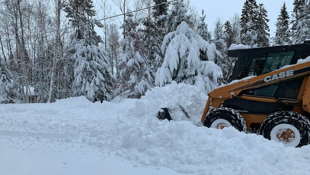
“Spring rains or even these wet snows, it makes a big difference in the fire season, gives us a much better start for everybody, ” said Denis Renaud, a resident of Wadin Bay who spent the morning scraping his community’s roads with a skid steer.
“It makes us all feel a little bit more comfortable and brings up the water table, then … the lake levels and that.”
Renaud said the school bus routes to La Ronge were cancelled Thursday, which hasn’t happened in a very long time. He said when he stepped out in the morning, he was greeted by 12 to 16 inches of heavy, wet snow.
WATCH | Heavy snow hit La Ronge, Sask., on Thursday: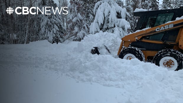
Heavy snow hit La Ronge, Sask., on Thursday
La Ronge, Sask., was one of many communities facing a snowfall warning Thursday.
“For the most part, we’re getting moisture,” he said. “I mean, you’re going to have a couple days here where it’s inconvenient for everybody, but at the end of the day, it’s good for the entire fire season, and hopefully some of the farmers themselves are getting some of this before they start seeding.”
In places like Saskatoon and Prince Albert, snowfall of 15 to 20 cm is expected by Friday evening. The area could see two rounds of snow.
“Snow will continue through this morning and be particularly heavy through the day. Snow will taper off this evening but another bout of snow is expected tomorrow, ending by evening,” the ECCC alert says.
“Prepare for quickly changing and deteriorating travel conditions.”
Saskatchewan’s Highway Hotline is showing the storm’s footprint already down south, with a broad area south of Moose Jaw not recommended for travel.
ECCC is also warning of high winds, making it feel colder and lowering visibility. The powerful winds could also lead to local utility outages and property damage.
Wednesday night, Mankota, Sask., was the windiest spot in the province, recording a gust of 116 kilometres an hour.
Desjardins said seasonal temperatures aren’t expected to return until early next week.