
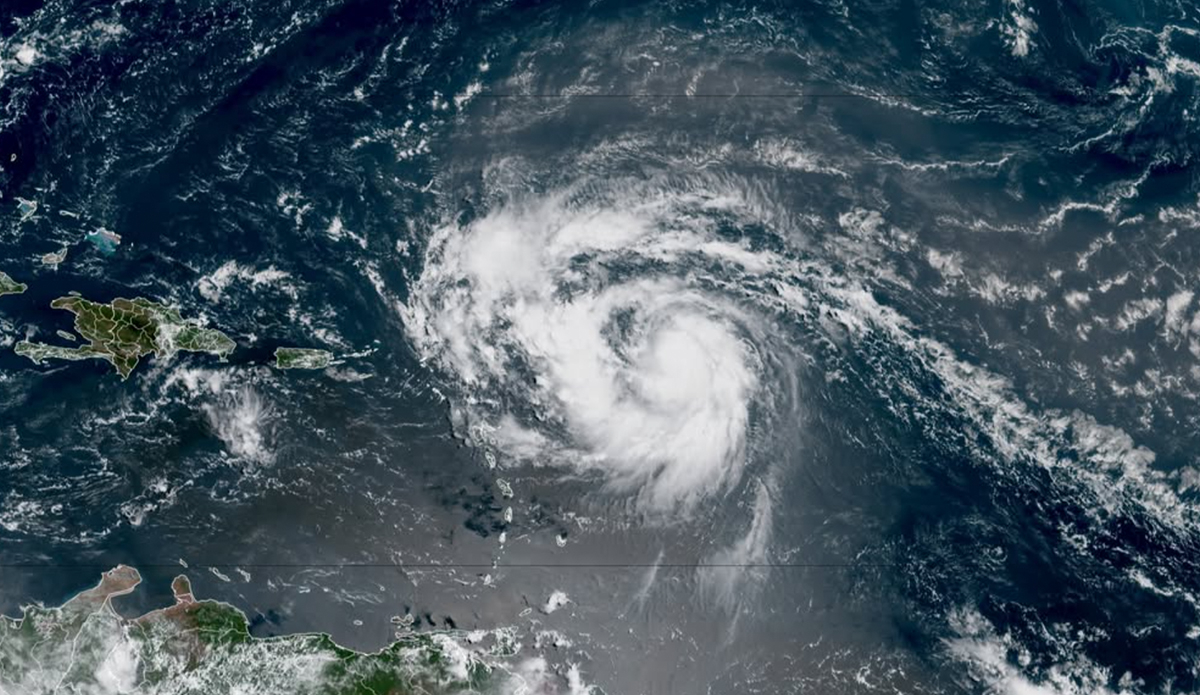
Erin is on the way. Friday morning, Tropical Storm Erin strengthened to a Category 1 storm, making it the first Atlantic hurricane of the 2025 season.
Erin first formed in the eastern Atlantic Ocean on Monday. It is currently located in the tropical Atlantic, over 400 miles east of the Northern Leeward Islands, according to a statement issued by the National Hurricane Center. An Air Force Reserve Hurricane Hunter aircraft reported maximum sustained winds around 75 mph, with higher gusts. The agency added that “Steady to rapid strengthening is expected during the next two to three days, and Erin is forecast to become a major hurricane during the weekend.”
In light of this, the NHC issued a tropical storm watch for Caribbean islands Anguilla and Barbuda, St. Martin and St. Barthelemy, Saba and St. Eustatius and Sint Maarten. A Tropical Storm Watch means that tropical storm conditions are possible within the watch area, generally within 48 hours. According to the organization, swells generated by Erin will begin affecting portions of the northern Leeward Islands, the Virgin Islands and Puerto Rico by this weekend, and will likely spread to the western Atlantic next week.
“Erin is forecast to explode into a powerful Category 4 hurricane as it moves across very warm waters in the open Atlantic. Water temperatures at the surface and hundreds of feet deep are several degrees higher than the historical average,” said Alex DaSilva, AccuWeather’s lead hurricane expert, to the Associated Press.
Host meteorological models predict the storm will remain hundreds of miles away from the east coast of the United States, as ABC News reports. However, the hurricane center told AP “there is still uncertainty about what impacts Erin may bring to portions of the Bahamas, the east coast of the U.S., and Bermuda in the long range.”
AccuWeather elaborated that dangerous surf and rip currents are expected to affect the U.S. East Coast next week, with waves reaching up to 15 feet along parts of the North Carolina coast.