
Dolly downgraded after briefly becoming tropical storm; rain expected in the Caribbean this weekend

 ORLANDO, Fla. —
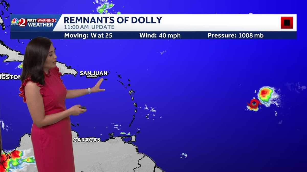
Dolly is now an open tropical wave after briefly becoming a tropical storm, the National Hurricane Center said Friday in its 11 a.m. update.
The system is still expected to bring rainfall to parts of the Caribbean this weekend, but the NHC will no longer issue updates on the system.
The remnants of Dolly are about 1,000 miles east of the Leeward Islands, moving west at about 25 mph.
The storm has maximum sustained winds of about 40 mph, and an estimated minimum central pressure of 1,008 millibars.
On the forecast track, the remnants should be nearing the Leeward Islands Saturday night and Sunday.
This content is imported from x. You may be able to find the same content in another format, or you may be able to find more information, at their web site.
Heavy rain still possible
Heavy rain from the remnants of Dolly could affect the Leeward Islands late Saturday into Sunday, with rainfall moving into the Virgin Islands, Puerto Rico and Hispaniola Sunday and Monday.
This heavy rain may produce flash flooding within areas of higher terrain of the Leeward Islands.
Dolly
Dolly is the fourth named storm of the Atlantic season. The name is pure coincidence to the death of music icon Dolly Parton earlier this week.
Tracking the Tropics
Stay with WESH 2 online and on-air for the most accurate Central Florida weather forecast.
Download the WESH 2 News app to get the most up-to-date weather alerts.
The First Warning Weather team includes First Warning Chief Meteorologist Tony Mainolfi, Eric Burris, Cam Tran, Victoria Wisniewski and Luke Vickery.
>> 2026 hurricane season | WESH long-range forecast
>> Download Very Local | Stream Central Florida news and weather from WESH 2
RESOURCES | HURRICANE SUPPLIES | SURVIVAL GUIDE | HURRICANE SEASON SPECIAL | WESH LONG-RANGE FORECAST | WHAT TO KNOW ABOUT INSURANCE | GENERATOR SETUP | TESTING CHAINSAWS | POST-STORM RESOURCES | DOWNLOAD WESH 2 APP