
Redevelopment less likely for remnants of Dolly as Invest 97-L drifts near Panhandle, NHC says

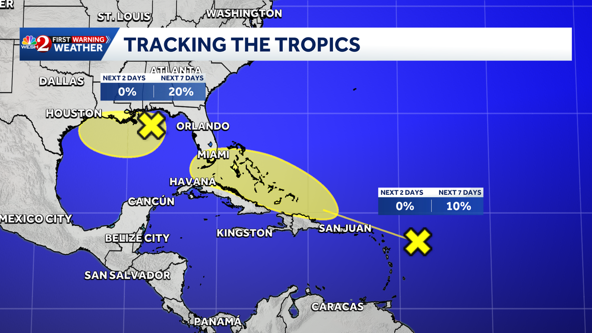
The National Hurricane Center continues to track two tropical Atlantic disturbances this weekend, giving the one closest to Florida — Invest 97-L, a weak low in the Gulf that’s expected to drift west — slightly better formation chances over the next week.
This content is imported from facebook. You may be able to find the same content in another format, or you may be able to find more information, at their web site.
Disturbance 1 (F.K.A. Tropical Storm Dolly)
Disorganized showers and thunderstorm continue in association with the remnants of Tropical Storm Dolly, located about 300 miles east of the Leeward Islands. However, there are no signs that the system is developing a closed circulation, according to the NHC’s 2 p.m. update Saturday.
Redevelopment of this system is unlikely while it moves westward to west-northwestward near 25 mph. The wave could bring locally heavy rains and gusty winds to portions of the Leeward Islands, the Virgin Islands and Puerto Rico over the next several days, the NHC’s website states.
Formation chance through next 48 hours: Near 0%Formation chance through next seven days: 10%Disturbance 2 (Invest 97-L)
Cloudiness and showers associated with a weak low pressure area centered about 125 miles south of Pensacola, Florida, have become a little better organized since yesterday, according to the NHC.
Some additional slow development of this system is possible during the next few days as it drifts westward, NHC forecasters said.
Formation chance through next 48 hours: Near 0%Formation chance through next seven days: 20% Dolly
Tropical Storm Dolly was the fourth named storm of the Atlantic season. The name was pure coincidence to the death of music icon Dolly Parton earlier this week.
Tracking the Tropics
Stay with WESH 2 online and on-air for the most accurate Central Florida weather forecast.
Download the WESH 2 News app to get the most up-to-date weather alerts.
The First Warning Weather team includes First Warning Chief Meteorologist Tony Mainolfi, Eric Burris, Cam Tran, Victoria Wisniewski and Luke Vickery.
>> 2026 hurricane season | WESH long-range forecast
>> Download Very Local | Stream Central Florida news and weather from WESH 2
RESOURCES | HURRICANE SUPPLIES | SURVIVAL GUIDE | HURRICANE SEASON SPECIAL | WESH LONG-RANGE FORECAST | WHAT TO KNOW ABOUT INSURANCE | GENERATOR SETUP | TESTING CHAINSAWS | POST-STORM RESOURCES | DOWNLOAD WESH 2 APP