
Pittsburgh: Severe Weather Alert Day for more storms this afternoon
Strong to severe storms are possible through late Friday.
 PITTSBURGH —
Severe Weather Alert Days today and tomorrow with hot and humid conditions plus the risk for severe thunderstorms. Friday is an Impact Day for more storm chances.
Severe Weather Alert Days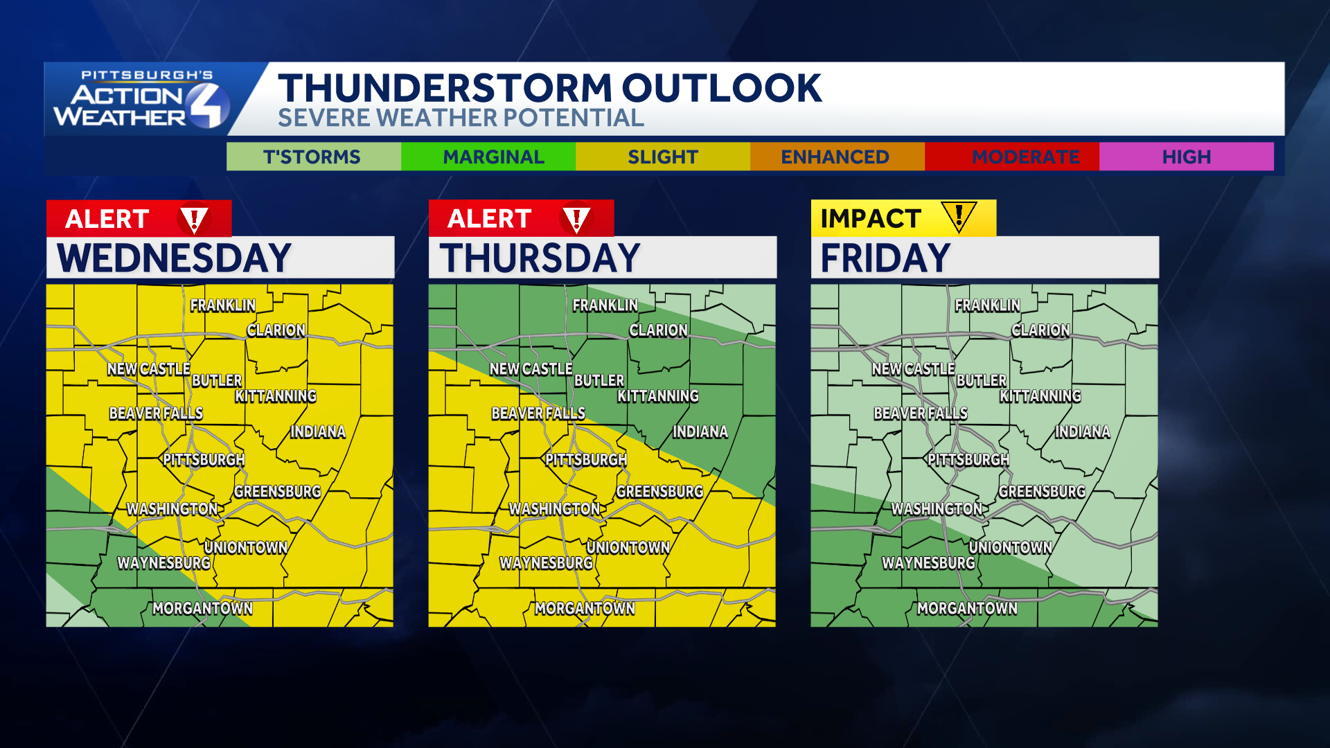
The best chance for strong thunderstorms will stretch between late Wednesday and Thursday. The afternoon will be prime for severe thunderstorms, especially north of Pittsburgh, through the early evening. Thursday will also have scattered strong to severe thunderstorms making it a Severe Weather Alert Day. Severe weather is possible with damaging winds and large hail threats. A brief tornado cannot be ruled out.
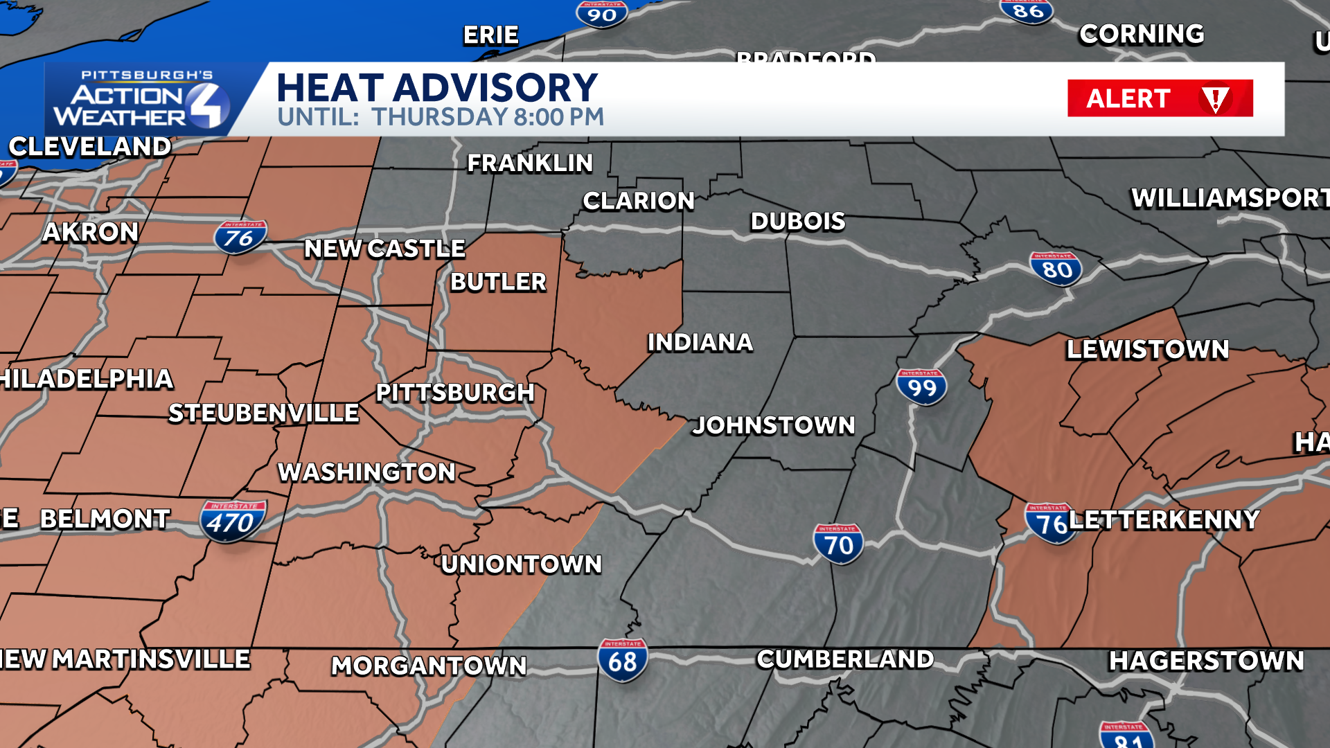
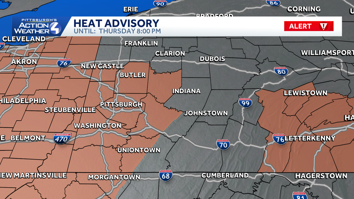
A Heat Advisory is in effect until 8 pm for Allegheny, Armstrong, Beaver, Butler, Greene, Lawrence, Washington and the lowlands of Monongalia, Fayette, and Westmoreland Counties. Heat index values could top 100 degrees.
Dry, Comfortable Labor Day Weekend
Showers and storms will likely hang around Friday, especially in the morning. The rain and storm chance makes Friday an Impact Day. Rain should end in time for high school football Friday night. Quieter weather arrives just in time for Labor Day weekend. Our area will enjoy dry and more comfortable conditions.
Hearst Owned
Hot and humid with storms and then a more seasonal weekend and comfortable start to next week.
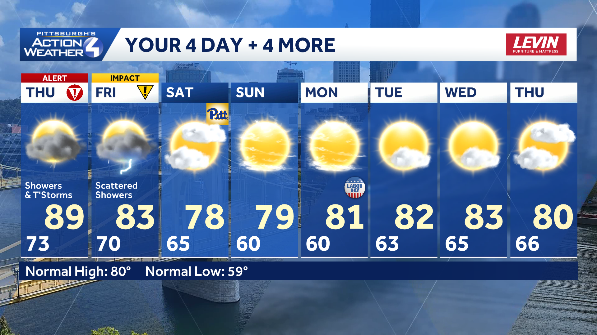
TONIGHT: Storms possible, warm, and muggy. Low 73°
THURSDAY – Severe Weather Alert Day: Scattered rain and storms. High: 89°, low: 70°.
FRIDAY – Impact Day: Mostly cloudy with AM showers. High: 83°. low: 65°.
SATURDAY: Mostly cloudy and less humid. High: 78°, low: 60°.