
Happy Labor Day! Clouds are lingering over much of the area this morning, left over from thunderstorms last night. These will decrease this morning with plenty of sunshine expected for a good chunk of the day. It will still be hot, but not as hot as Sunday, with highs ranging from the low 90s around Fort Leonard Wood to 100° in far western Missouri. Just west of Springfield, a heat warning remains in effect today.
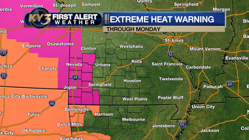 In this locations, highs may still reach 100°.(KY3)
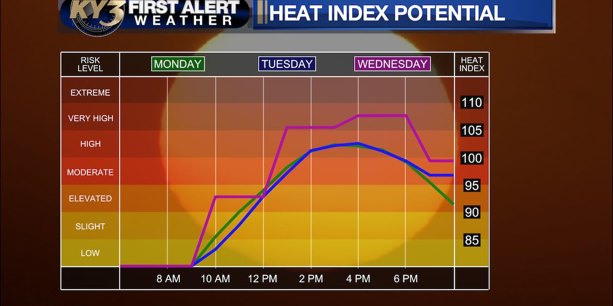
Tuesday could end up being the hottest day of the week, with high temperatures close to 100°, but Wednesday won’t be far behind, and with increased humidity.
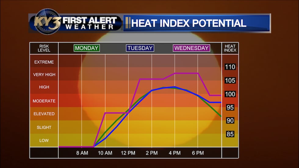 The heat index will likely peak on Wednesday ahead of a cold front.(KY3)
The good news is that a cold front will arrive late Wednesday into Thursday with a good chance of rain and some cooler temperatures. Wednesday will still be quite hot before thunderstorms develop across central Missouri late in the day and night.
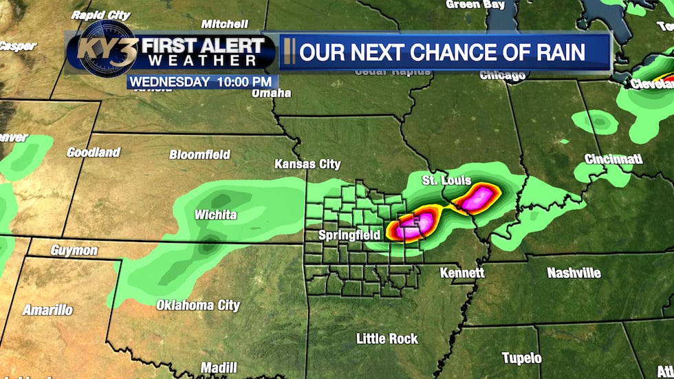 An incoming front will lead to scattered storms with heavy rain and perhaps high wind.(KY3)
With highs close to 100° and increasing moisture, instability will be plentiful, and a few severe storms are possible.
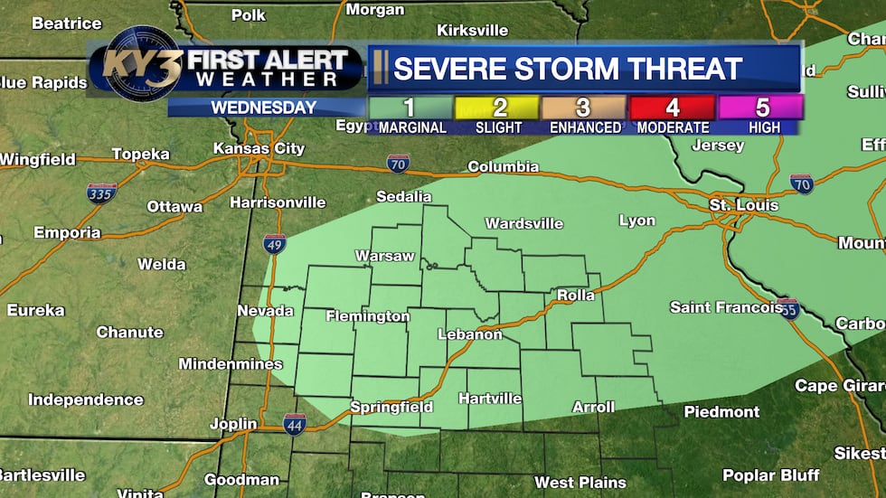 With hot temperatures and increasing moisture, a few storms could be severe Wednesday afternoon.(KY3)
Showers and thunderstorms should linger Wednesday night into Thursday near the front in a moisture-rich atmosphere. Locally heavy rain will be possible because of this, and with widespread clouds, Thursday will be much cooler.
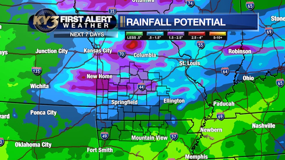 With rich moisture ahead of a cold front, locally heavy rain will be possible with any storms.(KY3)
A few lingering storms are possible Friday, with another front bringing scattered storms Saturday. Long-range model data shows temperatures returning to near average next week.
Copyright 2026 KY3. All rights reserved.