
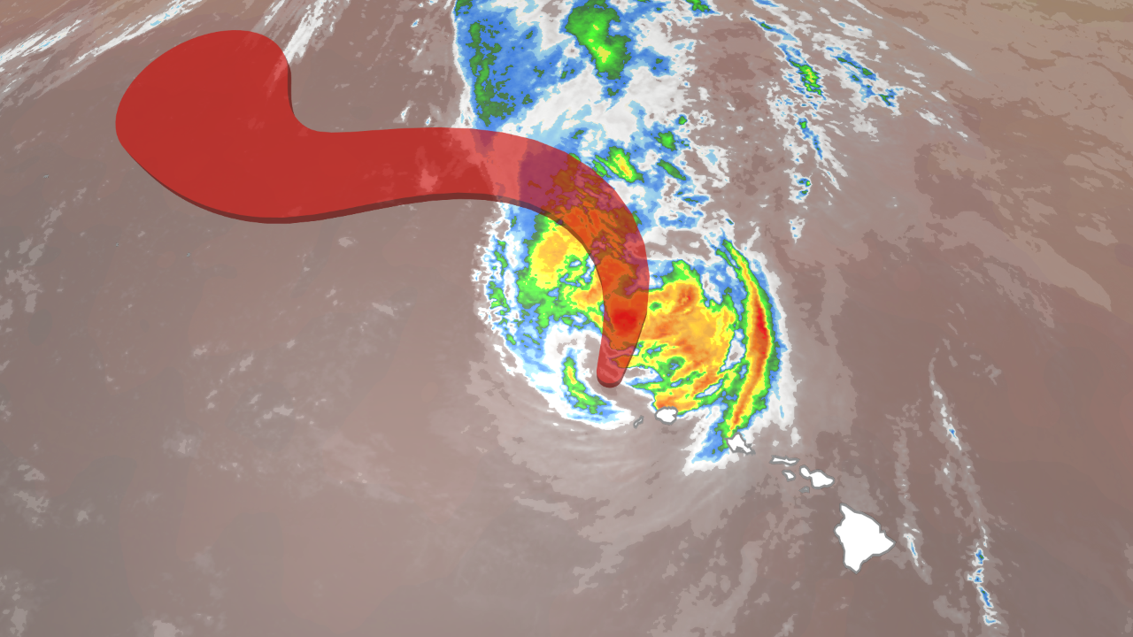
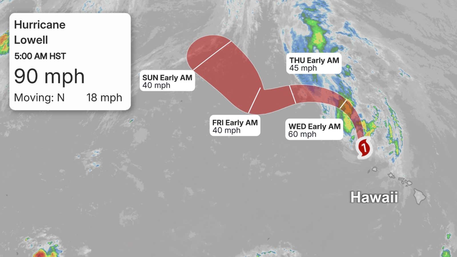
Hurricane Lowell continues to hammer parts of Hawaii with strong winds, flooding rain, surge and huge waves even as the center is now moving away from the island chain.
Latest reports, impacts
The center of Hurricane Lowell is now over 100 miles northwest of Lihue, Kauai, and is moving away.
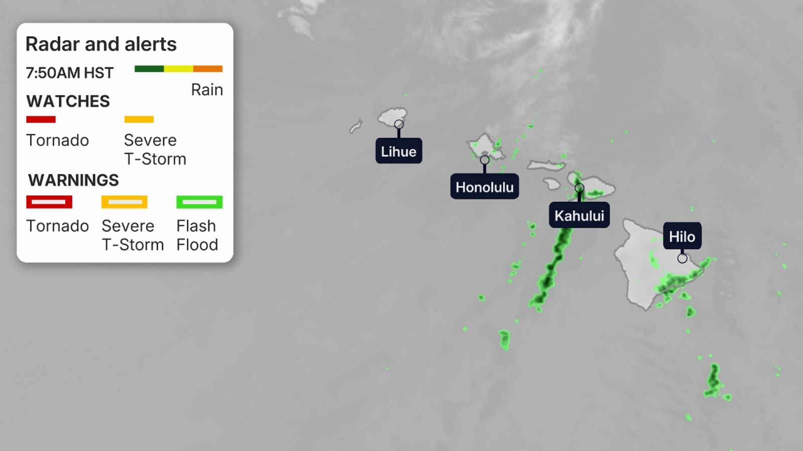
But strong winds gusting over 40 mph are still occurring in some areas from Maui through Oahu and Kauai.

Weather in your inbox
By signing up you agree to the Terms & Privacy Policy. Unsubscribe at any time.
So far, peak gusts of 80 mph or stronger have been measured in several locations on Kauai, including Waimea (85 mph) and Lihue (84 mph). An 80 mph gust was clocked near Kula on Maui’s interior, and gusts to 62 mph were reported in higher terrain of western Oahu.
These winds knocked out power to 90% of customers on Kauai.
High surf and coastal flooding affected some roads, prompting closures including a stretch of the Farrington Highway in western Oahu.
Get More of Our News on Google
Set The Weather Company as a ‘Preferred Source’ to get quicker access to the news you value.

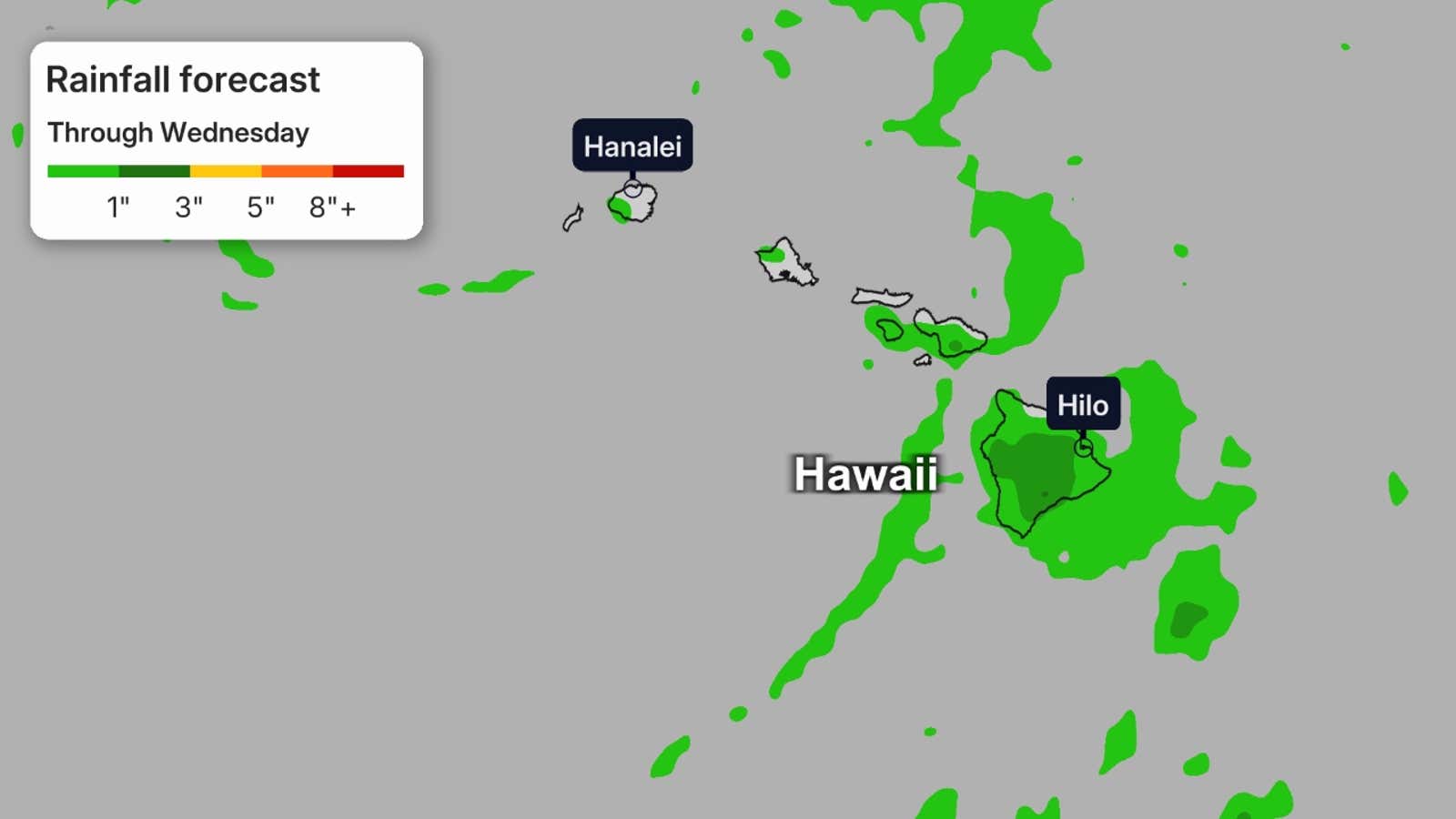
Almost 18 inches of rain has fallen so far over the mountains of Kauai, with general 2 to 5-inch totals over lower elevations. Up to 8 inches of rain has fallen over Oahu’s higher terrain well north of Honolulu, while up to 9 inches of rain has been recorded over Maui’s mountains.
Lowell even prompted Hawaii’s first known tornado watch for Kauai through early Tuesday morning.
(NEWS: The latest storm impacts from Lowell in Hawaii)
 When will conditions improve?
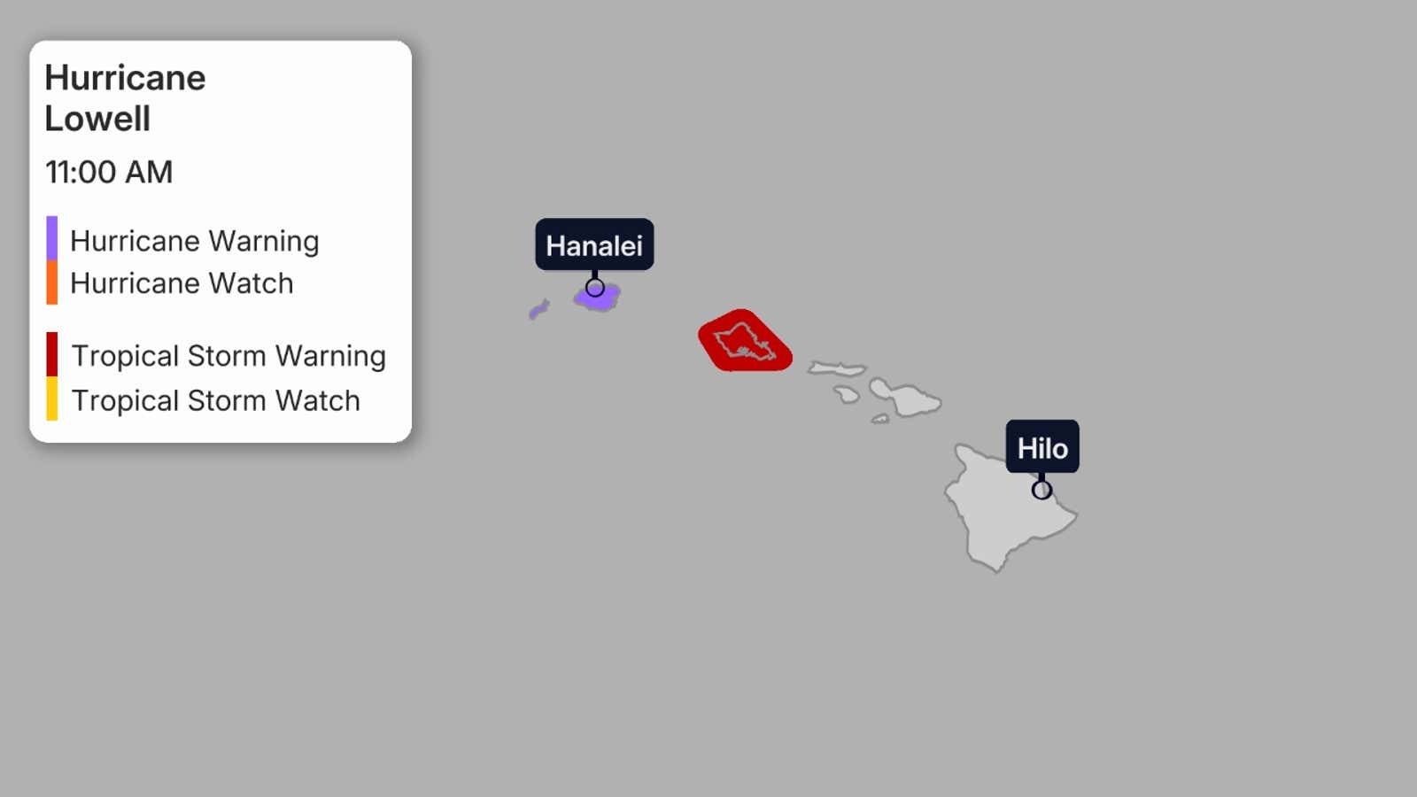
Hurricane warnings continue in effect for Kauai and Ni’ihau, and a tropical storm warning is in place for Oahu.
Tropical storm force winds, at least in gusts, and especially over and downwind of higher terrain, could last into Tuesday afternoon before subsiding. This could lead to additional downed trees and power outages.
Coastal flooding and battering waves may persist, especially in the western islands, through Tuesday before subsiding Wednesday. Stay out of the water if you’re not a strong swimmer or surfer. Obey all guidance from lifeguards.
Bands of locally heavy rain will persist over parts of the island chain Tuesday that could trigger flash flooding, especially over hilly or mountainous terrain. Those rainbands should become only isolated by Wednesday.
 Where Lowell is headed next
Lowell will soon curl westward as it continues moving farther away in the central Pacific as a tropical storm. according to the National Hurricane Center.
(MORE: What hurricane terms mean)
 The third storm to impact Hawaii
Lowell is the third storm to affect parts of Hawaii this El Niño-fueled Pacific hurricane season, following Lala, then Moke, both of which brushed parts of the islands in about a week’s time in August. In late July, Fausto passed north of the islands, but fizzled.
(MORE: The science behind the Pacific’s three hurricanes)
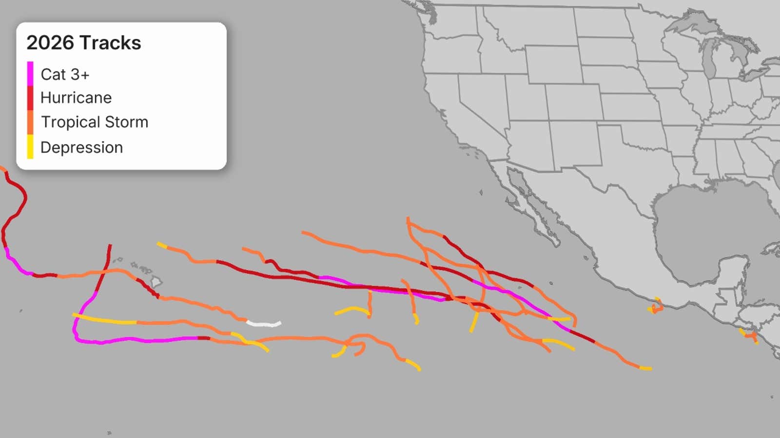
From early Sep. 1 to Sep. 2, Lowell rapidly intensified from a tropical storm to only the second Category 5 hurricane of the 2026 Pacific season.
Lowell weakened gradually but hung on to major hurricane status, meaning a Category 3 hurricane or stronger, until 11 am HST on Monday. The storm will continue to weaken over the next several days, but that will not do much to diminish the impacts that are ongoing.
(MORE: Hawaii hurricane history)
Jonathan Erdman is a senior meteorologist at weather.com and has been covering national and international weather since 1996. Extreme and bizarre weather are his favorite topics. Reach out to him on Bluesky, X (formerly Twitter) and Facebook.