
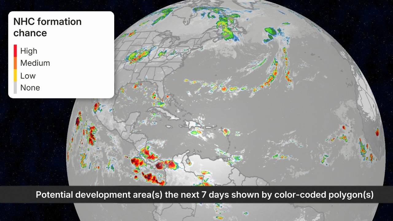
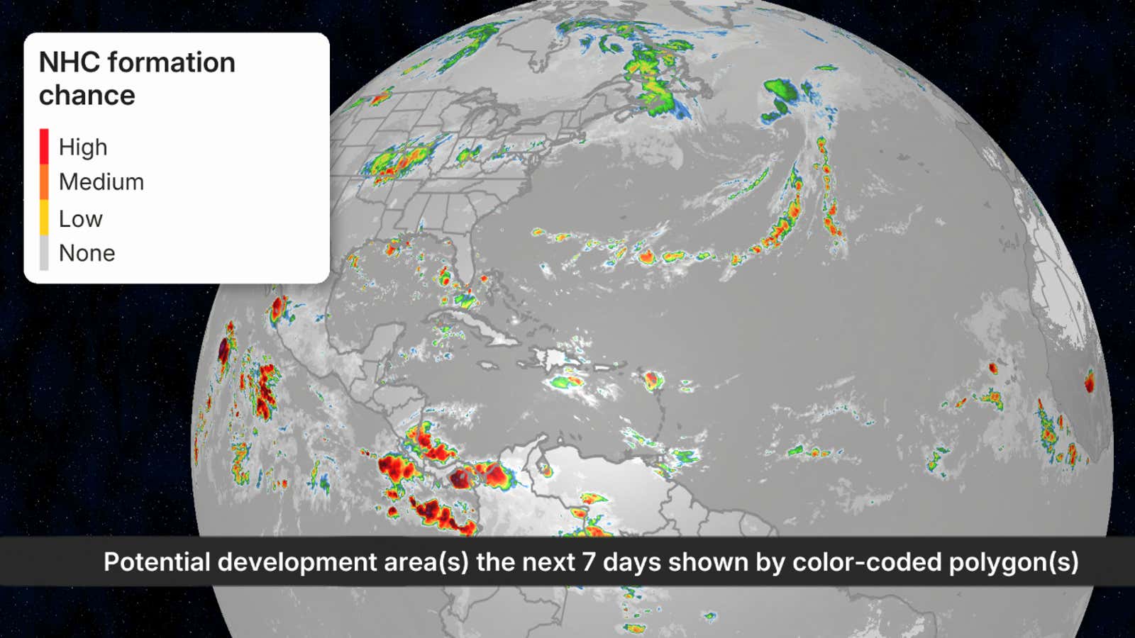
A satellite image of the Atlantic Basin on Sept. 10, 2026, showing no active areas the National Hurricane Center was monitoring for potential tropical development.
The Atlantic hurricane season is still snoozing even during its typical mid-September peak amid its quietest start in at least 60 years and a record-long wait for its first hurricane during an intensifying El Niño.
It’s usually busy right now
September is typically the most active month of the Atlantic hurricane season. Typical activity based on past hurricane seasons reaches a peak in the second week of September, as you can see in the graph below.
That’s because sea surface temperatures are at their warmest and atmospheric conditions are the most favorable for tropical development.

Weather in your inbox
By signing up you agree to the Terms & Privacy Policy. Unsubscribe at any time.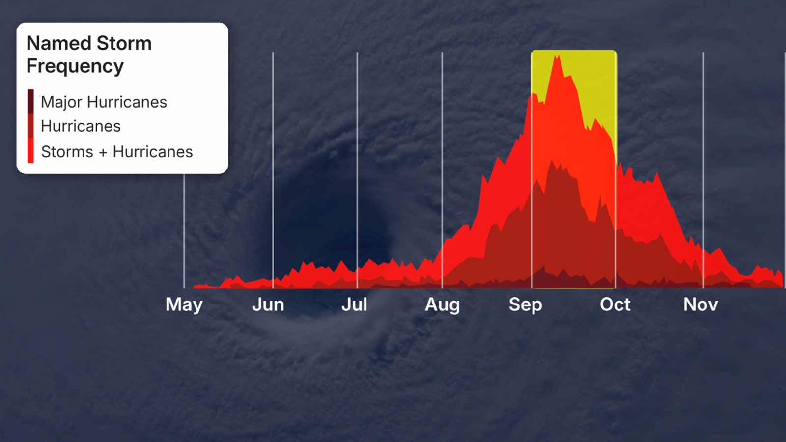
This graph shows the average storm, hurricane and major hurricane tallies from 1944 through 2020 in the Atlantic Basin. The yellow area highlights an average September.
(Data: NOAA/NHC)
Not this year
Instead, there were no active tropical storms or hurricanes anywhere in the Atlantic Basin during this second week of September.
The National Hurricane Center hadn’t even circled any areas that could develop in the next seven days, leaving a blank outlook map during this typically busiest time. That’s a map you would more often see in, say, June, July or November.
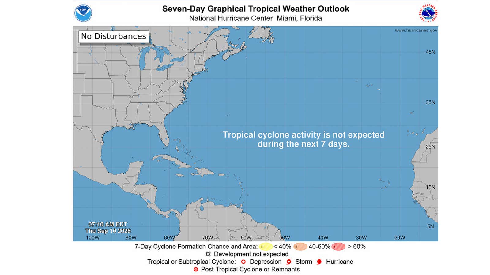
This is the National Hurricane Center tropical outlook map on Sept. 10, 2026.
(NOAA/NHC)
Zero hurricanes
We’ve had five tropical storms this season. Edouard was the most recent of these, which dumped up to 2 feet of flooding rain over parts of eastern Texas.
Get More of Our News on Google
Set The Weather Company as a ‘Preferred Source’ to get quicker access to the news you value.

But none of those became a hurricane.
And with nothing on the immediate horizon, that means 2026 will smash the satellite-era record for the longest wait for the season’s first Atlantic hurricane. That record-late date was previously Sept. 11, both in 2013 and 2002.
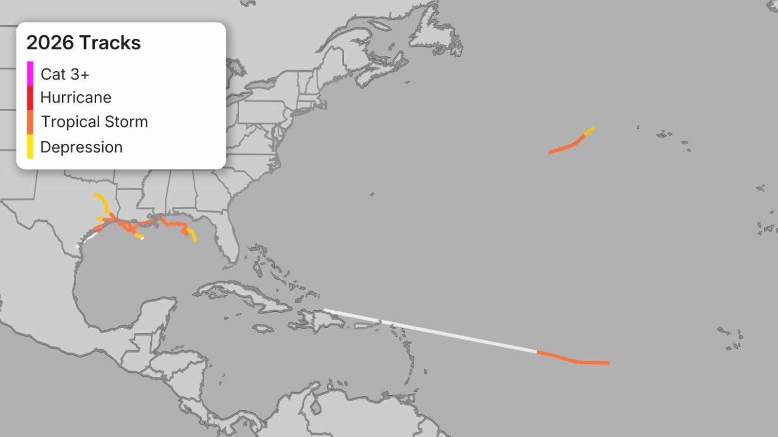
The tracks of the five tropical storms in the 2026 Atlantic hurricane season through Sept. 10. (Note: The white sections of each track correspond to when each system was a remnant.)
(Data: NOAA/NHC)
Record low activity
By another metric, we’re at a record snail’s pace this season.
None of those five tropical storms lasted long. Only Bertha in late July lasted longer than about a day in the Gulf in late July.
Accumulated cyclone energy, or ACE, is a measurement meteorologists use to not just count storms, but also how long each storm lasts and how strong each becomes. Adding the ACE of each storm gives us one measure of how active a season is.
In terms of ACE, as of Sept. 10, it has been the slowest start to an Atlantic hurricane season since at least 1966, the first year satellites routinely covered the Atlantic Basin.
The current ACE index would be typical of a hurricane season in the second week of July, rather than the peak second week of September.
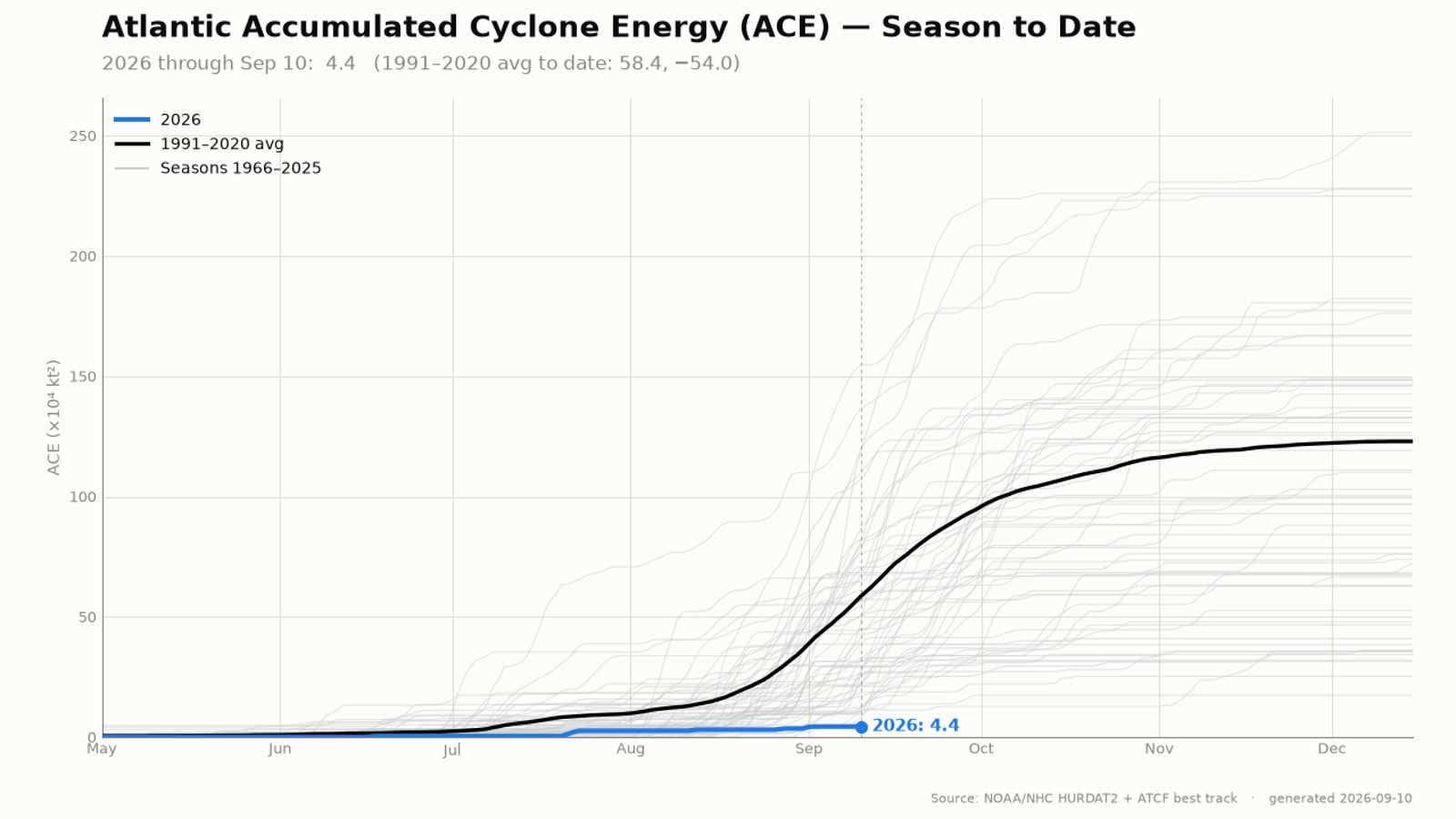
This graph shows the ACE index for the 2026 Atlantic hurricane season through Sept. 10 in blue, the average season ACE in black, and other ACE index values of hurricane seasons in the satellite era since 1966 in gray.
(Data: NOAA/NHC)
El Niño’s fingerprint
The intensifying El Niño has been by far the largest contributor to the way this hurricane season has unfolded.
Stronger El Niños typically increase wind shear, or changes in wind speed and direction, in the Atlantic Basin. This increase in wind shear can shred storms before they even develop, or weaken ones that do.
Wind shear since July from the Caribbean Sea to just off the west coast of Africa has been the strongest on record for that time of year since 1979, according to Colorado State University tropical scientist Phil Klotzbach.
It was this wind shear and dry air that spelled the quick demise of Tropical Storm Dolly in late August and has squashed other tropical waves moving westward off Africa that often give rise to storms and hurricanes this time of year.
And in mid-September, that wind shear was still acting like a giant wall, squashing any development from the Caribbean Sea into the Atlantic.
(MORE: Your guide for everything El Niño)
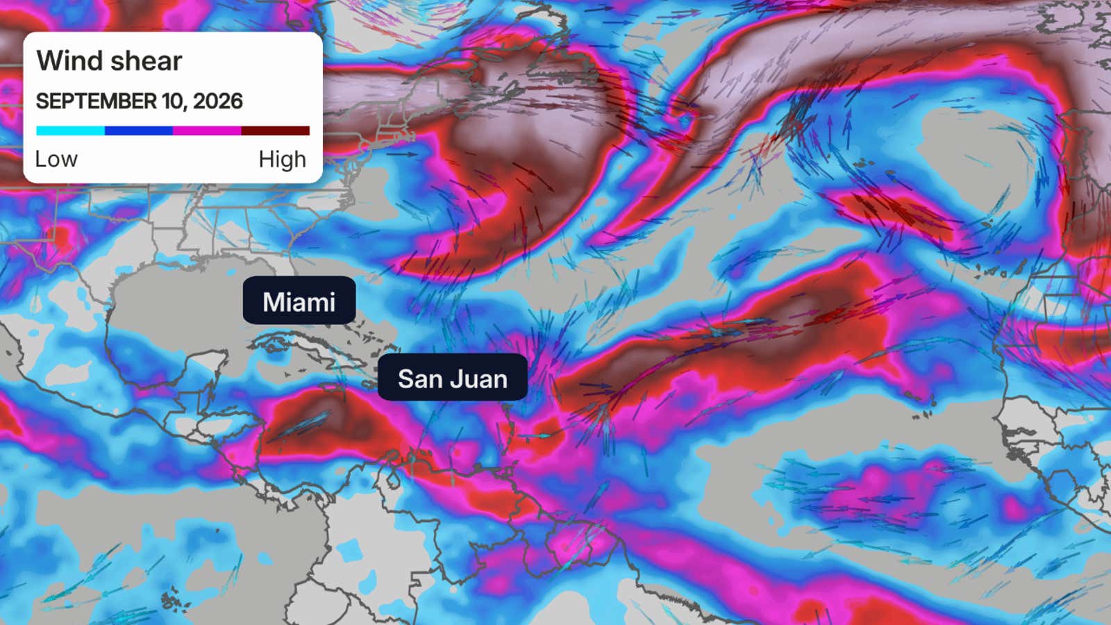
This map shows wind shear over the Atlantic Basin on Sept. 10, 2026. Areas of higher wind shear (purple contours) are generally hostile to tropical development.
Past super El Niño Septembers
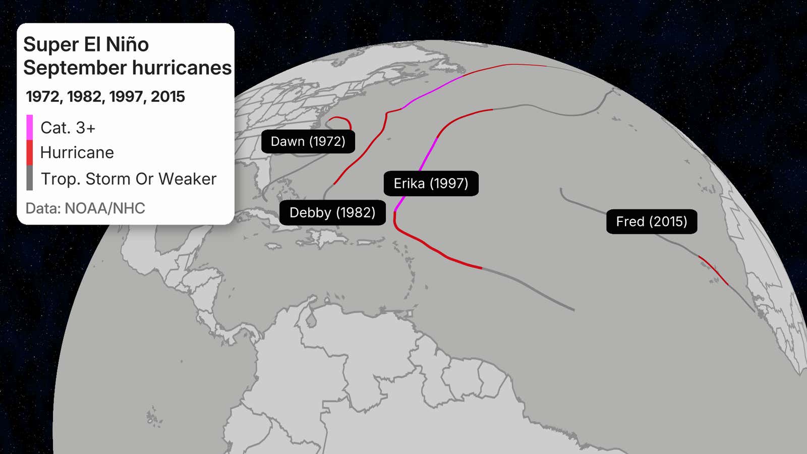
We looked back at four past Atlantic hurricane seasons in which an El Niño eventually reached super status by the end of the season.
There was only one September hurricane in each of those years. That’s about one to two fewer hurricanes than an average September, according to NOAA’s Hurricane Research Division.
So it’s not yet certain if September will be a hurricane shutout, yet. That’s only happened twice since World War II, in 1994 and 1962.
 So what should you do?
A quieter hurricane season doesn’t necessarily mean your area won’t experience a storm the rest of this season.
It only takes one destructive landfall, or even a slow-moving, flood-producing weaker tropical storm, to make a season memorable.
Pay attention throughout hurricane season, regardless of how it’s pacing.
Should a storm find a pocket of favorable conditions, a named storm can suddenly develop. Should this occur closer to land, you won’t have as much time to prepare.
Have a plan in place before storms form.
The Weather Company and Kalshi, a CFTC-regulated event-contract exchange, share data: we provide certain data Kalshi uses to resolve markets, and Kalshi provides market data featured in content like this article. Kalshi alone operates its event-contract exchange and is responsible for the contracts, trading, and settlement on its exchange. If you use our links to communicate with Kalshi and then open a Kalshi account or trade on Kalshi, we may earn a fee.
For Kalshi’s complete member agreement, click here.
Jonathan Erdman is a senior meteorologist at weather.com and has been covering national and international weather since 1996. Extreme and bizarre weather are his favorite topics. Reach out to him on Bluesky, X (formerly Twitter) and Facebook.