
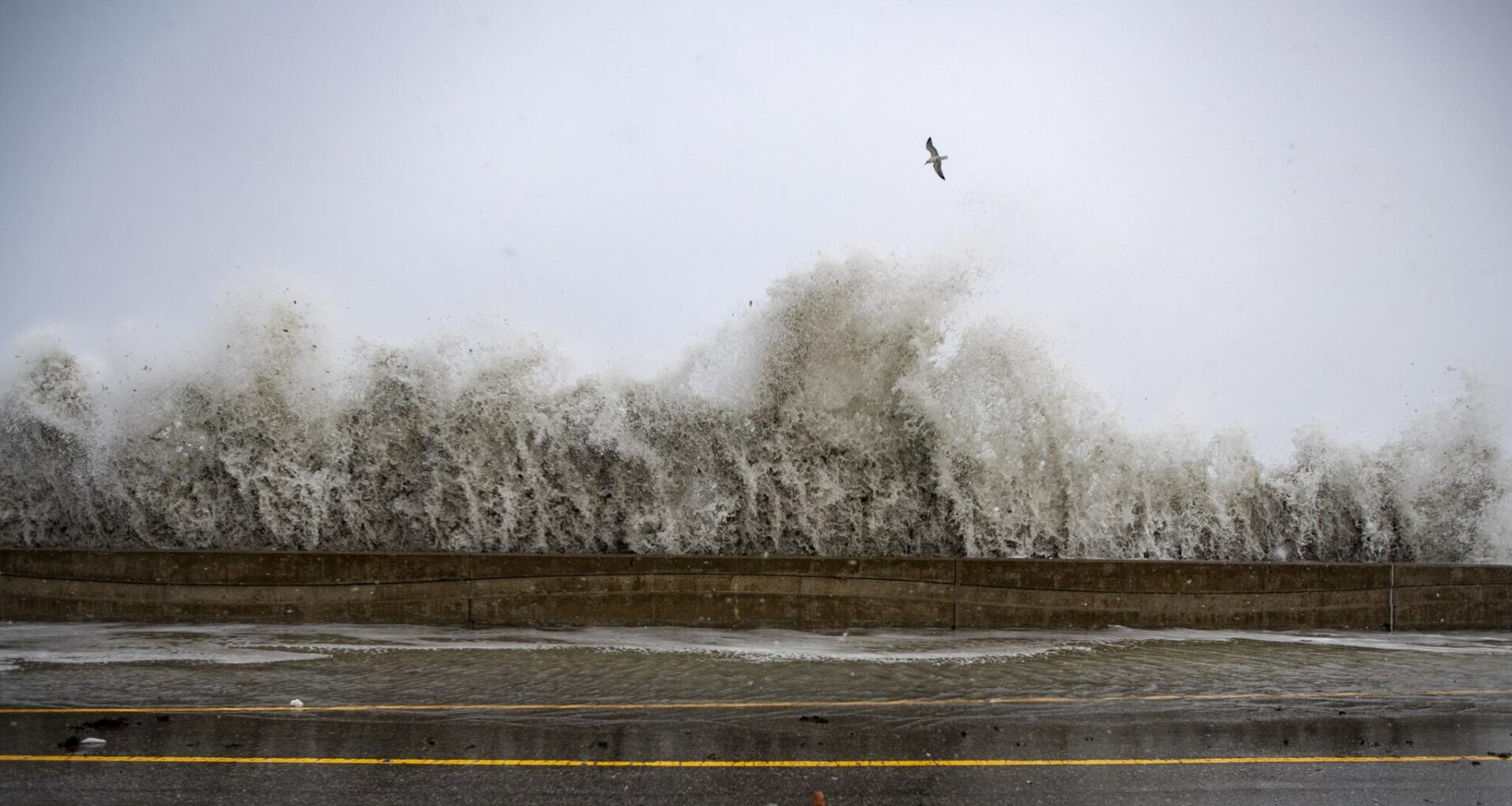
The first potential nor’easter of the autumn season always gets a ton of buzz days in advance. But if those who have lived in New England for more than a couple of seasons know well that trying to nail down local rainfall totals or precise timing several days out is a fool’s errand.
Here is where the meteorology stands right now: New England is looking at a slow-moving, long-duration system. Because the upper-level low is diving south and stacking directly over the surface storm, this system isn’t going to be a quick “in-and-out” scenario. It will sit, spin and slowly wheel its way past us, keeping coastal impacts, raw breezes and periodic rain in the forecast straight through the weekend before gradually lifting out on Monday.
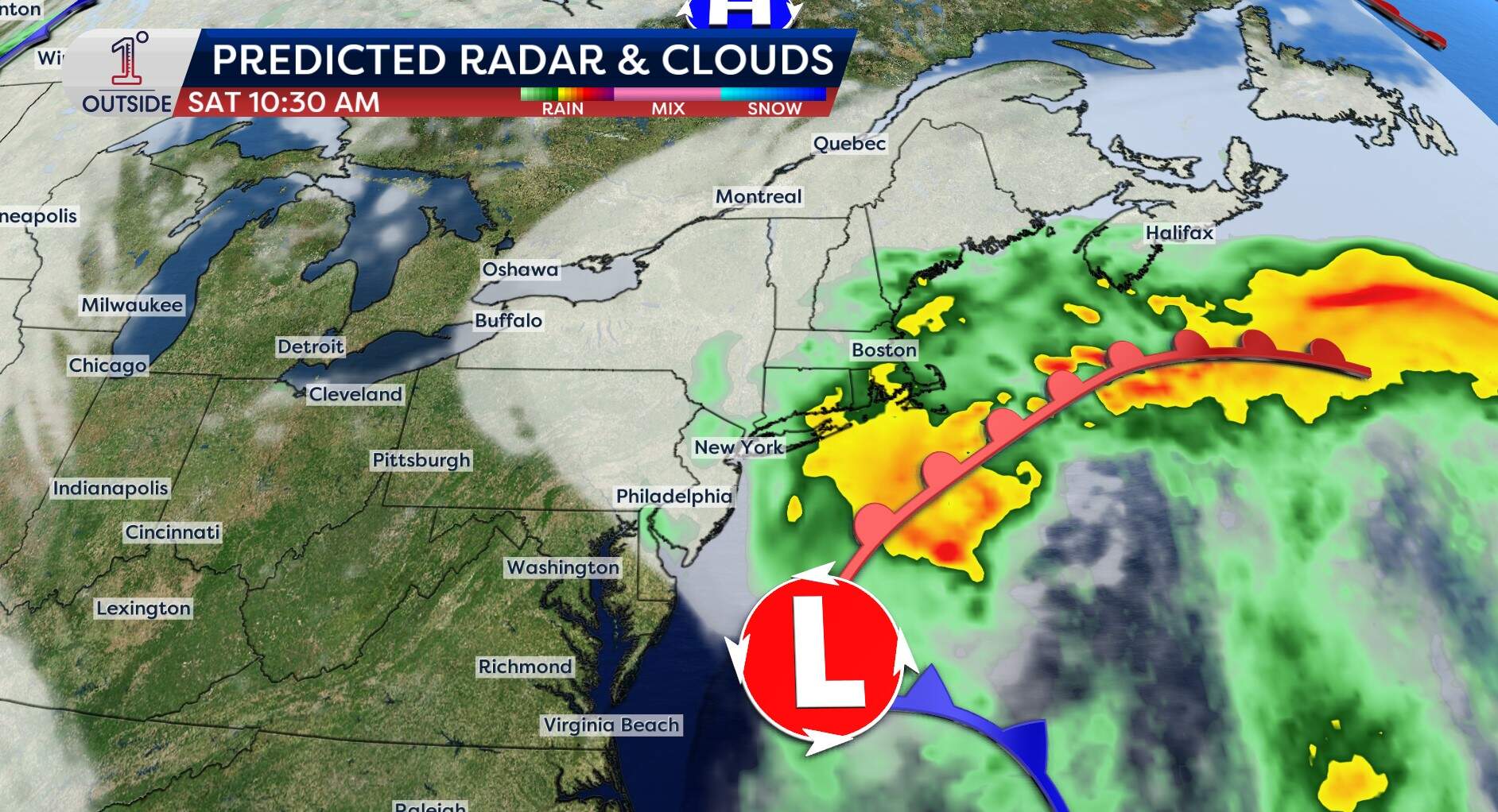 The predicted radar for Saturday, Sept. 26, at 10:30 a.m.(Danielle Noyes/1DegreeOutside)
Here is the breakdown of the threats, timing and where the uncertainties lie.
Timeline Friday: Most of the day may actually end up dry for much of southerern New England, though it will feel raw and breezy. Rain chances begin to ramp up over the Cape and Islands during the afternoon with some showers likely in eastern Massachusetts by evening Friday night into Saturday: Energy pinwheeling around the storm pushes rain inland across eastern and central Massachusetts. Saturday is the height of the storm Sunday: The slow-spinning storm sits just off our coast, keeping clouds, pockets of rain and damp conditions locked in. Monday: The system finally begins to pull northeast, bringing a gradual end to the rain and improving conditions slowly from west to east.Rain expectations
Because the storm center’s exact path is still TBD, rainfall totals will vary wildly depending on how far west the rain bands back up toward the coast.
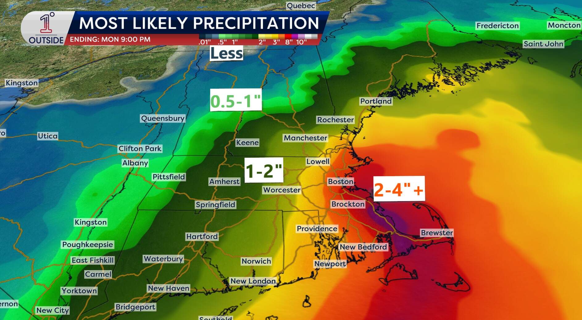 Predicted precipitation totals as of Wednesday morning for the weekend storm. (Danielle Noyes/1DegreeOutside) Eastern Massachusetts, South Shore and the Cape: This region sits closest to the storm’s moisture. Expect 2 to 4 inches of rain, with isolated higher amounts under heavier bands. This will create poor drainage street flooding and standing water. Interior southern and central New England: Looking like a solid 1- to 2-inch rain event. Northern and western New England: The farther north and inland you go, the more removed you are from the system.Coastal and marine hazards
Regardless of where the heaviest rain sets up, the coastal marine impacts are locked in.
A powerful pressure gradient between strong Canadian high pressure to our north and the low to our south will act like an atmospheric funnel, driving relentless north-northeast winds straight off the Atlantic.
Ripping winds and outage risks Inland and western Massachusetts: Breezy with gusts around 20–30 mph. Boston, metro west and North Shore: Gusts ramping up to 35–45 mph Saturday into Saturday night, isolated outages possible. Cape Cod and the Islands: Peak gusts of 50 to 60 mph are likely Saturday evening, creating pockets of wind damage and power outages.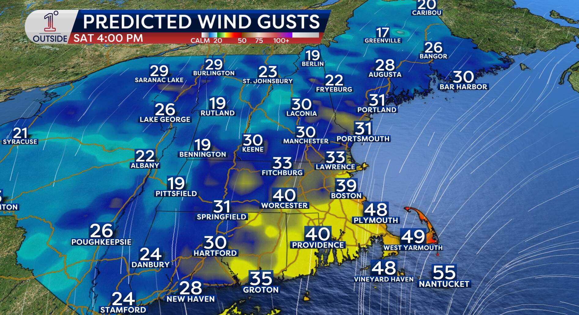 Predicted wind gusts for Saturday, Sept. 26, at 4 p.m. (Danielle Noyes/1DegreeOutside)Dangerous seas and full moon high tides
Persistent, long-fetch northeast winds will build large wave action over the Atlantic:
Offshore seas: Ramping up to 15 to 20 feet on Friday and Saturday – creating life-threatening conditions for the marine community. Near-shore waves: Building to 10 to 12 feet along east-facing beaches (like the Outer Cape and South Shore). Coastal flooding and erosion: The storm coincides with the Full Harvest Moon on Saturday, elevating astronomical high tides. Expect pounding surf, minor coastal flooding, and localized beach erosion over multiple tide cycles from Friday night potentially through Sunday.The bottom line for your weekend plans
With high temperatures stuck in the upper 50s to around 60 and a biting northeast wind, it is going to feel decidedly raw outside.
For anyone with outdoor events, sports or gatherings planned for Saturday or Sunday, now is the time to look at indoor backup options or build flexibility into your schedule. Fine-scale details, like exactly when the heaviest bands move through, will get ironed out over the next 24 to 48 hours.
Be sure to monitor the very latest on the free 1DegreeOutside app.