
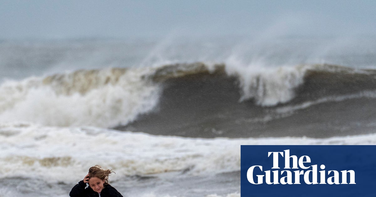
Hurricane Isaias crashed into the US Gulf coast on Friday as a dangerous category 2 storm, hammering communities in Alabama and the Florida panhandle with damaging winds, heavy rain, flooding and life-threatening storm surges.
The first hurricane of the Atlantic season made landfall near Destin, Florida, the National Hurricane Center said. It had maximum sustained winds of 105 mph (169 kph). The storm weakened to just below major hurricane status before it came ashore.
“The storm is here. Buckle down at this point. Don’t be getting out on the roads,” Florida’s governor, Ron DeSantis, said at a news conference, adding flash flooding would be a hazard “throughout the region”.
In Pensacola, about 50 miles (80km) west of Destin an Agence France-Presse reporter witnessed howling winds rip the roofs from some homes and businesses, snapping tree branches as the power went out.
“Things are flying really fast, and I’ve never seen wind this fast before, so it’s intense, it’s scary,” Jonathan Ramos, a 40-year-old government employee, said from his hotel in Pensacola, where the power went out.
“I don’t recommend people coming down here for fun to do this.”
President Donald Trump told reporters at the White House late Friday night: “We’re watching it very closely, the hurricane,” adding that it was “under control”.
Forecasters had expected Isaias to weaken from its peak earlier on Friday as a major category 3 hurricane because of shifts in wind speed.
Debris is seen in an intersection as wind and rain from Hurricane Isaias pass through the area in Pensacola, Florida. Photograph: Joe Raedle/Getty Images
But even as a weaker storm system, the NHC warned of a life-threatening storm surge affecting the Gulf Coast as dangerous hurricane conditions and flash floods spread inland. The hurricane is expected to cross Alabama and into the Tennessee Valley on the weekend, the agency added.
Warnings included a storm surge of up to 7ft (2.1 meters) along the Alabama-Florida line, and powerful wind gusts reaching parts of northern Georgia.
In the Florida Panhandle, Isaias’s early impacts also came into view. In Panama city beach, Noaa officials observed a water level 5.4 feet (1.64 meters) above average. About 125 miles west, at the Pensacola city hall, a wind gust up to 102 mph (164km/h) was recorded.
Powerful gusts of wind and heavy rainfall appeared to down the canopy of a Crestview gas station on Friday evening, according to a video captured by meteorologist Nick Stewart. The tattered cover hung on top of a filling station.
“The storm is here. Buckle down at this point. Don’t be getting out on the roads,” Florida governor Ron DeSantis said at a news conference, adding that flash flooding would be a hazard “throughout the region”.
The governors of Mississippi, Alabama and Florida all declared states of emergency ahead of the storm’s arrival, urging some residents of coastal communities to evacuate and many more to prepare for the storm’s likely violent arrival.
A vehicle drives through a flooded street as a result of Hurricane Isaias in Tarpon Springs, Florida. Photograph: Chris Urso/Reuters
Alabama governor Kay Ivey announced shortly before the hurricane made landfall that Donald Trump had approved the emergency declaration for her state. “This will help cut tape for our federal partners to aid in any response,” Ivey said.
The Mobile office of the National Weather Service warned parts of Florida could see “extremely dangerous” tornado-like winds.
By Friday evening, nearly 500,000 customers had lost power across Alabama and Florida, according to PowerOutage.com.
“Things are going to get really, really treacherous,” Jamie Rhome, deputy director for the National Hurricane Center, told the AP.
Florida’s national guard deployed roughly 5,000 soldiers and airmen to aid with the response, the AP reported. Some prisons were also evacuating their incarcerated populations. Most flights were grounded at several airports in Florida’s Panhandle.
The state guard has deployed about 400 soldiers to assess the hurricane’s damage and assist with route clearance, among other duties.
The Florida fish and wildlife conservation commission has readied 10 airboats, 18 shallow-draft boats, nine ATVs and six larger platform vessels in the event of damage or flooding.
Uber has also partnered with the state to offer free-round trips, up to $40 each way, to and from state-approved evacuation shelters.
A fallen tree blocks a street as wind and rain from Hurricane Isaias strikes Pensacola, Florida. Photograph: Joe Raedle/Getty Images
Isaias is notable as one of the two latest-forming Atlantic hurricanes on record, tying a record set on 8 October 1905. None of the eight previous named storms of the 2026 Atlantic season intensified above tropical storm status.
Ahead of the storm, oil and gas producers shut down a significant share of offshore production in the Gulf, which accounts for almost 15% of crude pumped annually in the US.
In a sign of how serious the warnings are, dozens of Waffle Houses in the Florida Panhandle were closed, according to the company’s website. The beloved Southern breakfast chain is known for staying open through severe weather and often is a measuring stick of a storm’s severity.
Kelsei Frazier, a Florida native living in Pace who is no stranger to hurricanes, knows all about the Waffle House Index.
“We joke because if Waffle House is still open, then you know it’s not a bad hurricane, but all the Waffle Houses that I know of within at least a normal range from us are closed,” said Frazier. “Which is a pretty big deal.”
Associated Press contributed reporting.