
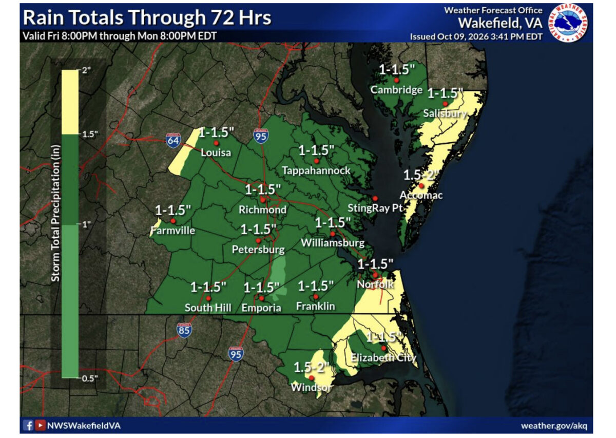
Accomack and Northampton counties face rain, gusty winds and hazardous boating conditions this weekend as the remnants of Hurricane Isaias move inland and interact with a frontal system.
The National Weather Service in Wakefield has placed its forecast area, including Virginia’s Eastern Shore, under a Slight Risk for severe weather Sunday, October 11. The designation is level two on a five-level scale, with damaging winds and a few tornadoes possible.
Rain is expected to spread across the region Saturday night and continue overnight into Sunday. Another round of showers and thunderstorms could develop Sunday afternoon ahead of an approaching cold front.
Forecasters have lowered projected rainfall totals somewhat, with approximately 1 to 1.5 inches expected along the coast. Actual amounts will depend on the storm’s track and whether drier air moves into the region between rounds of rain. The overall freshwater flooding threat is low, although localized flooding could occur in poorly drained areas Sunday morning.

Coastal wind gusts of 25 to 35 mph are forecast, with the strongest general winds expected early Sunday. Stronger gusts could occur in severe thunderstorms.
Conditions will also deteriorate on the Chesapeake Bay and Atlantic coastal waters. Bay waves could reach 3 to 5 feet Sunday, increasing to 5 to 7 feet near the bay mouth. Atlantic seas near shore could build to 6 to 9 feet.
A Gale Warning is scheduled for the mouth of the Chesapeake Bay from 4 a.m. to 1 p.m. Sunday. Atlantic waters from Parramore Island south to Cape Charles are under a Gale Warning from 4 a.m. to 4 p.m. Sunday. Waters north of Parramore Island remain under a Gale Watch in the early Saturday forecast, with an upgrade possible.
The weather service also expects elevated tides during Sunday’s high-tide cycle. Its discussion identifies the primary minor tidal-flooding concerns in Hampton Roads, along the western Chesapeake Bay shore and on Maryland’s lower Eastern Shore; it does not specifically forecast minor tidal flooding for Accomack or Northampton.

Winds should ease Sunday evening, although rough Atlantic seas may persist into Monday. The early Saturday advisory list includes marine alerts but no land-based watches or warnings for Virginia. Residents should monitor subsequent forecasts and any severe-weather alerts issued Sunday.