
AUGUSTA, Ga. (WRDW/WAGT) – Tornadoes are blamed for damage in at least three CSRA counties Saturday that sparked warnings across the region as severe weather spun off from Hurricane Isaias to our west.
The storms left damage in Allendale, Screven and Burke counties.
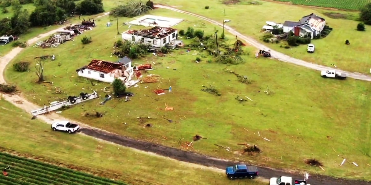
On Story Mill Road in Burke County, at least four buildings were destroyed by an apparent tornado.
Property owner Wesley Bailey was in disbelief. Luckily, he wasn’t living there.
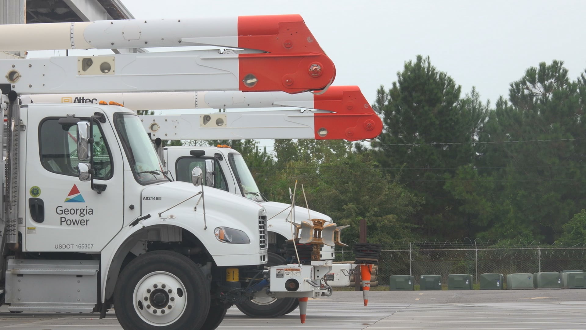
He’d been talking earlier in the day about the tornado threat.
“I kept telling my wife, I said, ‘That’s circulation in the air,’” Bailey said. “I see the clouds moving around in circles.”
The rain began to whip in different directions.
“All you can see is the wind, the rain going one way and going the other way,” he said.
“And then you couldn’t hardly see it, the funnel. But you could hear the rain, hear it roaring.”
Then a co-worker called with the news: “A tornado hit your place.”
Bailey farms the property on Story Mill Road, about halfway between Hephzibah and Waynesboro, but no one had been living there recently.
PHOTO GALLERY: BURKE COUNTY FARM SEES BIG DAMAGE
“Nobody lived here since the hurricane,” he said.
He’d been preparing to start working on the buildings again.
News 12 drone video from the scene showed at least four buildings damaged or destroyed. Two were missing parts of their roofs. One had a side ripped away. A fourth was flattened.
One of the homes was made of concrete blocks, but got shredded anyway.
Trucks and trailers were overturned.
Officials say no injuries were reported in Burke County.
“I’m glad nobody got hurt. That’s the main thing,” Bailey said. “All this can be cleaned up and replaced, but maybe it takes time.”
The storms are a reminder of how powerful nature can be.
“You never underestimate wind and rain or water,” Bailey said.
Elsewhere in the CSRA
The destruction on Story Mill Road was part of a larger outbreak of severe weather that spun off from the remnants of Hurricane Isaias.
The storms left damage in Allendale and Screven counties and triggered a series of tornado warnings, with the last one expiring around 7:30 p.m.
In Allendale County, a tornado was confirmed at 4:18 p.m. five miles south of Appleton, moving north at 30 mph, according to the National Weather Service. The storm eventually moved to Barnwell County.
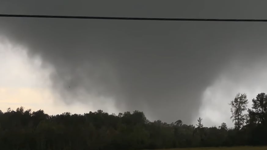
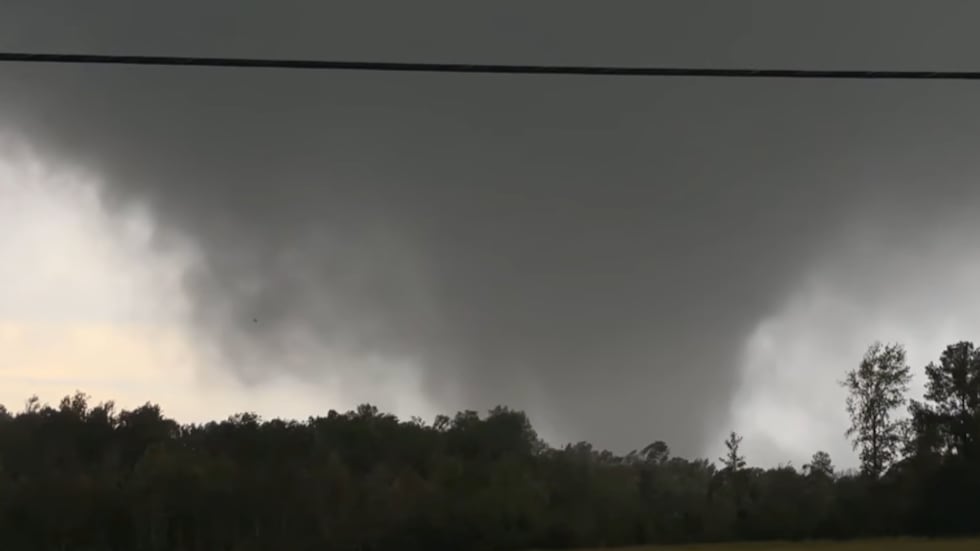 Image of tornado posted in National Weather Service chat during tornado warning in Allendale County,(Contributed)
Earlier, that same storm also spawned a tornado in Screven County, where there was confirmed damage. Trees were reported down in a 200-yard path near Old Savannah Highway and Highway 21.
Viewers sent News 12 a video of a classic stovepipe tornado sweeping through the area:
The damage came as a series of tornado warnings played out during a volatile afternoon and evening in the CSRA.
The last one expired at 7:30 p.m. for Aiken and Saluda counties, spurred by a severe thunderstorm capable of producing a tornado near Ridge Spring and Batesburg-Leesville.
It was the second radar-indicated tornado warning for the same area in a couple of hours. The earlier warning came after the New Holland area saw a confirmed tornado on the ground.
Also getting a second tornado warning of the day was Screven County, where a warning was in effect until 6:30. That warning was allowed to expire.
The tornado warningsA tornado warning was in effect for parts of northwestern Lexington County, eastern Saluda County and north-central Aiken County in central South Carolina. The National Weather Service in Columbia issued the warning at 7:02 p.m. and it remained in effect until 7:30 p.m. As of 7:02 p.m., a severe thunderstorm capable of producing a tornado was located near Ridge Spring, or near Batesburg-Leesville, moving north at 25 mph.A tornado warning was in effect until 6:45 p.m. for parts of west central Lexington County and southeastern Saluda County, as a strong storm with rotation moves north through the area. As of 6:37 p.m., the National Weather Service said a severe thunderstorm capable of producing a tornado was located over Batesburg-Leesville, moving north at 30 mph.A tornado warning was in effect until 6:30 p.m. for parts of Bulloch and Screven counties. As of 5:57 p.m., a severe thunderstorm capable of producing a tornado was located near Leefield, moving northeast at 20 mph.A tornado warning was in effect until 6:30 p.m. for central Aiken County. The National Weather Service in Columbia said that as of 5:38 p.m., a severe thunderstorm capable of producing a tornado was located near Aiken State Park, about 15 miles east of Aiken Mall, moving north at 30 mph.A tornado warning was in effect for northern Barnwell County until 5:45 p.m. As of 5:33 p.m., a confirmed tornado was located over Williston, or 14 miles north of Barnwell moving north at 25 miles per hour.A tornado warning was in effect until 4:45 p.m. for Screven County and Allendale County. As of 3:51 p.m., a severe thunderstorm capable of producing a tornado was located about 9 miles south of Burtons Ferry Landing, moving north at 25 mph.A tornado warning was in effect until 5:45 p.m. for east central Burke County. Around 3:48 p.m., a severe thunderstorm capable of producing a tornado was near Waynesboro, moving northeast at 25 mph.Aftermath of Isaias
Meteorologists say these storms were part of the broader severe weather pattern spinning off Hurricane Isaias, which roared ashore near Destin on Friday and has since weakened into a post-tropical system.
Even as Isaias moves inland, the storm’s outer bands are still feeding dangerous thunderstorms, heavy rain and isolated tornadoes across parts of the Southeast, including Georgia and South Carolina.
Forecasters warn that the risk for flash flooding, damaging winds and additional tornadoes could continue into the weekend as the remnants of Isaias track toward the Tennessee Valley and Mid-Atlantic.
Brett Buffington, Riley Hale, Emily Acton, Chris Still, Malik Bryant, Steve Byerly and others on the News 12 team contributed to this report.
Copyright 2026 WRDW/WAGT. All rights reserved.