
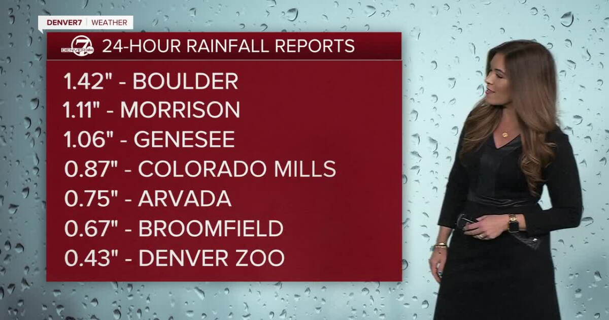
DENVER — Fall and winter weather collide in Colorado tonight as a powerful storm moves across the state! Rain and mountain snow will continue into Thursday, but the bigger concern may come Thursday night, when temperatures plunge and a widespread frost or freeze becomes possible in the Denver metro and plains!
Denver metro rain, mountain snow overnight; soggy Thursday morning, afternoon clearing
It’ll be a soggy start to your Thursday with scattered showers for the morning drive. The metro rain and mountain snow will stick around through midday before skies clear from north to south. Daytime highs will stay below-average in the low to mid 50s in the afternoon.
The Broncos-Seahawks game at Empower Field on Thursday night will be chilly and windy! You may see a few spotty showers for tailgating, but skies will clear out in time for kickoff. Bundle up because temperatures will dip into the low to mid-40s by the 4th quarter.
Skies will rapidly to clear Thursday evening, allowing temperatures to tumble overnight. A widespread frost or hard freeze is possible Thursday night into Friday morning, prompting a Freeze Watch for the Denver metro area and Eastern Plains through 9am Friday. Temperatures Friday will stay cool, with highs mainly in the mid to upper 50s under sunny skies and light winds.
Warmer weather returns just in time for the weekend. Highs will climb into the mid 70s Saturday, with another mild day expected Monday. More clouds could knock temperatures back a bit Sunday, potentially keeping some areas in the upper 60s to low 70s, but dry weather is expected to hold.
Looking ahead to next week, temperatures will remain above normal with mostly dry conditions continuing Tuesday and Wednesday. The next system worth watching is expected to develop along the West Coast late next week, potentially bringing another chance for some wet weather into Colorado.
DENVER WEATHER LINKS: Hourly forecast | Radars | Traffic | Weather Page | 24/7 Weather Stream
Click here to watch the Denver7 live weather stream.