

Meteorologist/Climate Reporter
The next round of rain and snow comes in Sunday, but this storm will behave very differently from Friday’s
Meteorologist/Climate Reporter
Northern California’s first big storm of the season wound down late Friday night and the KCRA 3 weather team is tracking two more that will move through over the next five days. Sunday and Wednesday are KCRA 3 weather Impact Days.
The forecast is dry on Saturday but chain controls will likely still be in place over the Tahoe area summits until Caltrans can get the freeways cleared.
Storm number two will slowly move in on Sunday. This system will behave very differently from Friday’s. Rain and snow will be lighter in intensity but precipitation will last longer. Wind will be less intense by comparison. Details on the timing and totals are in the graphics below.
A third storm will swing in on Wednesday with a little more intensity. Widespread heavy rain, gusty winds and heavy snow are possible. This third storm may be the biggest snow producer of the three. Additional details on this storm will be shared in a couple of days.
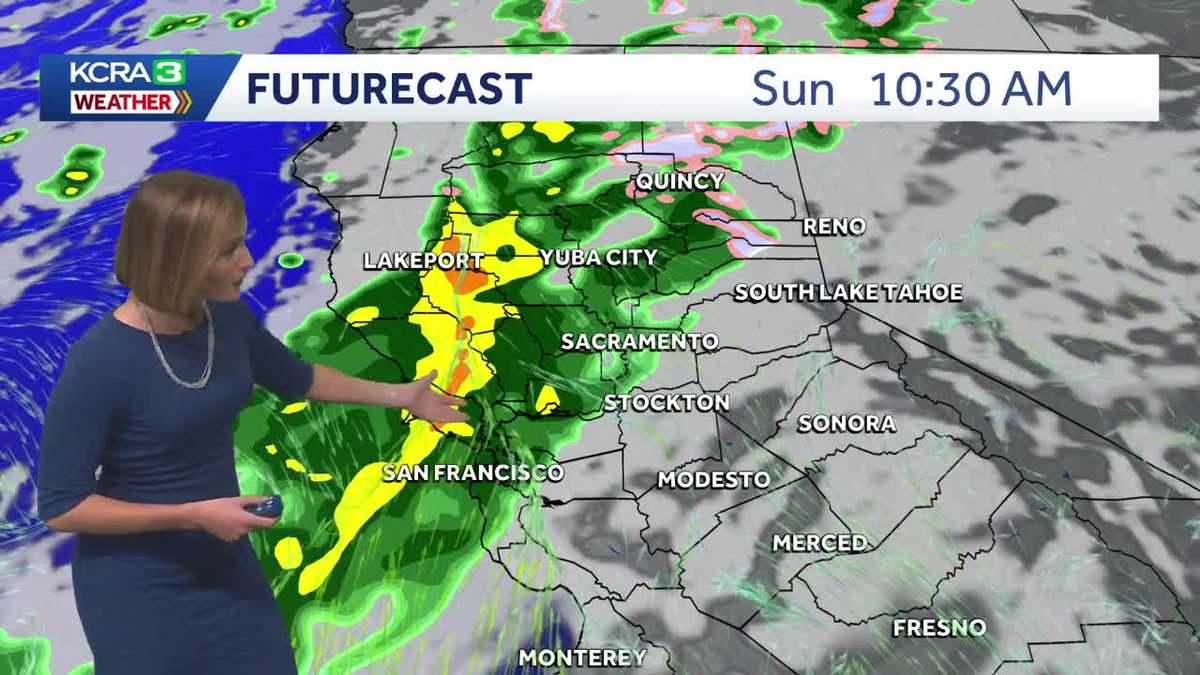
1Next rain arrives for some Sunday morning
Some parts of Northern California will see rain return as early as Sunday morning.
A narrow band of light to moderate rain will slowly move from northwest to southeast. There will be a bit of a breeze, but gusts will only peak between 20 and 25 mph.
Places south of I-80 will likely stay dry until the afternoon.
2Rain moves south Sunday evening
By Sunday evening, rain will reach the San Joaquin Valley and most places in the adjacent Foothills.
Snow will start falling above 7000′ around sunset. The snow level is expected to drop closer to 6500′ overnight. Chain controls may be needed Sunday night into Monday morning on I-80, Highway 50 and Highway 88.
3Valley clears by Monday morning
Rain should be done in the Valley by the time the sun comes up Monday.
Some light rain showers will linger in the Foothills for a couple of hours.
Light to moderate snow will continue above 6000′ until mid to late morning, mainly south of Highway 50.
4Sunday-Monday rainfall forecast
Storm number two will bring similar rain totals to Friday’s storm, but rain will accumulate much more slowly and last for a longer amount of time.
5Sunday-Monday snow forecast
Snow totals will be lighter with this second round, but there will still be enough for chain controls over the summits Sunday night into early Monday.
6Storm number three Wednesday
Tuesday will bring a break in the weather allowing for Northern California to dry out.
Storm number three will hit some time on Wednesday. This storm may come with a little more intensity. There is the potential for gusty winds, widespread rain (some heavy) and heavy snow. This storm also looks like it could be the biggest snow producer of the three coming in this stretch.
More details on precipitation timing and expected amounts will be shared in a couple of days.