
By Ivan Kesic
As the final leg of 2025 unfolds, Iran’s space program stands on the cusp of a significant operational leap, preparing to deploy enhanced versions of two cornerstone satellites that reflect its dual ambitions in remote sensing and secure communications.
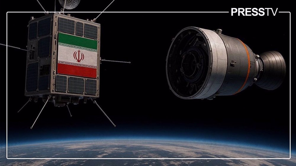
In a statement released in late September 2025, the head of Iran’s Space Research Center outlined a clear timeline for the country’s next steps in orbit: the second prototypes of the Pars-1 remote-sensing satellite and the Nahid-2 telecommunications satellite are slated for launch by late January.
Earlier this week, the agency announced that the second prototype of the Nahid‑2 communications satellite and the Pars‑1 imaging satellite will be launched by January 2026.
This announcement marks the maturation of strategic, domestically driven space architecture, building on the successful deployment of their predecessors and is intended to solidify key national capabilities.
The upgraded Pars-1 is designed to give Iran sovereign, multispectral observation coverage for environmental monitoring and resource management, while the new Nahid-2 prototype aims to further advance indigenous expertise in orbital communications and station-keeping.
Developed under the constraints of persistent international sanctions, these satellites embody Iran’s pursuit of technological self-reliance and its methodical progress toward an integrated national constellation serving both civilian needs and strategic objectives.
Pars-1: A multispectral sentinel for sovereign earth observation
Pars-1 is an Earth-observation and remote-sensing satellite developed by the Iranian Space Research Center (ISRC) and the Iranian Space Agency (ISA). Its mission is to image Iran’s territory, and potentially surrounding regions, providing topographic and remote-sensing data for mapping, environmental monitoring, land-use analysis, and related applications.
According to official statements, Pars-1 is “capable of capturing images of 95 percent of Iranian territory.” It has a mass of 134 kg and is designed for an orbit of roughly 500 km.
The key advancement in the upgraded Pars-1 prototype is its enhanced payload suite, comprising three imaging sensors: multispectral (MS), short-wave infrared (SWIR), and thermal infrared (TIR). This triple-sensor configuration moves beyond basic visible-light imaging, enabling data collection vital for agriculture, vegetation and water monitoring, land-use planning, disaster assessment, and urban development.
The upgraded platform falls within the 100-150 kg microsatellite class and incorporates gallium-arsenide solar cells for improved power generation.
The first Pars-1 was launched on 29 February 2024 from Russia’s Vostochny Cosmodrome aboard a Soyuz rocket, marking the program’s initial operational milestone.
The upgraded model was officially unveiled on 2 February 2025, and ISRC leadership later suggested a potential launch “in December” 2025, now aligned with the updated late-January timeframe for the second prototype.
Operating at approximately 500 km, Pars-1 is a modest but strategically important asset. Public sources do not attribute high spatial resolution (e.g., <5 m) to the satellite; its value lies in spectral diversity rather than fine-detail imaging.
For higher resolution products, Iran looks to future spacecraft such as the under-development Pars-3. Even so, Pars-1’s evolution reduces reliance on foreign imagery – which may be constrained by sanctions – and strengthens national self-sufficiency.
The move toward integrated multispectral, thermal, and SWIR imaging significantly expands the civil utility of the data produced. Should Iran proceed with a constellation, revisit times and coverage would increase, amplifying the strategic value of its remote-sensing infrastructure.
However, notable uncertainties remain, including precise spatial resolution, swath width, revisit cycle, and detailed sensor specifications. The exact orbital parameters and the extent of payload differences compared with the first prototype also remain publicly undisclosed.
Iran to unveil two new indigenous satellites
According to the head of Iran’s Space Research Center, the second prototype of the Nahid‑2 communications satellite and the second prototype of the Pars‑1 imaging satellite will be launched by late January. pic.twitter.com/aada0P0S4W
— Press TV 🔻 (@PressTV) November 30, 2025
Nahid-2: the pioneering Ku-band platform for communications autonomy
Nahid-2 is a telecommunications and data-relay satellite developed by the Iranian Space Research Center (ISRC) and the Iranian Space Agency (ISA), aimed at establishing domestically controlled satellite-based communications, ranging from broadband and data links to the foundations of a potential satellite-internet infrastructure over time.
Conceived as both an operational platform and a research-and-technology demonstrator, Nahid-2 is intended to validate a range of essential subsystems, including attitude control, propulsion, power generation and management, thermal regulation, and multi-band communications.
The first Nahid-2 satellite was launched on 25 July 2025 aboard a Soyuz-2.1b rocket from Russia’s Vostochny Cosmodrome and placed into a low Earth orbit at an altitude of roughly 500 km.
With a mass reported at around 110 kg (earlier estimates suggested up to ~120 kg), it occupies the microsatellite class. The upcoming second prototype is expected to refine and build upon this proven design.
A central element of Nahid-2’s technical importance lies in its communications suite: the satellite supports Ku-band, X-band, and UHF links and is reportedly Iran’s first telecommunications spacecraft to incorporate Ku-band capability. This marks a notable step toward indigenous broadband and higher-capacity data-relay functions.
Nahid-2 also integrates several advanced subsystems. These include a three-axis attitude determination and control system (ADCS); power generation and distribution hardware; thermal control components; telemetry and telecommand (TT&C) systems; and a domestically developed chemical propulsion unit, a hot-gas engine providing roughly 1 N of thrust, for orbital corrections, altitude maintenance, and station-keeping. Its average onboard power capacity is stated at 49 watts.
Initial post-launch telemetry confirmed that the satellite was healthy and operating normally. Key functions – including rotational stabilization, power regulation, thermal management, and S- and U/V-band communications – were successfully validated shortly after deployment.
The propulsion system, a critical milestone for Iran’s orbital autonomy, enables independent orbit control and lifespan optimization. The satellite’s design lifetime was initially cited as two years, with some subsequent reports suggesting operational potential of up to five years depending on in-orbit performance.
Nahid-2 represents a major step forward for Iran’s indigenous satellite communications capability, an essential pillar in the development of national data-relay infrastructure and, potentially, future satellite-internet services.
Its heavy reliance on domestically produced technologies, including propulsion, batteries, thermal systems, and communications transceivers, underscores the program’s trajectory toward strategic self-reliance.
As a microsatellite, Nahid-2 also provides the technological groundwork for scaling up to future constellations or larger spacecraft, such as the already designed Nahid-3.
Yet several parameters remain publicly undisclosed, including detailed data-throughput capacity, the scope of its ground-segment architecture and user-terminal ecosystem, and concrete plans for a fully operational communications constellation.
Broader constellation: integrating into a grand strategic roadmap
The upcoming launches of the upgraded Pars-1 and Nahid-2 prototypes are not isolated milestones but integral components of a sprawling, decade-long space roadmap.
As outlined by ISA chief Dr. Hassan Salarieh, this national vision spans the full spectrum of space activities, from Earth observation and communications to launch systems and deep-space cooperation.
The enhanced Pars-1 and Nahid-2 satellites follow the successful launch and evaluation of their initial prototypes, forming part of a continuous, step-by-step development chain.
In parallel, Iran is advancing more capable successors: Pars-2 is undergoing final tests, while Pars-3 – designed to achieve sub-meter resolution – and the Rad-2 synthetic-aperture radar (SAR) satellite are currently in development.
On the communications front, the higher-bandwidth Nahid-3 is progressing rapidly.
These next-generation spacecraft will eventually operate alongside other emerging platforms, including the advanced Kowsar 1.5 satellite – an upgraded remote-sensing system offering 3.45-meter resolution for precision agriculture – as well as the Zafar and Paya Earth-observation satellites, both slated for foreign launch in the coming months.
Together, these systems are intended to form a sophisticated national constellation supporting environmental monitoring, precision agriculture, resource management, and broad civilian applications.
Iran is also developing the “Martyr Soleimani” narrowband Internet of Things (IoT) constellation, whose first nanosatellite prototypes have been completed. This layered approach, drawing on the combined efforts of public institutions and private knowledge-based companies such as SpaceOmid, the developer of Kowsar, demonstrates a whole-of-nation drive to establish an independent space ecosystem.
International partnerships remain a key pillar of this strategy. Iran’s active participation in China’s Chang’e-8 lunar mission and its ongoing discussions regarding space-station collaboration reflect a deliberate effort to cultivate strategic alliances outside Western-dominated space frameworks.
These engagements offer critical technical exchanges while reinforcing the country’s geopolitical positioning in the emerging multipolar space landscape.
Overcoming barriers: launch infrastructure and sanctions resilience
A decisive enabler of Iran’s long-term ambitions is the pursuit of sovereign launch capability. The imminent activation of the Chabahar National Spaceport represents a major inflection point. Phase One, dedicated to solid-fuel launch vehicles, is nearing completion, with preparations underway for the site’s inaugural launch.
Located along Iran’s southeastern coast, the spaceport provides access to a wide range of orbital inclinations, ideal for constellation deployments and sun-synchronous missions.
Phase Two, intended for larger liquid-fuel vehicles capable of lifting heavier payloads, is planned to follow. Establishing domestic launch infrastructure is essential for operational security and flexibility, reducing reliance on foreign launchers such as the Russian Soyuz rockets currently used for missions like Pars-1 and Nahid-2.
Iran’s broader space program stands as a testament to scientific persistence under pressure, having achieved notable technological progress despite decades of restrictive Western sanctions. The emphasis on domestic component production, reported at more than 85 percent for satellites such as Kowsar 1.5, underscores a national strategy centered on resilience and self-reliance.
Despite Western objections, Iran consistently maintains that its satellite initiatives are peaceful, civilian, and research-oriented, supporting practical services in agriculture, communications, environmental management, and disaster response.
The program’s methodical trajectory, from early recoverable capsules to communication satellites equipped with station-keeping propulsion, reflects a long-term vision that treats sanctions not as impediments but as catalysts for indigenous innovation.