
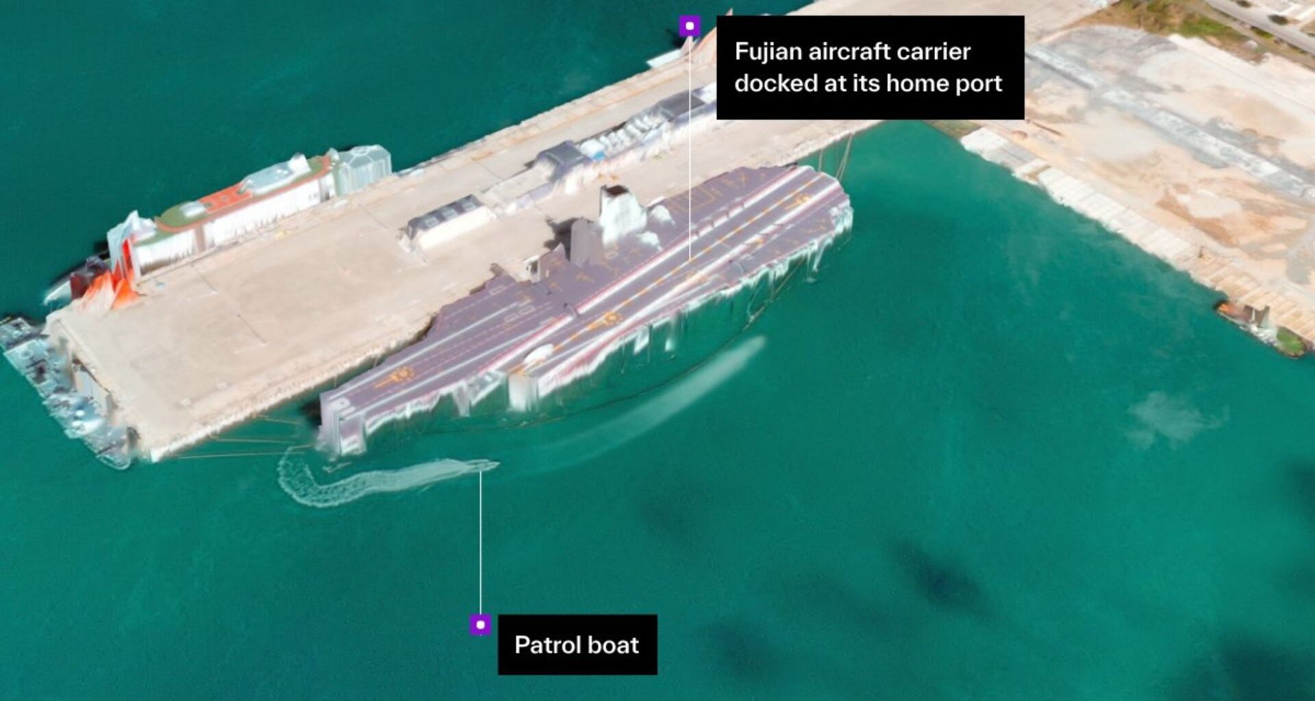
U.S. satellite company Vantor just showed off its satellite imaging capabilities by sharing highly detailed images of the Yulin Naval Base on Hainan Island, the southernmost point of China. The company posted the highly detailed photographs on X, which claims a 50cm (around 20 inches) resolution and a sub-4-meter (less than 14 feet) spatial accuracy. More importantly, this was achieved with only a single satellite pass and was processed in under 10 hours. Although this will not give you a live video feed of what’s happening on the ground, it still gives anyone accessing the data so much more information they can use for analysis, planning, and reconnaissance. Moreover, you can explore the images in full 3D, thanks to Vantor’s Forge software.
“We generated this high-resolution 3D terrain from a single satellite pass at 11:21 a.m. local time today, processing it into this finished image within 10 hours. All delivered in 50 cm resolution and at sub-4 m spatial accuracy,” the company said in its post. It later added, “Command systems and autonomous platforms rely on our highly accurate 3D spatial foundation to serve as a trusted ground truth for the operational terrain. Our rapid 3D processing capability updates this foundation with only a single satellite pass, keeping that foundation current at mission tempo.”
China’s Yulin Naval Base earlier this morning. Explorable in full 3D. We generated this high-resolution 3D terrain from a single satellite pass at 11:21 a.m. local time today, processing it into this finished image within 10 hours. All delivered in 50 cm resolution and at sub-4 m… pic.twitter.com/s3ZSdzx5g0December 5, 2025
Satellite imagery can deliver a lot of information to any nation. However, processing that amount of data can take a team of experts days, if not weeks, to understand what’s going on. Vantor aims to revolutionize this with the use of artificial intelligence, accurate global data, and software to allow its clients to build a digital twin of any particular site that its satellites can see. This makes planning easier and more accurate for just about anyone — from civilian governments looking at urban planning and disaster response, to military personnel planning operations and executing war games.
You may like
What’s more impressive is the sharpness and resolution of the final image. The 50cm pixel size means that each pixel on the processed image is about 20 x 20 inches, which is not bad considering the height of the orbiting satellite. This should be sharp enough to see individual vehicles on the ground, and that fact that it can be processed into 3D view would make it easier for analysts to determine what they’re looking at.
Combining high-resolution imagery with machine learning will definitely make it easier for intelligence experts to process the tons of data that multiple sensors gather all-year-round. This is partly the reason why some members of the U.S. government are leery on allowing Chinese access to the latest American chips from Nvidia and AMD, as their dual-use capability mean that they can be used for both civilian and military applications, with the provider being unable to control the final purpose of these AI GPUs when they’re delivered.

Follow Tom’s Hardware on Google News, or add us as a preferred source, to get our latest news, analysis, & reviews in your feeds.