
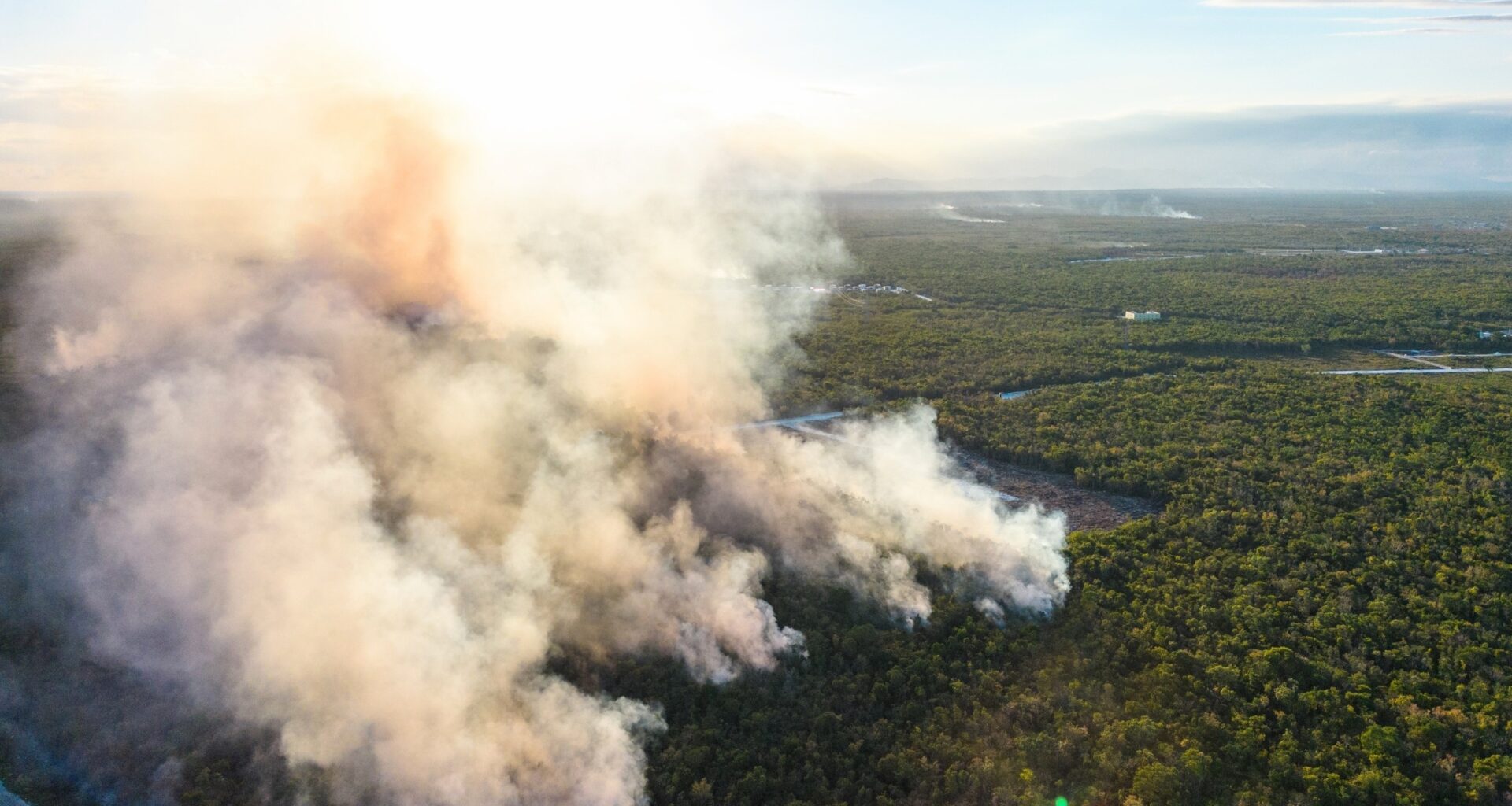
Researchers estimate that wildfires and prescribed burns release about 158 million tons of organic air pollutants each year.
A team in Beijing built the inventory to count heavier smoke gases from wildfires and prescribed burns that can form harmful particles.
Mapping smoke pollution

Building an emissions inventory, a map of pollutants by place and time, starts with deciding which smoke chemicals matter.
The study, led by Dr. Shuxiao Wang at Tsinghua University (THU), was focused on combustion emissions in cities and landscapes.
Dr. Wang’s research tracks how organic smoke chemicals age in sunlight, which helps model the pollution people breathe.
Overlooked smoke vapors
Most global fire inventories tally only the lightest organic gases that evaporate quickly from hot ash and char. These are volatile organic compounds, carbon-based gases that can travel far downwind.
This narrow focus leaves out larger molecules that behave differently, causing models to underestimate particle pollution.
Between fast-evaporating gases and solid soot, there are many compounds that rise with smoke and cool into sticky vapors.
Scientists call them intermediate-volatility organic compounds (IVOCs), gases that evaporate slowly and often recondense.
Because routine monitoring rarely measures IVOCs, many inventories ignore them, and air models may undercount later particle formation.
Tiny airborne particles
Another set of smoke organics evaporates at flames but condenses as air cools, coating surfaces and existing particles.
These semi-volatile organic compounds (SVOCs) are chemicals that flip between gas and particle.
Oxidation adds oxygen to SVOCs and lowers their tendency to evaporate, so more material moves into tiny airborne particles.
Sorting smoke chemistry
To capture all these behaviors, the inventory sorts organic emissions by volatility – how easily a substance evaporates into gas.
Each bin groups chemicals with similar evaporation rates, letting researchers estimate how much stays gaseous or forms particles.
That approach can flag pollution older methods miss, but results still depend on measurements that represent real fires.
Tracking fire history
The researchers started with a global record of burned land, built from satellite maps that mark fire scars.
This dataset spans 1997 to 2023 and separates forests, grasslands, and peatlands, since each fuel type burns differently.
Year-to-year swings in drought and land use change the totals, so averages hide sharp spikes in bad seasons.
Measuring smoke output
For each vegetation type, researchers rely on average pollution per amount of fuel burned to translate acres burned into gases.
THU field campaigns measure smoke directly when possible, while laboratory burns fill gaps for rarer fuels or unsafe conditions.
Laboratory fires control moisture and wind poorly, so the inventory carries uncertainty where wild burns behave less predictably.
The bigger global estimate
Combining land burned with emission factors added a missing 27.7 million tons (25.1 million metric tons) of IVOCs and SVOCs each year.
Overall organic emissions rose by about 21%, reflecting compounds that many earlier inventories excluded from their chemistry lists.
That added mass can change how modelers assign pollution sources during smoky weeks, especially near large fire complexes.
Global smoke hotspots
Some regions release far more organic smoke per area than others, partly because frequent grass fires cover wide terrain.
Southern Hemisphere Africa led with 12.6 tons per square mile (about 4.4 metric tons per square kilometer yearly).
Such hotspots drive strong local exposure, and they also feed long-range haze when winds move smoke across borders.
Fire meets urban emissions
Across the globe, wildland fire organics reach about 79% of human-made totals, even when factories and cars dominate.
Comparable IVOCs and SVOCs emissions from both sources can mix in the same air, complicating source tracking for regulators.
Equatorial Asia, Northern Hemisphere Africa, and Southeast Asia show overlapping hotspots, so clean-air plans must address combustion on several fronts.
Health risks of smoke
Wildfire smoke harms health most when it carries fine particulate matter, tiny particles that reach deep into lungs and inflame tissues.
A major 2016 review linked wildfire smoke exposure with higher respiratory illness and growing evidence for mortality risk.
Children, older adults, and people with heart or lung disease face added risk when dense smoke persists for days.
Improving air-quality models
More complete smoke chemistry can improve air-quality modeling.
These computer simulation that predicts pollution levels hour by hour, during fire seasons.
“The inventory provides a foundation for more detailed air-quality modeling, health-risk assessment and climate-related policy analysis,” said Lyuyin Huang, the first author.
Better inventories also help health planners estimate exposure, but they cannot replace local monitors when smoke varies street by street.
Smoke and climate signals
Smoke particles affect climate by changing how sunlight moves through air, which can cool surfaces or warm the atmosphere.
Organic particles mainly scatter light, while black carbon, soot that strongly absorbs sunlight and warms air, can change clouds.
These climate effects add uncertainty to planning, since smoke varies widely in composition and season across regions.
Why this matters now
Taken together, the inventory shows that counting heavier smoke organics can raise pollution estimates and sharpen regional source maps.
Better inputs can support smarter burn decisions and health alerts, but real progress needs cleaner engines and better fire management.
The study is published in the journal Environmental Science & Technology.
—–
Like what you read? Subscribe to our newsletter for engaging articles, exclusive content, and the latest updates.
Check us out on EarthSnap, a free app brought to you by Eric Ralls and Earth.com.
—–