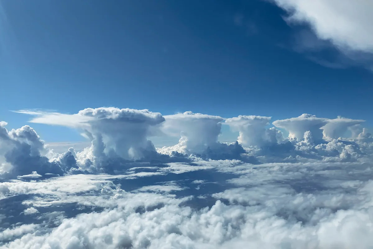
Pilot Michelangelo Svrznjak captured this incredible image above Western Australia from the cockpit of his plane. Source: Michelangelo Svrznjak via Bureau of Meteorology
A pilot has photographed a rare spectacle from the cockpit of his plane, capturing rows of thunderstorm clouds from high in the sky. The chain of clouds was captured above the Western Australian coastline, perfectly plotting out a west coast trough.
Comparing the image to radar data, the Bureau of Meteorology told Yahoo News Australia the storms stretched over a distance of 150km. The spectacular image has been selected to feature as the November image in this year’s Australian Weather Calendar.
“Each storm cell would likely have been a few to tens of kilometres wide,” a Bureau spokesperson said.
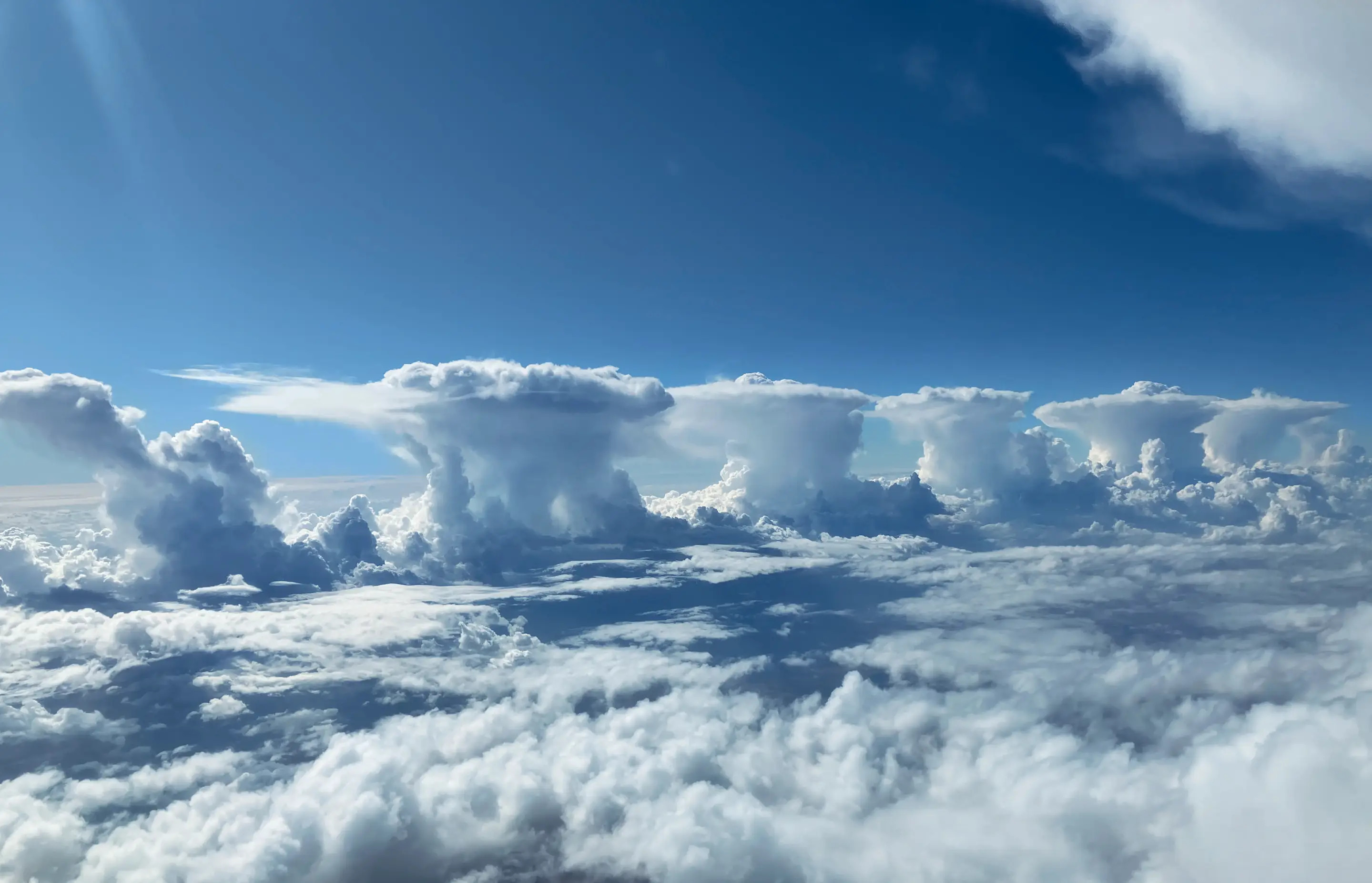
“One of the remarkable parts of this photo is the complete lack of cloud around and between each large thunderstorm cloud, giving us a completely clean and clear view of the line.”
While the weather looks bright and calm in the clouds, the same can’t be said for the conditions on the ground.
The tall, fluffy clouds have the potential to produce severe storms, including heavy rainfall, damaging wind gusts, and large hail.
“This is a rare view of storm clouds, as this image was taken around 11 km above the ground,” the spokesperson said.
“From ground level, these storms would look very different, and may even be indistinguishable from the other surrounding clouds.”
Pilot in awe of rare sight
The pilot behind the camera, Michelangelo Svrznjak, told the Bureau he’d never seen anything like it.
“To see them formed perfectly, almost equally distant from each other, was pretty awesome,” he said.
“It’s the first and probably the last time I’ll ever see something like that.”
Bureau of Meteorology National Community Information Manager Andrea Peace said Mr Svrznjak’s image was a standout when selecting photos for this year’s calendar.
“It had all the judges immediately hooked,” she said. “From the moment we saw it, it was a winner.”
“From a meteorologist’s perspective, it is amazing to see the view from above. We can see what is happening from the ground and on the radar, but to have this perspective is something special.”
Why are there so many storm clouds in a row instead of one large one?
A trough often marks a boundary between converging winds, moist and dry air or hot and cold temperatures, but these conditions are not uniform along the length of the trough, the Bureau explained.
“This allows multiple or many storm cells to form simultaneously, in similar conditions,” the spokesperson said.
“One way to understand how storms form is by imagining a pot of boiling water. You know that when the water reaches a certain temperature, bubbles will start forming on the surface of the water. You don’t know exactly where the first bubble will form, or how many bubbles will form in the pot overall, but you can be confident that they will all form in the same similar conditions in the pot.”
You can purchase the 2026 Australian Weather Calendar here.
Do you have a story tip? Email: newsroomau@yahoonews.com.
You can also follow us on Facebook, Instagram, TikTok, Twitter and YouTube.