
Heavy rainfall and severe thunderstorms have caused flooding throughout the Northern Beaches this afternoon and this evening, Saturday 17 January, with authorities warning it could continue for up to 48 hours, extending into Sunday, as slow-moving storm systems affect much of the NSW coastline.
We are providing updates in chronological order on this link until the weekend’s weather system has fully passed.
11:15pm WHAT CAN WE EXPECT NEXT?
It appears the heaviest next falls are predicted to be between 4am and 6am Sunday morning. Sustained rain and winds are expected throughout Sunday which will also see many trees down with strong winds in damp soil.
11:10pm WATCH AND ACT: MANLY LAGOON
The NSW SES advises people in the following area(s) NOT TO ENTER FLOODWATER due to current localised flooding along the northern bank of Manly Creek bounded by Nolan Reserve, Pittwater Road, Manly Creek and Mill Park – including Riverview Parade, Palm Avenue and Lakeside Crescent.
You should monitor the situation as it is constantly changing. Avoid floodwater for your safety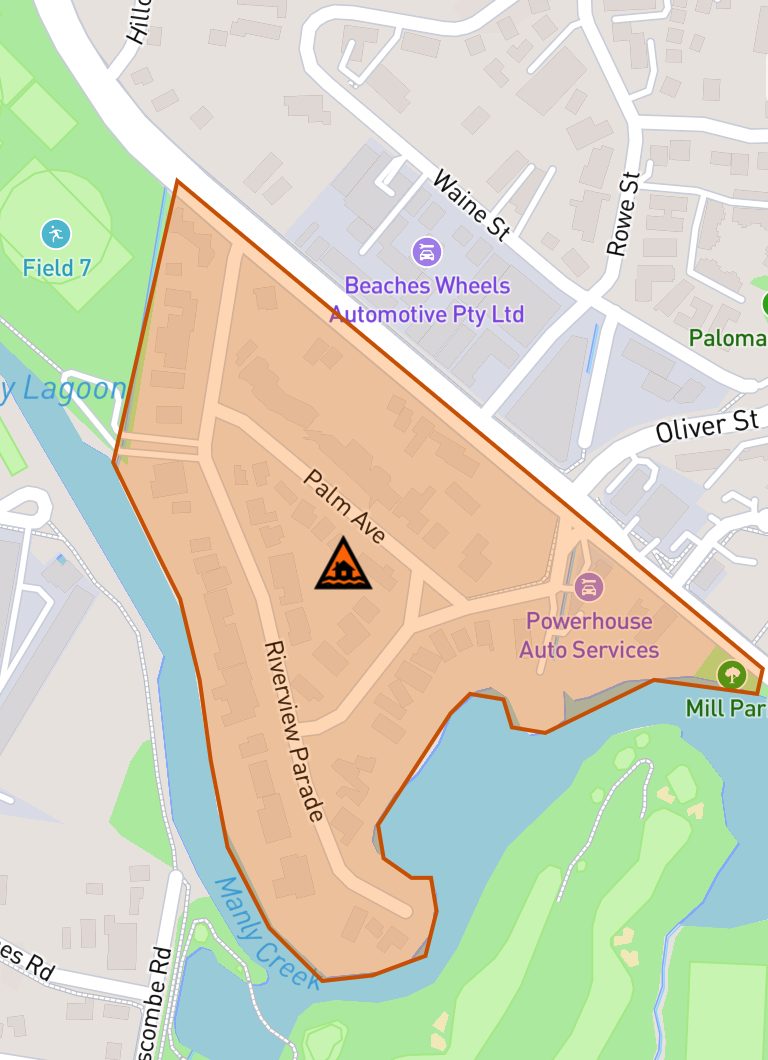
What are we expecting?
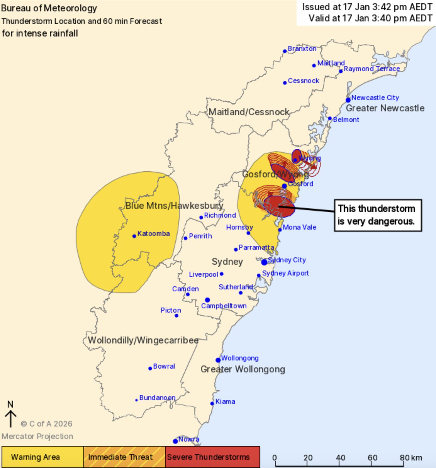
A VERY DANGEROUS THUNDERSTORM that produced heavy, locally intense rainfall that may lead to dangerous and life-threatening flash flooding was detected near Mona Vale and Manly.
Manly Lagoon is open. The heavy rainfall may result in flooding of low-lying areas and roads around the Lagoon.
This event may change quickly. NSW SES will monitor the situation and update warnings if the situation changes.
⚠️ ⚠️ ⚠️
11pm EVACUATION ORDER: NARRABEEN
The NSW SES is directing people in the following to evacuate Narrabeen Lagoon and surrounds, including the BIG4 Sydney Lakeside Holiday Park before 11:30pm tonight, Saturday 17 January.
You must evacuate before this time because floodwaters are rapidly rising and may impact properties.
We understand from Mayor Sue Heins that the Mona Vale Memorial Hall is open as an evacuation centre.
You should evacuate to stay with family, friends, or alternate accommodation in areas unaffected by flooding.
If you remain in the area, you may become trapped without power, water, and other essential services. It may be too dangerous for NSW SES to rescue you, and buildings may not be able to withstand the impact of flood water.
What are we expecting?
A VERY DANGEROUS THUNDERSTORM producing heavy, locally intense rainfall that may lead to dangerous and life-threatening flash flooding was detected near Mona Vale and Manly.
Narrabeen Lagoon remains closed. The heavy rainfall may have resulted in flooding of low-lying areas and roads around the Lagoon.
This event may change quickly. NSW SES will monitor.
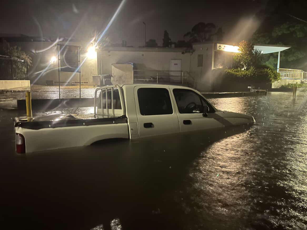
10.25pm More than 150 mm of rain has fallen on the Northern Beaches since 9am this morning, 17 January 2026.
9.31PM Saturday 17 January
Narrabeen Lagoon and surrounds – Prepare to evacuate.
The NSW SES has advised people in Narrabeen Lagoon and surrounding areas to prepare to evacuate due to localised flooding.
Residents should monitor the situation and be ready to leave safely if instructed.
Narrabeen Lagoon remains closed and the heavy rainfall may result in flooding of local low-lying areas and roads.
 SES screenshot. Narrabeen Lagoon prepare to evacuate
9.21PM Saturday 17 January
The NSW SES is advising people to stay indoors due to flash flooding.
8PM Saturday 17 January
Balgowlah road closed near Harris Farm and Andrew Boy Charlton.
8.35PM Saturday 17 January
Very dangerous thunderstorm likely to produce heavy rainfall and potential flash flooding to hit Mona Vale and Manly before heading towards the northwest at approximately 8.35PM.
5.40PM Saturday 17 January
More than 62 millimetres of rain was recorded at Avalon in just one hour, up to 2:13pm, as conditions intensified across the peninsula.
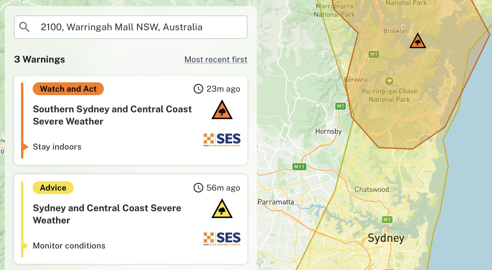
The Bureau of Meteorology issued a Watch and Act warning for areas north of Sydney, with very dangerous thunderstorms detected near Terrigal and Palm Beach.
 https://www.ses.nsw.gov.au
A separate severe thunderstorm reached Dee Why at around 3.30pm and moved northwest towards St Ives.
3.35PM Saturday 17 January
Manly Observer has received images of flooding at several locations, including:
Near Harris Farm in Manly.
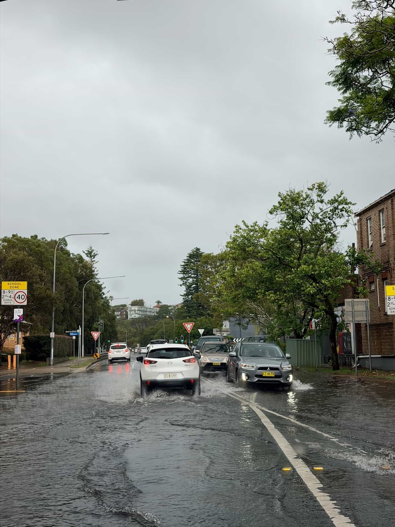 Outside Harris Farm, Manly
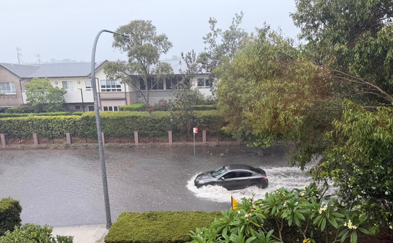 Barrenjoey Road, Warriewood. Photo: Tim
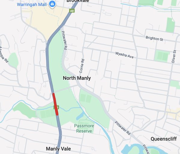 Red area showing flooding on Condamine Street. Photo: Screenshot from map, edited by Harriet Thornton
At this stage, Manly ferries appear to be running as normal, but members of the public are advised to monitor updates on the Transport NSW Trip planner.
SES response:
More than 880 requests for assistance have been made to the NSW State Emergency Service (SES) as storms and heavy rainfall continue to impact large sections of the coastline.
NSW SES State Duty Commander, Acting Assistant Commissioner Sonya Oyston said: “We are starting to see many catchments become wet and we have already seen the impacts of flash flooding right across the coast and ranges, so it is important people take the necessary precautions don’t become complacent.”
Safety advice:
The Bureau of Meteorology is urging residents to:
Stay informed by monitoring official weather warnings.
Avoid unnecessary travel where possible.
Keep clear of flooded roads, creeks and drains.
Follow advice from emergency services.
Don’t walk, ride your bike or drive through flood water.
Stay indoors away from windows, and keep children and pets indoors as well.
For emergency help in floods and storms, ring the SES on 132 500.
Stay updated on the Hazards Near Me NSW app or the ACT ESA website https://esa.act.gov.au.
This article will be updated as more information becomes available.