
An Emergency Warning has been issued for people in the area of an uncontrolled bushfire burning south of Adelaide.
The Country Fire Service (CFS) issued the warning about 6:45pm on Monday, warning those in the Deep Creek, Silverton and Blowhole Beach Road and Cape Jervis region on the Fleurieu Peninsula were “now in danger” and should take shelter in a solid building.
“Do not delay. Do not leave or enter this area in a vehicle or on foot,” the warning states.
“It is too late to leave, as the roads will not be safe.
“Shelter before the fire arrives, as heat can kill you well before the flames reach you.”
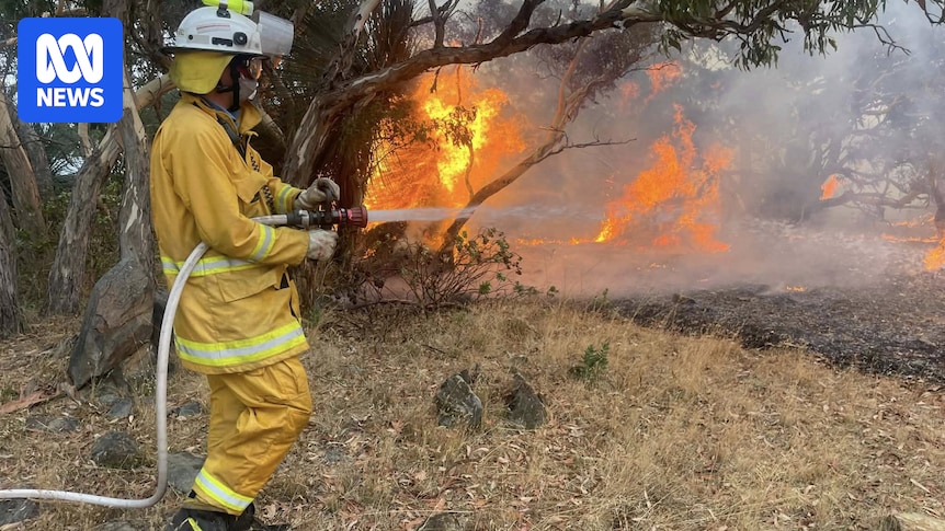
More than 250 firefighters are battling the uncontrolled bushfire burning in “inaccessible” terrain, with the CFS warning “firefighters are now unable to prevent the fire spreading”.
The CFS also warned smoke from the fire was impacting surrounding areas and extending across to Kangaroo Island and the Yorke Peninsula, and urged anyone with respiratory or cardiac conditions to close their homes and stay indoors.
A CFS spokesperson said Metropolitan Fire Service strike teams had earlier been tasked to protect properties in the area.
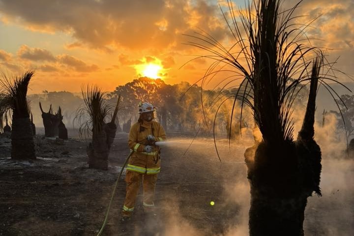
More than 250 firefighters are battling the blaze on the Fleurieu Peninsula. (Supplied: Willunga Country Fire Service)
The fire, which has so far burnt about 960 hectares, began on Sunday in the Deep Creek Conservation Park, and has since moved into the Talisker Conservation Park.
Twelve aircraft — including two Black Hawks — are helping tackle the fire, with 230 drops over the fire today.
Chief Officer Brett Loughlin told ABC Drive that the “very volatile” fire was burning in steep terrain, while winds “from a multitude of directions” including “terrain driven winds” had combined to create a “challenging situation” for those battling the fire.
“There’s parts of the fire where it’s burning intensely at the front of the fire but there’s equally parts on the sides or the back which have still got reasonable fire behaviour beyond what you would expect in a more standard single direction, wind driven fire event,” he said.
“That means our firefighters are busy across the whole fire ground.
“They’re making progress where they can, but they are being constantly challenged and have been since this fire started.”
The CFS said the scrub fire was burning in a west-north-westerly direction towards Cape Jervis, and the CFS has warned anyone in the Blowhole Beach Road, Silverton, Talisker Conservation Park, Woodroofe Road, and Main South Road area, north-west of the Deep Creek National Park to “enact their bushfire plans and stay informed as the situation is quickly changing”.
Main South Road is currently closed in the westbound direction from Cole Road, Delamere to Cape Jervis.
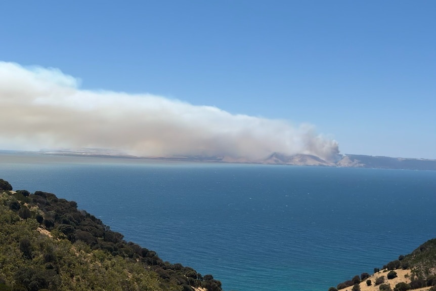
Smoke from the fire could be seen on Kangaroo Island. (ABC Radio Adelaide: Troy Sincock)
Mr Loughlin said the fire was continuing to grow, and expected crews to be on the ground “for days”.
“The next few hours will be pretty critical for our people and they’re certainly up to the challenge if they can get an opportunity to start gaining the upper hand,” he said.
He said the cause of the fire was “under investigation”.
“We will hopefully be able to determine that once we can ease some of the threat to assets and we can safely get some investigators in there,” he said.
The CFS also warned members of the public not to fly drones in the area as they pose “a serious hazard to firefighting aircraft and must be kept well away from firegrounds”.
The SeaLink Kangaroo Island ferry service has warned “there is a high potential for disruptions” on Tuesday due to the fire.
For updates on the fire check the CFS website at cfs.sa.gov.au.