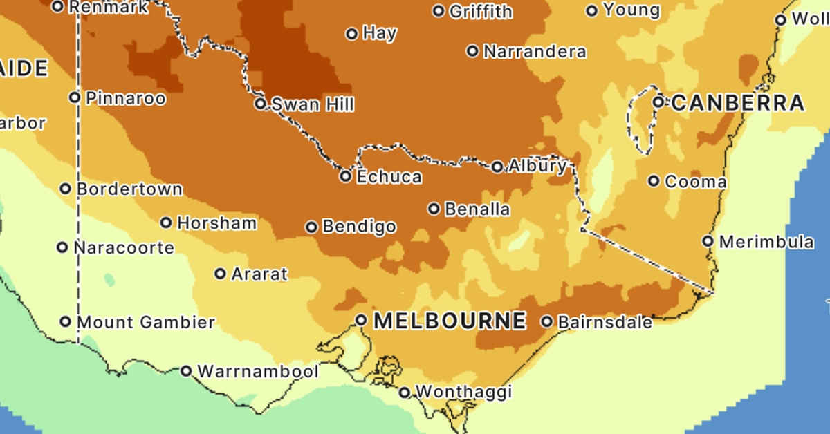
A Total Fire ban has been declared for most of Victoria tomorrow, as the driest conditions in nearly 20 years coupled with blustery winds spike the state’s fire danger rating.
An extreme fire danger rating will be in place across most of the state, with warm conditions and north-westerly winds expected, before a gusty south-westerly change.
The South-West and East Gippsland Fire Districts are the only regions where fire danger will be rated high, rather than extreme, tomorrow.
 A band of heat is expected to cover large parts of Victoria tomorrow, sparking extreme fire danger. (Nine)
A Total Fire Ban has been declared tomorrow for the Mallee, Wimmera, North Country, North Central, Central, North East and West and South Gippsland.
A Total Fire Ban means no fire can be lit in the open air or allowed to remain alight from 12:01am to 11:59pm on the day of the declaration in affected districts.
The mercury is set to reach 32 degrees in Melbourne, with a high chance of showers in the afternoon and evening.
It is tipped to be even hotter in northern parts of the state, with temperatures to soar to 40 degrees in Mildura.
A high of 39 degrees is expected in Echuca, and 36 degrees is forecast for Bendigo.
In Gippsland, Bairnsdale is headed for a top of 37 degrees, with five to 15mm of rain expected in the afternoon and evening.
 The South-West and East Gippsland Fire Districts are the only regions where fire danger will be rate high, not extreme. tomorrow. (Nine)
A cooler southwesterly change is expected to move across the south-west in the morning and hit Melbourne between midday and 2pm.
A band of rain is also expected to pass over the state in the afternoon and evening, with most parts of the state expected to pick up a few millimetres.
Bureau of Meteorology’s Kevin Parkyn warned forecast north-westerly winds can “can carry fire through the landscape pretty quickly”.
“It’s the hot north-westerly winds in combination with the parched landscape that’s elevating the fire danger risk across Victoria,” Parkyn said.
“We’re forecasting north-westerly winds of about 30 to 40 km/h with stronger gusts over north-western Victoria and central parts, including Melbourne.”
Victoria had its driest start to the year since 2009, with most rainfall stations registering less than 10mm last month.
“The fuel is very dry, the bush, the grasslands are very dry and there’s much bush and grass across Victoria that hasn’t been subject to the last round of fires, so the risk is real. The risk is absolutely there,” CFA chief officer Jason Heffernan said.
 CFA chief officer Jason Heffernan warned dry fuel across large parts of the state could ignite in peak fire conditions. (Nine)
“We’re asking people in affected districts to strictly follow the conditions of the Total Fire Ban and think carefully about how the increased fire risk could affect them.
“Make sure your fire plan is up to date and covers all possible scenarios.”
The north-east district is already under a total fire ban today due to hot and very dry conditions combined with moderate westerly winds.
Tomorrow’s extreme conditions will be a”one day wonder” according to Parkyn, with temperatures in Melbourne expected to drop 14 degrees for a top of 18 degrees on Thursday.
Three major fires are still burning in Victoria, namely the Walwa, Longwood and Otways fires. They have all been contained.
NEVER MISS A STORY: Get your breaking news and exclusive stories first by following us across all platforms.

