
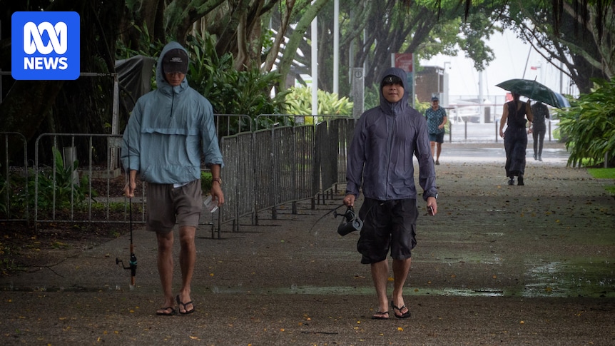
Heavy rainfall is lashing Far North Queensland as a tropical low makes its way towards the coastline, where it is expected to cross this morning near Innisfail.
The Bureau of Meteorology (BOM) yesterday cancelled a cyclone watch from Cooktown to Palm Island but the system is bringing heavy rainfall and gales to coastal areas with already sodden catchments.
Forecaster Harry Clarke said the Daintree to Cooktown stretch had already seen “some phenomenal rainfall totals”.
“Quite scary, I imagine, up there,” he said.
“The top falls in our gauges were 425 millimetres at Yandill to the north of Daintree village [since 9am yesterday] … China Camp 369 and various other falls in excess of 200, quite comfortably.”
The heaviest falls still to come today are forecast to be further north of the system’s centre.
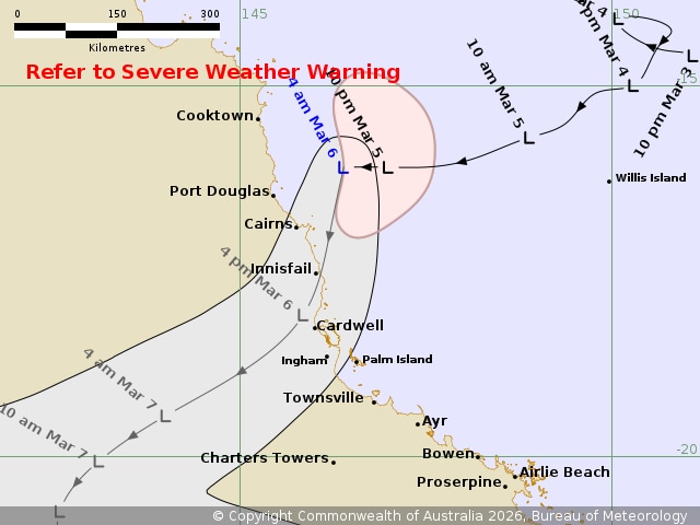
Tropical Low 29U is expected to cross the cost around Cardwell this morning. (Supplied: Bureau of Meterology)
“Tropical lows still do have the potential to bring strong, damaging … gale-force winds and heavy rain, leading to flooding, and that is all certainly a possibility,” forecaster Jonathan How said.
A flood watch is in place for large parts of northern Queensland, for coastal rivers extending from Cooktown to Mackay.

More rain will fall on already swollen rivers in north Queensland. (ABC Far North: Brendan Mounter)
“The Herbert and Daintree rivers only just got out of floods, but with the rainfall coming, we could see renewed rises and further warnings being issued … there is the possibility of rainfall totals of up to 350mm,” he said.
The Daintree Ferry, which connects the northern Daintree rainforest and Cape Tribulation with the rest of far north Queensland, broke its moorings overnight as the river rose 2 metres above major flood level within hours.
“It’s been located, and it’s not too far away,” Douglas Shire Mayor Lisa Scomazzon said.
It will be removed from the water today to assess the damage.
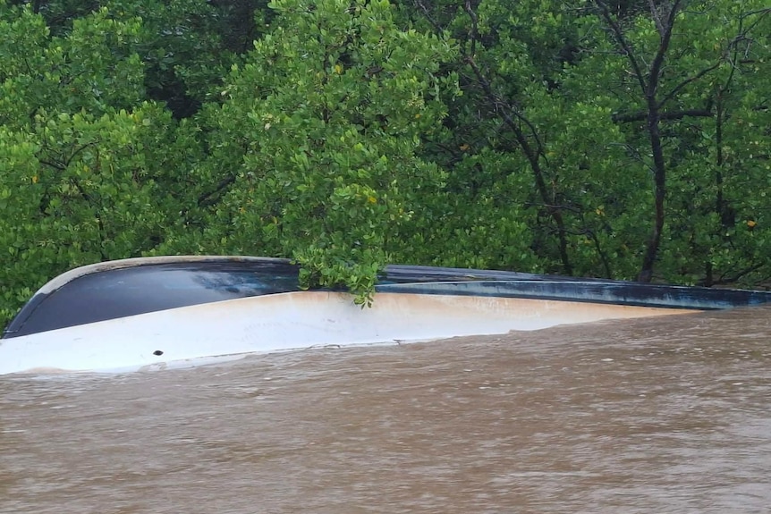
David White’s boat, Solar Whisper, was washed away in the Daintree. (Supplied: David White )
Solar Whisper boat owner David White believes his boat is attached to the ferry after also breaking away.
“I’m devastated … the water came up so fast and took everyone by surprise … the whole wharf ripped off the bank.”
Cr Scomazzon said most places around the shire were still accessible.
“They’re wet, but they’re ok, this is our rain season,” he said.
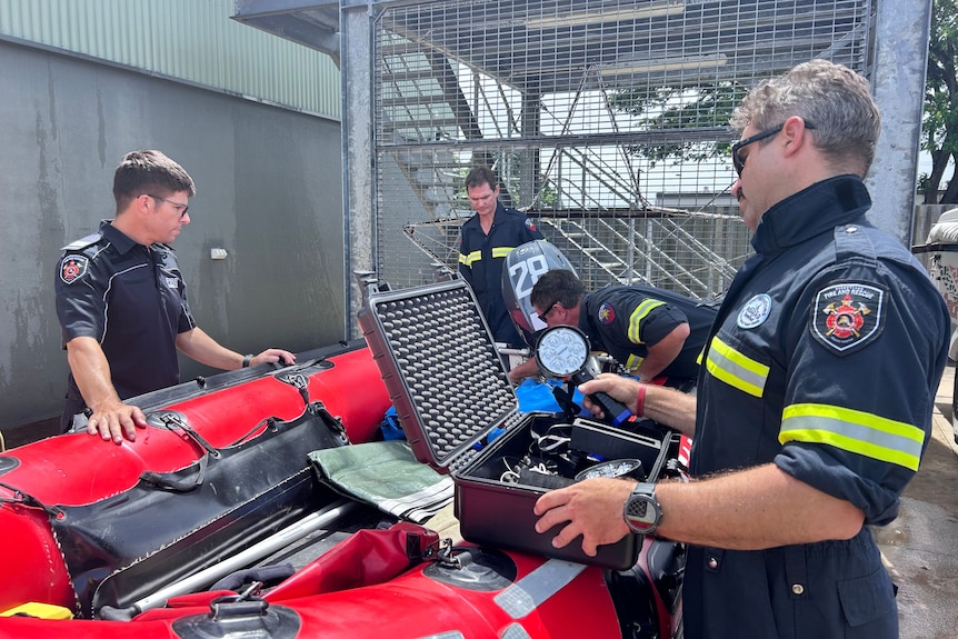
Queensland Fire Department staff have been deployed in advance as far south as Gladstone. (ABC North Queensland: Emily Anderson)
Coastal communities prepare
Queensland Fire Department personnel have been pre-positioned in coastal and inland communities ahead of possible flooding.
Cairns North zone Acting Superintendent Neal Gatti said 50 extra staff had been pre-deployed into the region ahead of the low’s landfall.
“We’ve pre-deployed extra crews from Cooktown to Halifax, and we’ll be dynamic with the weather as it changes and moves south,” he said.

Neal Gatti says specialised swift water crews are in place in high-risk areas. (ABC Far North: Christopher Testa)
“There is a team currently staged in Mareeba, and they are up in case the range is closed; they can respond west.”
Just over a year since widespread flooding wrecked houses and damaged bridges and roads in towns between Townsville and Cairns, residents have braced for more rain.
A Watch and Act warning for the Cassowary Coast region has been issued by the local disaster management group ahead of the expected severe weather, with residents urged to prepare their homes and secure all objects that strong winds may move.
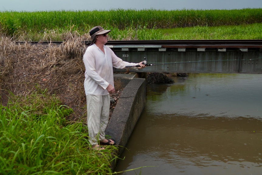
Mark Wanless says the barramundi are biting already. (ABC News: Baz Ruddick)
Ingham resident Mark Wanless’s house has been damaged by previous floods.
He said he hoped this tropical low would mainly impact the number of fish nibbling his lure.
“Last February, we had three-quarters of a metre of water right through the house, we got smashed,” he said.
“This weather event coming now is not going to be as severe.
“It’ll send the fish crazy, the barramundi will go nuts.”

Jai Stuart and Marg Oxley hope any flooding will be minimal. (ABC News: Baz Ruddick)
Marg Oxley, also from Ingham, said she was concerned about the prospect of more flooding as the community continued to recover from previous floods.
“It’s a worry. My house went under, I’m still getting repairs,” she said.
“Every time we hear there’s a bit of a storm coming, I get concerned.”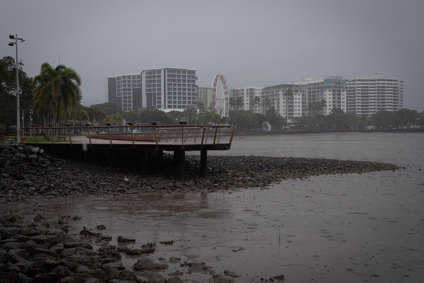
Heavy rain is due to fall north of Innisfail, including in Cairns. (ABC Far North: Brendan Mounter)
Rainfall likely further south
The BOM said although the low would make landfall in the state’s north, coastal communities through to Central Queensland would likely feel the effects of the weather system in the next 48 hours.
“Beyond the low crossing the coast, we’ll actually see the surface trough associated with that low move along the Queensland coast, and we are expecting the heavy rain to extend down towards Mackay, potentially even Rockhampton on Saturday,” he said.
“The conditions leading up to this are that it’s been incredibly wet and we won’t need as much to get flooding.”