
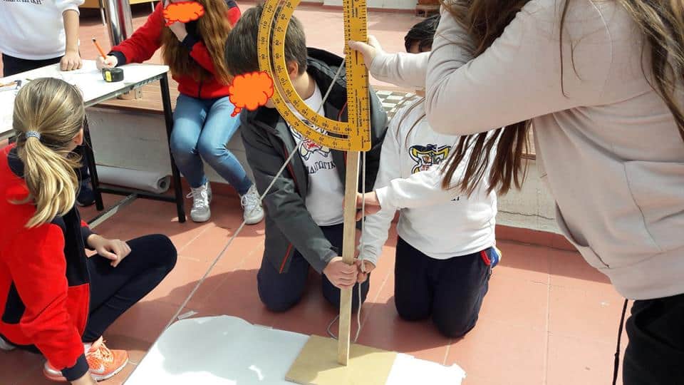
Greek students measuring the Earth. Credit: PANEKFE
On Friday, March 20, 2026, the day of the vernal equinox, students across Greece will participate in a nationwide educational initiative that revives one of the most remarkable experiments in scientific history pertaining to Eratosthenes’ calculation of the Earth’s radius and circumference.
The 2026 initiative for students, titled “Eratosthenes’ Experiment for Calculating the Earth’s Radius,” is organized by the Panhellenic Association of Science Laboratory Center Managers (PANEKFE) in Greece in collaboration with the Institute of Astronomy, Astrophysics, Space Applications & Remote Sensing (IAASARS) of the National Observatory of Athens, and the Greek ESERO office. The project is fully supported by the Ministry of Education, Religious Affairs, and Sports.
The vernal equinox marks the beginning of spring in the Northern Hemisphere. On this specific day, the sun is positioned directly above the Earth’s equator, making day and night nearly equal in length. These unique astronomical conditions provide the perfect opportunity to replicate the historic experiment conducted by Eratosthenes more than 2,200 years ago.
As part of the project, primary and secondary school groups will conduct measurements within their schoolyards. By collaborating with schools in various regions of the country and comparing their data, students will work together to recalculate the Earth’s dimensions.
This initiative creatively bridges physics, mathematics, geography, astronomy, history, and information technology. It fosters experiential, collaborative, and discovery-based learning, while highlighting the vital role of experimentation as a cornerstone of the modern educational process.
Eratosthenes of Cyrene, studied by students in Greece
Eratosthenes of Cyrene, working in Alexandria in the third century BC, famously estimated the Earth’s circumference using the angles of shadows at Syene and Alexandria at noon on the solstice.
He then overlaid the known world with a grid of meridians and parallels and introduced the very term “geography,” envisaging climate zones and turning the map from a traveler’s aid into a scientific tool that could be updated based on the latest reports.
Related: How the Greeks Mapped the Mythical Places of Their Heroes and Legends