
A practical framework for aligning farming, planning and policy with soil capacity, condition and long-term natural capital
Soil as a strategic national asset
Soil underpins food and fibre production, water regulation, carbon storage, biodiversity, and the viability of rural economies. Yet it is still too often treated as a passive backdrop to agriculture and development, rather than an asset that needs active stewardship.
Soil security brings soil into the same decision space as water, biodiversity and climate risk. It links soil science to the choices made on farms, in planning systems and across government – so land use and investment are guided by soil limits and opportunities, not just short-term convenience.
The Soil Security Framework in five dimensions
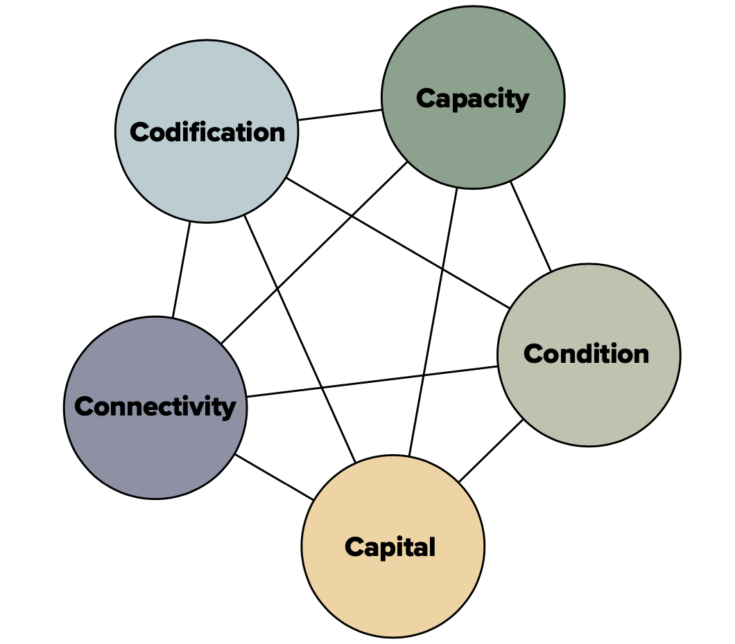
The Soil Security Assessment Framework translates complex soil science into a structure that is usable for policy, planning and practice. It is built around five interconnected dimensions:
Capacity:
What soils are inherently able to do in a given place – store and supply water, cycle nutrients, and support plant growth. Capacity is shaped by soil type, depth, texture, mineralogy and landscape position, and it sets the biophysical limits for sustainable land use.
Condition:
How soils are performing today relative to capacity. Even high- capacity soils can fail when compacted, eroded, acidified or biologically degraded. Tracking condition provides a basis for measuring improvement or decline over time.
Capital:
A reframing of soil as natural and production capital – an asset that generates flows of value, from food and fibre to water regulation and carbon storage. Recognising soil as capital brings it into investment conversations where it is too often invisible.
Connectivity:
How soil knowledge moves between researchers, farmers, advisers, planners and policymakers. Strong science has limited impact if it is disconnected from real decisions; connectivity is about trust, usability, access and timeliness.
Codification: How soil is embedded in rules, incentives and institutions.
Planning frameworks, reporting systems, regulations and investment strategies shape soil outcomes. Without codification, soil security remains a good idea rather than an operational reality.
Together, these dimensions shift the conversation from what soil is to what soil does, what it is worth, and how it is governed – an essential reframing for Australia and beyond.
Mapping soils for better decisions
For decades, soil maps have guided land management, but many were produced at coarse scales and emphasised classification over function. That supported broad regional planning, but was often too general for field-scale decisions or targeted policy design.
Digital soil mapping is changing this. New approaches identify more distinct soil–landscape units (including pedogenons-soils formed through particular combinations of soil-forming processes) and group them into soil districts. Work identifying around 1,370 pedogenons for Australia and 6,500 globally illustrates a diversity that older mapping could not capture.
The practical value is actionability. Farmers can better match crops, inputs and management to local constraints. Planners can assess land-use change against soil capacity and long-term risk, rather than relying on regional averages. Policymakers can target incentives and regulations to the places where measurable improvements in condition are most feasible and cost-effective.
Turning soil function into economic value
Soil security becomes especially powerful when soil function is expressed in decision-relevant metrics. One example is available water capacity (AWC) – the amount of water a soil can store and make available to plants. In Australia’s variable climate, AWC is a key determinant of productivity and resilience: higher-AWC soils buffer crops against dry periods, stabilise yields and improve water-use efficiency.
Indicative findings that each 1 mm increase in AWC can be worth close to $300 per hectare provide a tangible benchmark for the value of improving soil condition. The implication is straightforward: modest improvements – through increasing organic matter, reducing compaction, or improving structure – can generate substantial returns, particularly when targeted to the right soils and landscapes.
Embedding soil in governance
The Soil Security Assessment Framework (Evangelista et al., 2023) bridges a persistent gap between science and policy. By framing soil around capacity, condition and capital – and strengthening connectivity and codification – it creates concepts that align with planning, economic and environmental policy processes.
Codification is pivotal: it is the difference between soil information existing and soil information being used. Practical examples include integrating soil capacity into land-use zoning and development assessment; requiring soil condition reporting in sustainability frameworks and supply chains; using incentives and stewardship payments that reward verified improvements in condition; and embedding soil metrics into climate, water and biodiversity programmes where outcomes depend on healthy soils.
Towards a soil-secure Australia
A soil-secure Australia would be one where land use is aligned with soil capacity; where soil condition is monitored and improved; where the value of soil functions is recognised; and where institutions protect soil as a national asset.
Barriers remain – soil degradation is often slow and out of sight, and data gaps and institutional silos still limit uptake. Even so, a soil-secure future is achievable if soil information is treated as critical infrastructure for land-use decisions – and if we choose to manage soil as a governed asset, not background.