
About 500 people from the Northern Territory community of Numbulwar will be evacuated to Darwin ahead of Severe Tropical Cyclone Narelle’s expected landfall on the territory’s east coast this weekend.
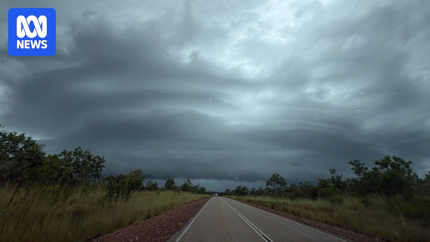
Severe Tropical Cyclone Narelle — currently a category four system off the Far North Queensland coast — is expected to move across Queensland and into the Gulf of Carpentaria over the next few days, before crossing into the NT from late Saturday.
It is forecast to ease back to a category two over Queensland before re-intensifying to a category three on Saturday afternoon.
Severe Tropical Cyclone Narelle live updates: For the latest news on the cyclone, read our blog.
Numbulwar, as well as Groote Eylandt and Ngukurr, are expected to be some of the first communities to be impacted, with the system later forecast to track near Katherine and Beswick.
In a statement on Wednesday night, emergency service agency SecureNT said the entire community of Numbulwar would be evacuated “over the coming days”, in a “precautionary measure to ensure the safety of all residents”.

About 500 people will be evacuated from Numbulwar community. (Supplied: Roper Gulf Regional Council)
“Preparations are now underway, with evacuation to take place by air,” the statement said.
A government spokesperson said the Numbulwar evacuees would be accommodated at a “temporary evacuation staging centre” at the Nightcliff High School gym.
NT communities urged to prepare
Residents of NT communities in the cyclone’s path are being urged to use the days before its territory crossing to prepare, with authorities calling on locals to take the situation seriously.
The system is approaching the NT just weeks after major flooding in Katherine and nearby Beswick, both of which are in the cyclone’s likely path.
Live 5-day Cyclone Narelle forecast mapThis map shows a forecast of Tropical Cyclone Narelle’s path for the next five daysIt also shows high wind, cyclone watch and cyclone warning areasRefer to the Bureau of Meteorology for official cyclone warnings and forecast.
Emergency services are stepping up preparations in the days before the system’s NT crossing, with the territory emergency operations centre ready and staff assessing the state of cyclone shelters.
Residents in communities likely to be impacted are being asked to start preparing now, from readying their cyclone kits to knowing their nearest cyclone shelter and staying up to date with warnings.
“While we have a couple of days to prepare, it’s a really good opportunity for community residents to start working on their cyclone emergency kits, particularly for those communities that may have already been impacted [by weather events], that may have depleted water, food, medication, batteries, torches, all that type of stuff,” NT Emergency Service deputy chief officer Greg Jarvis said yesterday.
“This is an opportunity to start preparing, to take a big deep breath, acknowledge that we’re all very tired and we have been working for a long time, but we have to go again.”
Kirsten Engels says although it has been a busy wet season, NT residents need to take the cyclone “really seriously”. (ABC News: Pete Garnish)
Incident controller Kirsten Engels said authorities were asking anyone who might be impacted “to begin their preparations now, and to take this really seriously”.
“It’s a very dynamic situation and it’s unfolding right now,” she said.
“We know that it’s starting to get tedious, we know that we’ve been together a long time now talking about weather, but we really need you to keep your focus going and prepare for what we know is going to strike this weekend.”
Residents in flood-affected Katherine and Beswick have been warned to expect moderate flooding, with the cyclone forecast to bring heavy rainfall as it crosses.
But the BOM’s Jude Scott said the fast-moving system was expected to cross the whole of the NT “within a 24-hour period”, giving it “less opportunity … to stall and produce the heavier falls that can lead to prolonged and major flooding”.
‘Sense of anxiety’ on Groote Eylandt
One of the communities sitting right in Tropical Cyclone Narelle’s projected path through the NT is the small community living on Groote Eylandt.
Its last cyclone impact was just under two years ago, when Tropical Cyclone Megan hit in March 2024, devastating the town’s economy and causing extensive damage to its manganese mine and wharf.
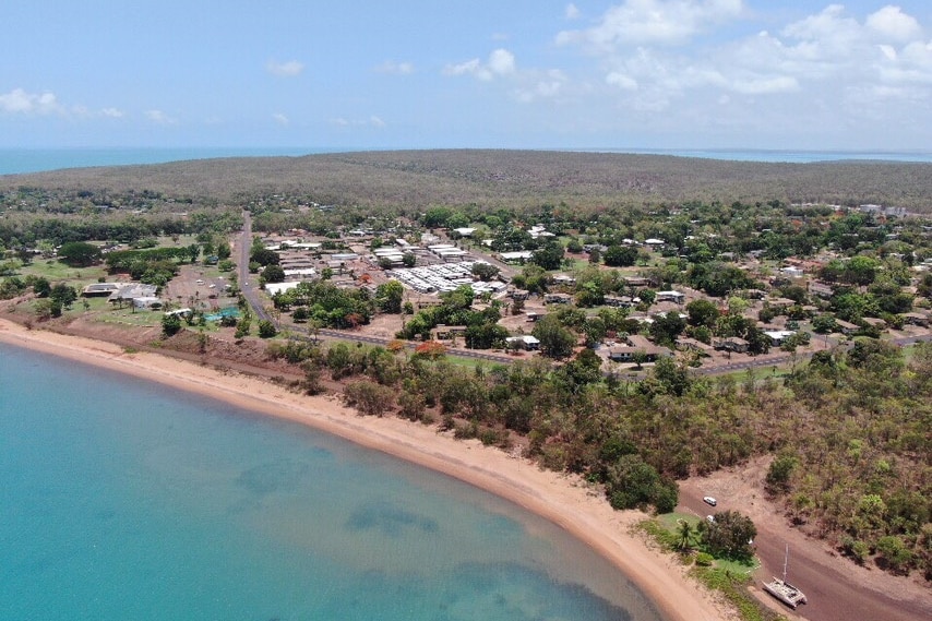
Groote Eylandt is expected to be impacted by Severe Tropical Cyclone Narelle over the weekend. (ABC News: Jano Gibson)
Anindilyakwa Land Council chief executive Kupa Teao said local authorities were taking the situation “one day at a time”, but residents were feeling a great deal of trepidation.
“We’re feeling obviously this sense of anxiety, the sense of unknown,” he said.
“No doubt if this cyclone hits the island, it will impact infrastructure and assets and obviously will have an effect on the economy as well.”
Mr Teao said strong communication would be key as the community braced for the cyclone.
“There’s been high-level discussions with the Northern Territory government around the emergency management plan,” he said.
“It’s going to be a layered approach … managing and coordinating [emergency] processes.”
Meanwhile, flood evacuees from Nauiyu/Daly River and Palumpa will be transferred to accommodation facilities at the Batchelor Outdoor Education Unit in the coming days.
The move from Darwin’s Foskey Pavilion is aimed at providing greater privacy and better access to schools and essential services.