
By Emily Anderson, ABC
A tracking map released in the early hours of Friday.
Photo: ABC / BOM
Residents in Far North Queensland are taking shelter as Severe Tropical Cyclone Narelle carves a path of destruction as it makes landfall on Friday morning.
The cyclone has been downgraded to a “high end category four” system as it approaches the coastline, but is still producing sustained winds of close to 200 kilometres per hour.
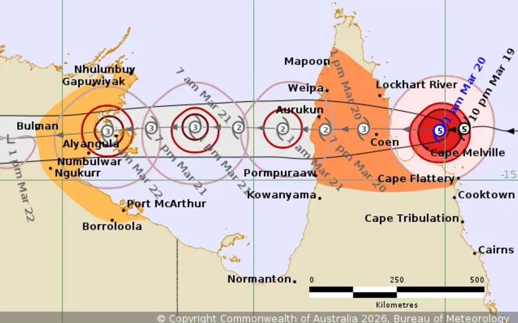
The storm is 110km east of Coen and moving towards the coastline at 21km/h.
The system is now expected to cross the coast between Lockhart River and Cape Melville, between 7am and 10am (Queensland time).
The Bureau of Meteorology (BOM) has warned that the system is fast-moving and is generating gusts up to 250 kilometres per hour near the centre.
BOM meteorologist Baden Gilbert said the slight weakening of the system does not mean the situation is less serious for residents.
“There’s still going to be a very destructive core as this system crosses the coast to the east of Coen,” he said.
“Take shelter” warnings have been issued for multiple communities since 4am including Hope Vale, Lockhart River, Cook Shire, Coen, Port Stewart and Wujal Wujal.
Cyclone Narelle is expected to remain at cyclone strength as it crosses into the Gulf of Carpentaria by Friday evening before moving into the Northern Territory.
The cyclone warning zone covers Cape York Peninsula between Lockhart River and Cape Flattery, and between Mapoon and Pormpuraaw, including Coen, Weipa, and Aurukun.
A watch zone is in place for the Northern Territory south of Nhulunbuy, taking in Port McArthur, Borroloola, Numbulwar, and Alyangula and Ngukurr.
Queensland areas from Cape Tribulation to Cape Flattery, including Cooktown, are no longer in the warning area.
But the BOM has also warned that heavy rainfall, causing riverine and potentially life-threatening flash flooding, is expected to persist after Cyclone Narelle passes.
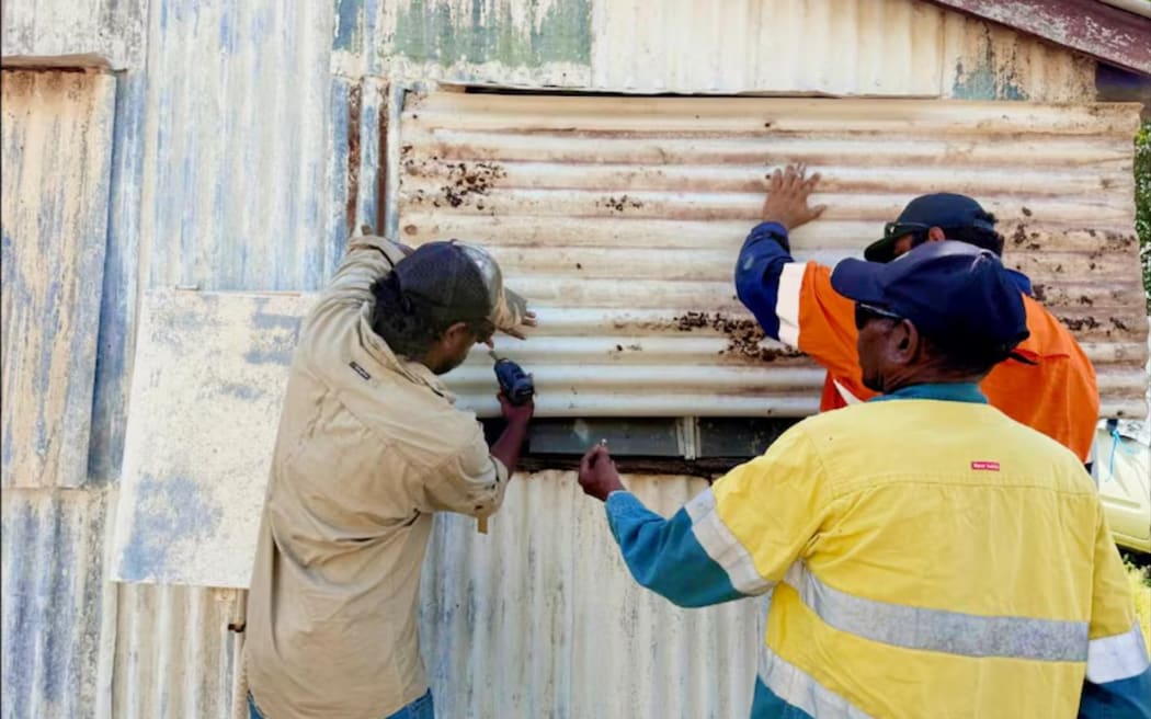
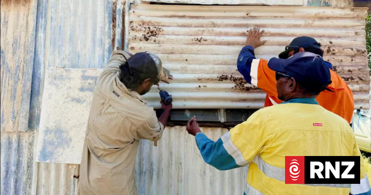
Locals in Coen spent the week preparing houses and buildings for the direct impact of Severe Tropical Cyclone Narelle.
Photo: ABC / Dion Creek
People in the south-east and north-east Gulf of Carpentaria are being warned to expect storm-force winds from Friday.
Strong winds have also been predicted as far north as the Torres Strait and as far south as the Cairns Coast.
Hurricane-force wind warnings, the most severe category, have also been issued for the south-east and north-east parts of the Gulf of Carpentaria.
Once Narelle moves into the Gulf tides on the western Peninsula between Weipa and Kowanyama may be higher than normal and large waves may bring minor flooding to low-lying areas.
Residents hunker down
Communities in the path of Cyclone Narelle have hunkered down after days of preparing their homes for impact.
The region’s schools remain shut, vulnerable people have been evacuated, and store shelves are almost bare.
Fewer than 400 locals in the small town of Coen, 550km north of Cairns, were in the direct path of the cyclone.
The town does not have a dedicated cyclone shelter, so residents have been told to shelter in cyclone-proof homes or the local community wellbeing centre.
“We have resilience hubs across the shire and we will stand them up if we need,” Cook Shire mayor Robyn Holmes said.
“People need to understand this is a severe weather system and they need to stay indoors.”

The local store has many bare shelves after locals stocked up on supplies ahead of Tropical Cyclone Narelle. (
Photo: ABC / The Little Bush Pantry
The water system has been turned off at Coen, Portland Roads and other communities further north.
Locals have been told to store water in bathtubs, water bottles and other containers.
The coastal community of Port Stewart, 90 kilometres north-west of Coen, has been evacuated.
One of the residents, Mary Withers, said some properties were very low-lying and were at a high risk of storm surges.
“I’m just thinking we’ll probably have nothing left,” she said.
“It’s the most severe cyclone that’s come across there since I don’t know when.”
Meanwhile, graziers and station owners across the Cape York Peninsula have also made preparations for their property, livestock and homes.
But there are concerns that the winds will bring down many trees because the soils are already damp from wet season rainfall.
“There probably won’t be a fence left standing,” said Upson Downs property owner Debbie Jackson.
“You can’t let yourself get into a panic, you’ve just got to ride it out.”
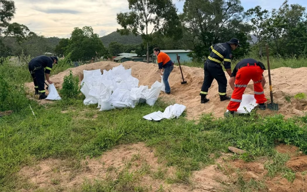
Emergency crews have been dispatched from across Queensland to be deployed in isolated localities in the Cape York Peninsula.
Photo: ABC / State Emergency Service
Boots on the ground
The region’s schools, which enrol around 780 students, have closed as communities brace for the heavy winds and rainfall.
The remote localities were supplied with medication and pharmacy products earlier in the week from a Cooktown pharmacy in anticipation of road closures that could leave small Cape York Peninsula towns isolated.
Pharmacist Suraj Singh said Cooktown locals were quick to stock up on their medication well ahead of the system approaching.
“They should have sufficient stock to prepare for the whole cyclone, maybe a month,” he said.
Emergency crews and authorities have continued to bolster their numbers across the region.
The added numbers include 49 extra police officers, 200 Ergon workers and helicopters in Cooktown and Horn Island.
“The type of wind being predicted is the sort of thing that will blow apart sheds, blow caravans down roadways and create fields of airborne debris,” Queensland Police state disaster coordinator Chris Stream said.
“Those objects being propelled at over 100km/h will have a fatal outcome.”
-ABC