
Australians can expect a warm and mostly settled Wednesday across much of the country, ahead of a significant cool change set to hit the south-east later in the day.
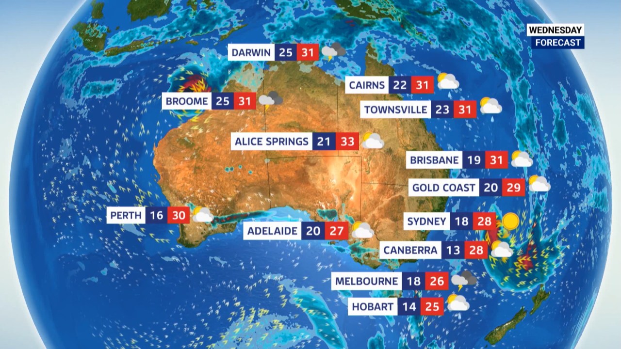
Sky News Weahter Meteorologist Marina Neuman said Sydney would see sunny conditions and a top of 28 degrees, while Brisbane should remain partly sunny with a high of 30.
Melbourne is forecast to reach 27 degrees with thunderstorms developing, while Canberra will also hit a top of 27.
Elsewhere, Hobart is expecting rain and Adelaide may see light showers.
While most capital cities should see a warm start to the day, Neuman explained conditions were set to shift during the afternoon and evening.
“That cool air pushing out of the Tasman…(is) bringing in a major cool change,” she said.
The change will sweep across Victoria, Tasmania, South Australia and into New South Wales by the end of Wednesday, bringing a sharp drop in temperatures.
“Twenty one in Adelaide, 18 in Melbourne and 16 in Hobart for our Thursday afternoon – just a major drop in 24 hours,” Neuman said.
The cool air is already driving severe weather across parts of Victoria and Tasmania, with thunderstorms, strong winds and heavy rainfall developing.
“Some strong storms and even some heavy rainfall now moving… including hail,” Neuman said.
“Chance for some thunderstorms picking up and also some potentially heavy rainfall in the mix… potential to see at least 50 millimetres across the centre of Victoria.
“Potential to see even heavier totals across Batemans Bay, just at that very corner of New South Wales, and Tasmania looking to see a decent soaking as well. Adelaide at least a sprinkle.”
Snow flurries are also possible across the Victorian and NSW alpine regions as colder air pushes through.
Meanwhile, conditions in Western Australia should remain warm and dry on Wednesday, with Perth reaching a top of 32 degrees, before ex-Tropical Cyclone Narelle tracks towards the coast later in the week.