
Tropical Cyclone Narelle is forecast to make landfall in Western Australia on Friday night as a severe category 3 system. The massive storm hit far north Queensland last week, before moving over the Northern Territory and then continuing all the way west to the Indian Ocean.
You can follow the path of Cyclone Narelle in the tracking map below. The map will be updated periodically with the latest forecasts, with the live BoM Tropical Cyclone 34U forecast track map available here.
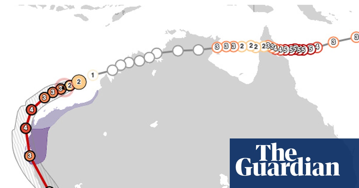
Severe Tropical Cyclone Narelle 34U tracking map and path tracker towards Perth, Western AustraliaCyclone Narelle 2026 path and tracking map.
The system was regaining strength to a severe category four storm as the Bureau of Meteorology warned of wind gusts up to 275 km/h in Exmouth later on Thursday, while the cyclone is forecast to make landfall as a category 3 system over the tourism town of Denham in Shark Bay.
Tropical Cyclone Narelle is set to be the first storm system for 20 years to make landfall in three of Australia’s states and territories, and will have travelled more than 5,500km (3,400 miles) by the time it approaches Perth.
This page will be updated as the story develops …