

Australia has just been soaked by its third wettest February-March on record, but for most of the country, skies have cleared up just in time for Easter.
In fact, for the first time in months, the country will go through an entire week without any major weather events — no heatwaves, no floods, no cyclones, and only a handful of thunderstorms.
But while Easter weather is looking subdued, another Severe Tropical Cyclone should develop next week in the Coral Sea, and remarkably, it could follow a similar track to the epic journey taken by Cyclone Narelle.
Loading…Textbook April weather map for Easter
As the clock ticks down to Easter, the dominant weather system on the charts is a high-pressure system currently centred south of WA.
The high will spend the next few days travelling east towards the Tasman Sea — a welcome sight for anyone hoping to spend the long weekend outdoors, since highs bring generally settled weather.
But not every pocket of Australia will be bathed in warm sunshine all Easter, and typically for autumn, it is the east coast that can expect grey clouds and showers on most days.
And by Easter Monday, a trough of low pressure has the potential to bring showers to nearly the whole of Tasmania, Victoria and adjacent parts of SA.
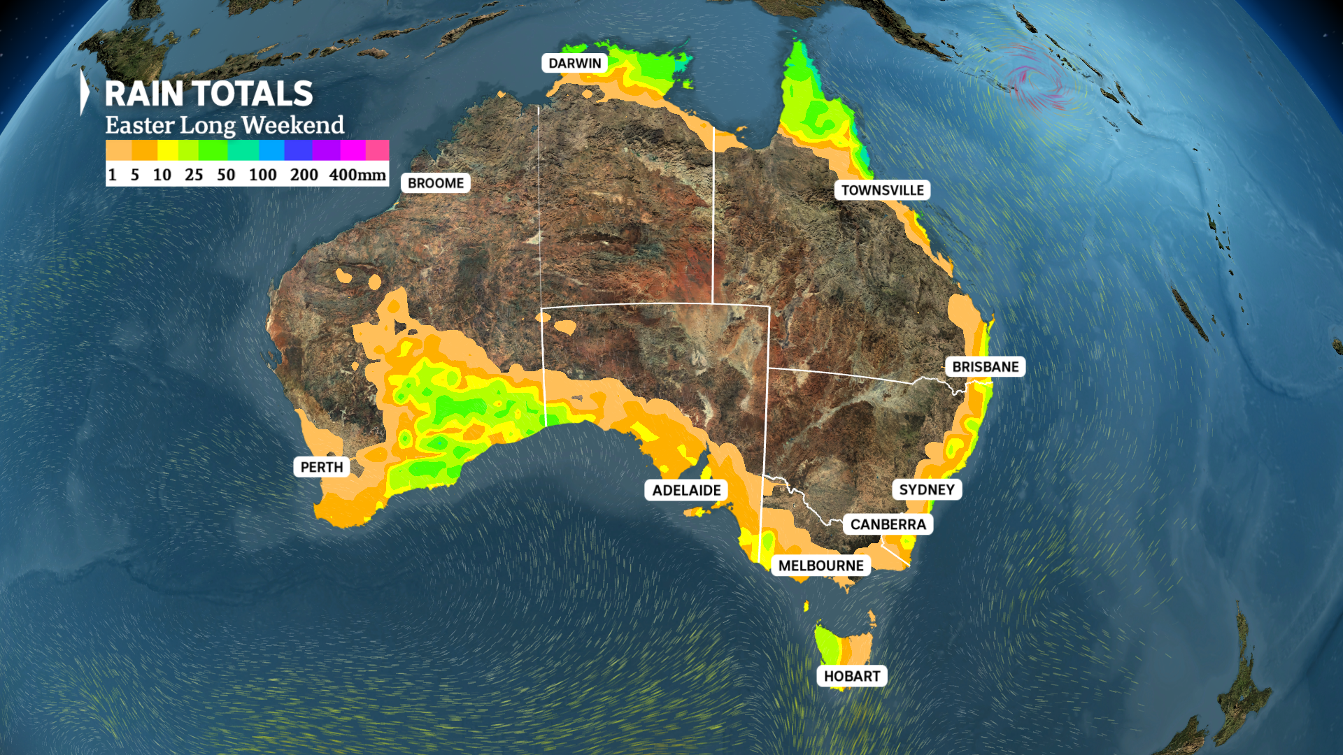
Through the next four days, the vast majority of Australia will receive less than 1mm of rain. (ABC News)
For northern Australia, the recent flood-inducing tropical lows have disappeared off the charts and precipitation will be mostly restricted to a few storms over the Top End and Cape York Peninsula.
The hottest place in Australia this Easter will be the Pilbara and Kimberley, where inland towns should hit around 40 degrees Celsius, while the coldest weather will be felt over the Tasmanian Highlands, where minimums will dip to around freezing.
The country’s wettest spots should be Far North Queensland and Arnhem Land, where up to about 50 millimetres is possible.
Here is a state-by-state breakdown of what to expect this Easter.
Seafood industry urges public to buy local this Easter
Qld
There will be little change in the weather across Queensland this Easter.
Onshore winds will blow showers onto the east coast, while a few thunderstorms will fire up each day over Cape York Peninsula.
The west of the state is looking warm and sunny with highs in the low to mid 30s.
For Brisbane, highs will range from 28C to 29C, with a 50 to 60 per cent chance of precipitation from Friday to Sunday, and a four-day total likely below 10mm.
Essentially, this means the vast majority of Easter is looking dry since even if a shower does arrive on any given day, it may only last five to 10 minutes.
NSW/ACT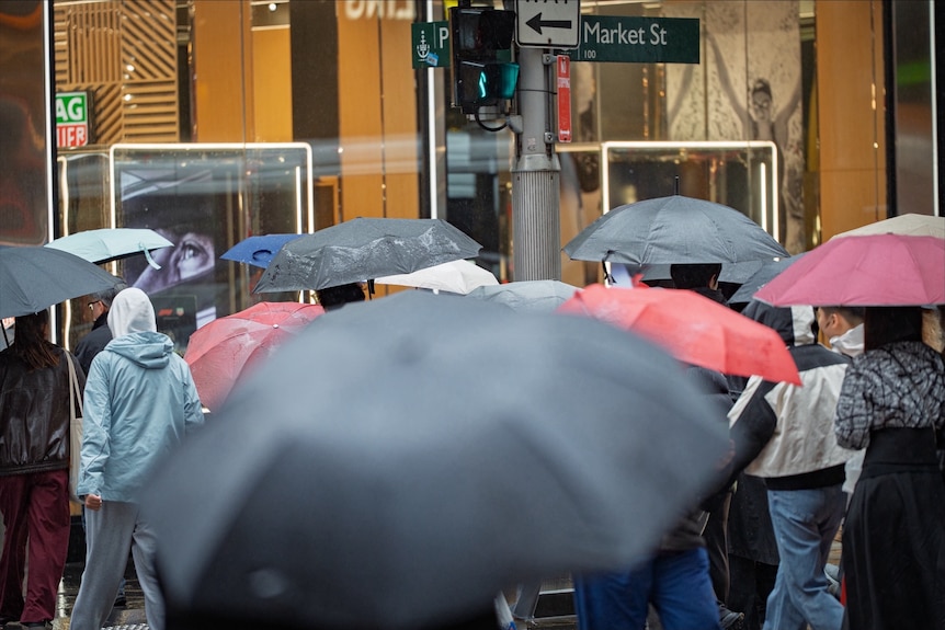
Sydney may experience some showers during the long weekend. (ABC News: Timothy Ailwood)
Winds blow anticlockwise around a high, meaning as the high drifts below SA on Good Friday, it will send a cool southerly change with showers and the odd storm up the southern and central NSW coast.
The onshore winds and showers will then extend up the coast for Saturday and Sunday, before contracting to the northern half of the coast on Monday.
For Sydney, a mostly sunny 27C to start Good Friday will turn showery later in the day.
Guide to the 2026 Sydney Royal Easter Show
A high chance of showers will follow on Easter Saturday and Sunday, with tops of 24C and 23C before mostly dry weather returns on Monday.
Sydney’s four-day rain total is likely to range from 5 to 20mm in the east, with lighter falls in the west.
Canberra is looking mostly dry this long weekend — just a possible brief shower from Friday to Sunday. After a top of 25C tomorrow, highs will drop to 19C for Saturday, 20C for Sunday and 23C on Monday.
West of the ranges, it is looking like a mostly sunny Easter with highs ranging from the mid-20s in the south to the low-30s in the north.
Vic
Victoria will also see light coastal showers on Good Friday thanks to southerlies on the high’s eastern flank, but both Saturday and Sunday are looking ideal, including warm afternoons, relatively light winds, and plenty of sunshine.
At this stage, Monday is not looking quite so bright, with the trough moving in from the west and bringing isolated showers, most likely in the state’s west
Melbourne is tipped to see a shower or two and a top of just 18C on Friday, followed by a mostly sunny 21C on Saturday and 26C on Sunday, then a potentially showery 27C on Monday as the trough arrives.
Tas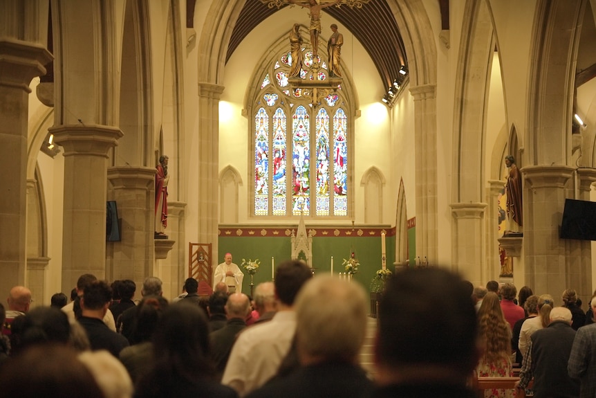
Hobart is expecting good weather from Friday to Sunday. (ABC News: Jonny McNee)
Tasmania can generally expect dry weather and rising temperatures during the coming days as the high drifts directly overhead, including for Hobart a Friday top of 15C, Saturday 17C and Sunday 20C.
That is ahead of widespread showers on Easter Monday as the trough sweeps across the state.
SA
Most of SA can expect sunny and warm weather this Easter, apart from light showers south of a line from about Ceduna to Renmark on Sunday and Monday.
Adelaide has a 40 per cent chance of seeing a shower on Sunday, increasing to a 50 per cent chance on Monday, and can expect very comfortable highs of 24C and 25C for Friday and Saturday, then 29C on Sunday and 27C for Monday.
Northern parts of SA will climb into the 30s, while southern coastal regions will see autumnal tops of around 20C.
WA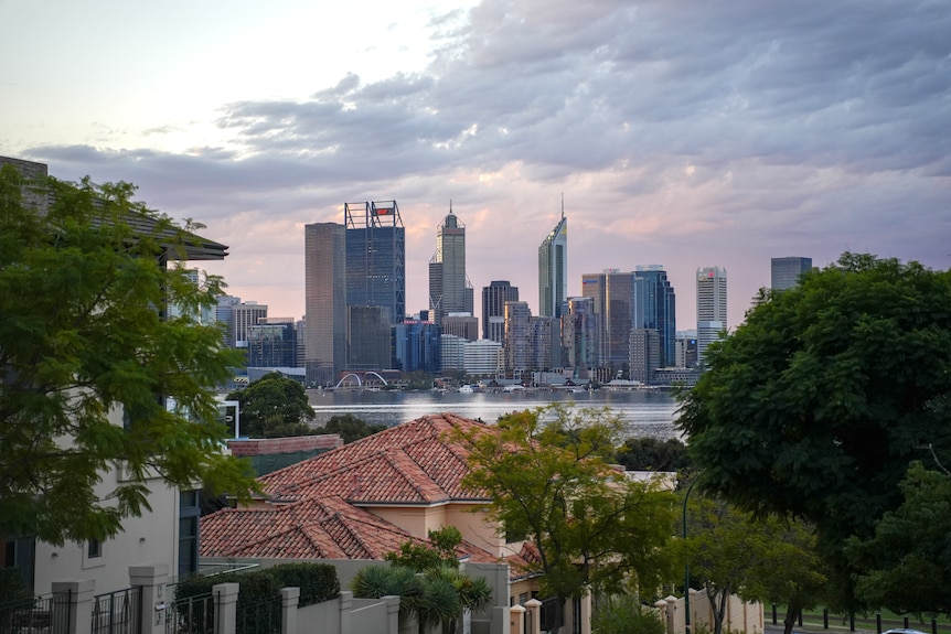
Temperatures in Perth will drop after Friday. (ABC News: Benjamin Gubana)
WA perhaps has the most interesting weather this Easter — a region of thunderstorms will form over the Goldfields, South East Coastal and Eucla districts, with the odd storm also possible further west across the wheatbelt and along the west coast.
Perth’s chance of precipitation will peak on Saturday and Sunday at 30 per cent, and the city will see a drop in maximums from 28C on Friday to a range from 23C to 25C between Saturday and Monday.
NT
While the monsoon is taking a break, the typical wet season storms will still fire up each day over the Top End.
For Darwin, there is between a 50 and 70 per cent chance of precipitation each day with the usual highs between 32C and 34C.
Queensland cyclone brewing into next week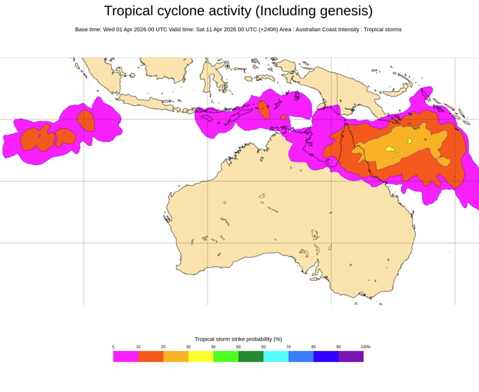
This map shows the probability of a tropical cyclone passing within a 300 kilometre radius from a given location within a time window of 48 hours — centred on Saturday April 11. (Supplied: ECMWF)
After benign weather this Easter, the 11th tropical cyclone of the wet season is likely to drift west into the north-east Coral Sea around the middle of next week.
What is concerning is that some modelling predicts the system, currently named 37U, will continue tracking west through the week, possibly striking the Queensland coast as a severe tropical cyclone sometime around next weekend.
While it is far too early to forecast the precise path and impact, the map above from the European Centre for Medium Range Weather Forecasting shows a strike is possible anywhere from about Rockhampton to Cape York Peninsula.
A second cyclone to cross the Queensland coast in three weeks would be the shortest gap between direct strikes for the state since Cyclone Anthony and Yasi in early 2011.
It is even possible the system will hit the same location as Cyclone Narelle, and even further ahead, do not rule out a second landfall over the eastern Top End.
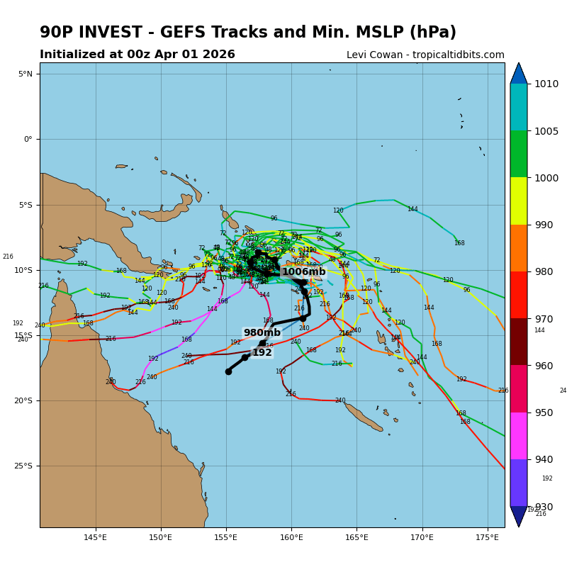
An ensemble prediction of tracks for 37U shows a range of scenarios from a strike on the Queensland coast to a route into the South Pacific. (Supplied: Tropical Tidbits)
However, unlike Narelle, which was one of the more straightforward cyclones to predict, the future path of storm 37U is far more uncertain, and as the plot above shows, it could stall or track south well before reaching the Queensland coast.