
Heavy rain, gale-force winds and dangerous surf are set to lash several parts of the nation this weekend, with severe weather forecast for Western Australia, south-east Queensland and north-east NSW.
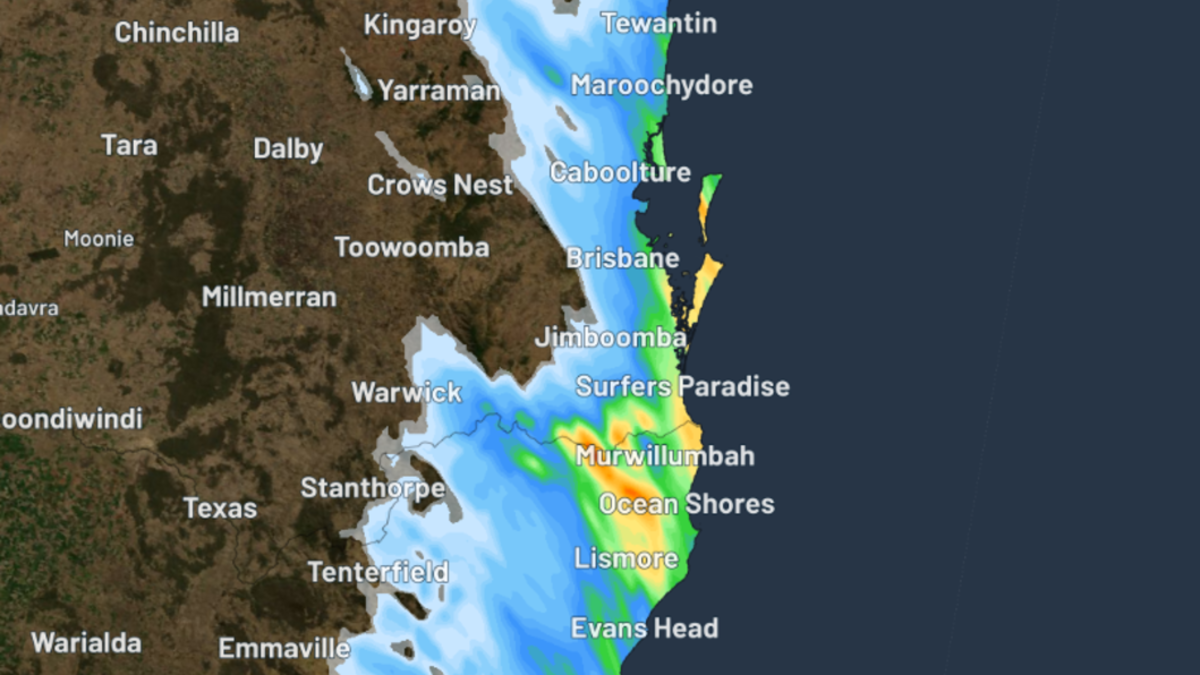
While parts of WA have already recorded their heaviest rain in years, a developing low-pressure system off Queensland’s coast is expected to bring of heavy rain, wind and waves to that area.
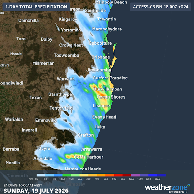
Heavy rain is set to continue across Western Australia as a separate weather system brings gale-force winds, dangerous surf and flooding concerns to southeast Queensland and northeast NSW. Weatherzone
Gales, heavy rain and dangerous surf for east coast
Downpours, gale-force winds, and hazardous surf is heading to south-east Queensland and northern New South Wales.
Strong high pressure inland is forecast to strengthen southerly to southeasterly winds along parts of the coast and offshore.
Weatherzone says the system could bring another 30mm to 50mm of rain in 24 between North Stradbroke Island and Coffs Harbour.
Some spots have already recorded more than a month’s worth of July rain, including Lismore Airport, which was smashed by 53mm in three days.
Winds are forecast to reach gale force across the K’gari, Byron, Sunshine Coast and Gold Coast waters through to tomorrow evening.
Winds are also tipped to generate waves of four to five metres along the Gold Coast, Moreton Island and North Stradbroke Island, with rough conditions into Monday and Tuesday.
WA records biggest drenching in years
Parts of Western Australia have copped their heaviest drenching in years over this week, with some heavy deluges set to last over the weekend.
A wall of rain, bringing a cold front and a low-pressure trough, hit the state’s south-west with more than 50mm of downpour from Thursday until Friday morning.
A rain gauge in Bunbury, a coastal city in the state’s south-west, recorded 65mm of rain, while a 53mm drenching hit the nearby Ferguson Valley, bringing its heaviest rainfall in two years.
Badgingarra, a small town north of the state’s capital, copped 39 mm of rain, its most since August 2022.
The trough that brought the record-breaking weather continued to trigger moderate to heavy rain over the state’s Central West, Lower West and Central Wheat Belt districts on Friday.
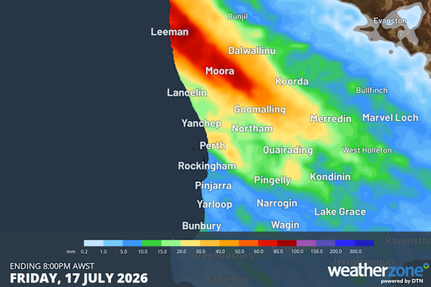
Parts of Western Australia have copped their wettest days in years. Weatherzone
The Bureau of Meteorology has warned that the ongoing deluge could bring flooding and late inundation, particularly within the Moore and Hill catchments, including Moora.
BOM has warned that the flooding may isolate some communities and homesteads within the region.
The wet weather is expected to last all weekend, moving further inland across the lower Gascoyne and Goldfields districts while showers linger in the state’s south-west.
Although scattered showers may persist into Monday and Tuesday, a high-pressure system should bring calmer conditions by Wednesday.