
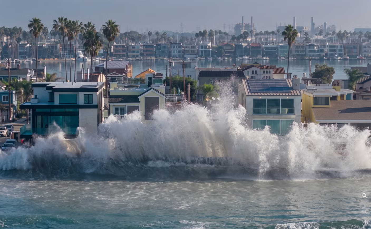
The last story we did on El Niño mentioned houses in Southern California falling into the ocean. This one, conversely, is about the ocean rising to the houses.
As you may have seen on the news and social media, SoCal took another belting late last week with coastal inundation and damage to shoreline property. The worst-hit regions were Newport Beach, Long Beach, and Laguna Beach, though few places escaped unscathed.
Many news outlets placed the blame on waves from Hurricane Rachel. However, what happened on the weekend was the combination of many factors, the swell being only one contributor.
What’s worse, especially for those directly affected, is that some of those factors will linger for a while yet.
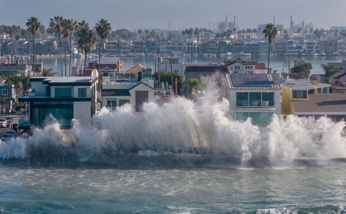
Waves batter the wooden bulkhead along the Alamitos Peninsula, Long Beach (NBC)
Much has been said about the El Niño in the eastern Pacific, however it’s a complex event with many aspects. Fundamentally, it’s warm water gathering in the eastern equatorial region, but it also causes sea level rise via thermal expansion – warm water takes up more space.
On top of that, the warm water doesn’t drift east so much as travel in pulses called Kelvin waves, which are bulges of water a few hundred kilometres wide but only centimetres high.
When a Kelvin wave hits the land boundary of the Americas, it splits north and south, hugging the coast as a bulge of slow-moving, elevated sea levels.
“This morning’s tide came in 20 inches higher than the actual predicted tide value,” Newport Beach utilities director Mark Vukojevic said last Friday.
That’s half a metre in metric, and is the sum of thermal expansion and the Kelvin wave. Oh, and Friday’s high tide was already one of the highest of the year.
The surf through Friday to Sunday wasn’t particularly large but it was a mix of shorter period swell from Rachel and an underlying, and more damaging, long period (16-18 seconds) south swell.
It needn’t be said to a surf audience, but beaches are dynamic zones constantly being shaped by local conditions. When the sea level suddenly rises by half a metre, they struggle to cope with the new ‘conditions’.
Also, it’s not just a higher sea level but deeper water allows more energy to reach the shoreline. More energy equals more erosion.
“Every 2 to 4 inches of sea level doubles our flood risk,” says Patrick Barnard, research director at the Center for Coastal Climate Resilience at the University of California, Santa Cruz.
Some communities were buffered by a broad sandy beach that soaked up the energy. Unfortunately for many regions, a prolonged period of erosion left them defenceless. At Newport once waves breached the berm they ran downhill to the suburban streets. At Long Beach they broke directly onto an exposed seawall, till it too broke. At many places the beach disappeared altogether and waves broke onto rocks, rip rap, concrete pathways, or whatever hard structure the waves first found.
“It’s not that this Kelvin wave is going to come and flood anything on its own,” said Michael Jacox from NOAA. Instead, the weekend flooding was a confluence of bad luck.
However, the factors that contributed aren’t retreating. Southern California will again have high tides in late November and late December, though it’s unknown if they’ll coincide with a Kelvin wave (three or four more waves are expected during El Niño).
Meanwhile, the current Kelvin wave is moving north and will reach San Francisco in mid-October. No doubt residents of Pacifica will be watching closely.
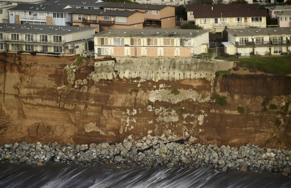
Along three kilometres of beach front, buildings at Pacifica teeter as the cliff draws ever closer (NBC)
Faced with its own chronic erosion problem, Pacifica is exposed to the winter north-west swells. So if a North Pacific swell coincides with a Kelvin wave the waves will be further undercutting the cliff.
Or maybe the Kelvin wave alone will do that?
All this and the El Niño winter hasn’t even begun.
//STU NETTLE and CRAIG BROKENSHA